Cof Cymru: National Historic Assets of Wales · Wales
Barn at Rose Hill
Erbistock, Wrexham, Wales
A Grade II listed building in Rose Hill, Erbistock, Wrexham, designated on 13 February 1995.
The record
- Designation
- Listed building, Grade II
- Broad class
- Agriculture and Subsistence
- Date of designation
- 13 February 1995
- Locality
- Rose Hill
- Town
- Erbistock
- Community
- Erbistock
- Unitary authority
- Wrexham
- Country
- Wales
- Coordinates
- 52.97904, -2.97132
- Cadw reference
- 15177
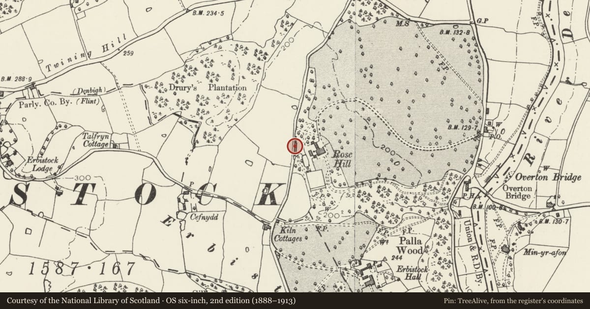
Slide toward Today to fade the historical sheet and see the modern map underneath.
David Rumsey Map Collection, Stanford LibrariesDavid Rumsey Map Collection, Stanford LibrariesDavid Rumsey Map Collection, Stanford LibrariesDavid Rumsey Map Collection, Stanford LibrariesDavid Rumsey Map Collection, Stanford Libraries
5 historical maps cover this location, the earliest the 1608 map "(13) Cambriae Typus." (David Rumsey Map Collection, Stanford Libraries).
Historical maps covering this location
- 1608 · (13) Cambriae Typus. (David Rumsey Map Collection, Stanford Libraries)
- 1637 · Particular description of Wales. Cambria seu Wallia (David Rumsey Map Collection, Stanford Libraries)
- 1883 · Watershed map England, Wales 3. (David Rumsey Map Collection, Stanford Libraries)
- 1898 · 121 Wrexham (Hills) (David Rumsey Map Collection, Stanford Libraries)
- 1901 · Sheet 9 and 10. (David Rumsey Map Collection, Stanford Libraries)
Cadw's description
Location
Situated 50m E of Rose Hill House
History
Barn, perhaps former cowhouse with haybarns added at a later date. Probably C17 with additions of C18 and C19 alterations.
Exterior
Timber framing with brick infill, red sandstone rubble with squared quoins, slate roof, some alterations in red brick, iron tie-plates. Rectilinear plan. At each end a red sandstone rubble range with ventilation slits and openings, including pitching eyes, some later C19 alterations. Long central range has red sandstone plinth and timber framing in squarish panels with narrow horizontal timbers within the panels suggesting that the infill replaced the original wattle and daub. Three doorways, probably not all original. Rear elevation to road, partially obscured, has single doorway.
Interior
Interior not accessible at time of survey (October 1994).
Reason for designation
Listed for its special interest as a well-preserved estate barn associated with Rose Hill.
Group value with Rose Hill and Coach House.
Nearby in the register
- Coach House at Rose HillDomesticunder 1 mi
- Rose Hill (including Walled Garden)Domesticunder 1 mi
- Farmbuilding to North of Erbistock HallAgriculture and Subsistenceunder 1 mi
- Erbistock HallDomesticunder 1 mi
Other entries of the same register within about three miles of this one, by straight line.