Cof Cymru: National Historic Assets of Wales · Wales
Byre (former Dower House) at Cefndeuddwr
Ganllwyd, Gwynedd, Wales
A Grade II listed building in Cefndeuddwr, Ganllwyd, Gwynedd, designated on 13 February 1995.
The record
- Designation
- Listed building, Grade II
- Broad class
- Domestic
- Date of designation
- 13 February 1995
- Locality
- Cefndeuddwr
- Community
- Ganllwyd
- Unitary authority
- Gwynedd
- Country
- Wales
- Coordinates
- 52.81745, -3.88615
- Cadw reference
- 15158
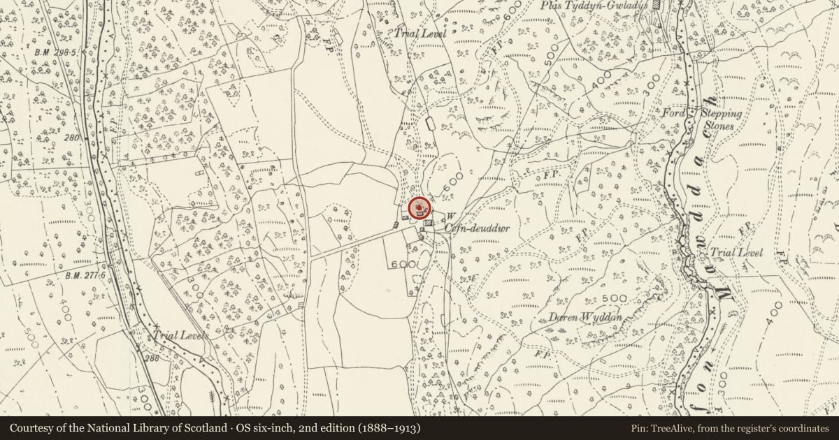
Slide toward Today to fade the historical sheet and see the modern map underneath.
David Rumsey Map Collection, Stanford LibrariesDavid Rumsey Map Collection, Stanford LibrariesDavid Rumsey Map Collection, Stanford LibrariesLlyfrgell Genedlaethol Cymru – The National Library of WalesDavid Rumsey Map Collection, Stanford Libraries
5 historical maps cover this location, the earliest the 1795 map "To Sir Watkin Williams-Wynn Bart ... the map of the six counties of North Wales is most humbly inscribed by his obedient humble servant" (Llyfrgell Genedlaethol Cymru – The National Library of Wales).
Historical maps covering this location
- 1795 · To Sir Watkin Williams-Wynn Bart ... the map of the six counties of North Wales is most… (Llyfrgell Genedlaethol Cymru – The National Library of Wales)
- 1883 · Watershed map England, Wales 3. (David Rumsey Map Collection, Stanford Libraries)
- 1896 · Sheet 7. Ordnance Survey of England and Wales. (David Rumsey Map Collection, Stanford Libraries)
- 1899 · 135 Harlech (Hills) (David Rumsey Map Collection, Stanford Libraries)
- 1901 · Sheet 9 and 10. (David Rumsey Map Collection, Stanford Libraries)
Cadw's description
Location
Located 50m NW of Cefndeuddwr farmhouse, immediately to the N ofthe upper barn.
History
Former dower house or steward's house serving the mainhouse and contemporary with it, c.1600. Converted mid C19 (orearlier) to a byre; at this stage the W gable end was rebuilt andthe stack removed.
Exterior
Rubble construction with slate roof; rectangular plan. C19 entrance to N side with pegged doorcase and boarded door. ToR a part-glazed (6-pane) window with ventilation slats beneath. Blocked primary entrance to E gable end with 9-pane C19 sashwindow above, apparently in original opening. Small, blockedoriginal window to L of S side. Upper entrance to rebuilt W gablevia stone stepped and parapeted access.
Interior
Fine beamed ceiling with 3 deeply stopped-chamferedtransverse beams and delicately stopped-chamfered subsidiarybeams. 2-bay roof with contemporary truss, though missing itsqueen struts. Cobbled floor (C19).
Reason for designation
A scarce example of this building type with good beamed ceiling.
Group value with other listed items at Cefndeuddwr.
Nearby in the register
- Upper Barn at CefndeuddwrAgriculture and Subsistenceunder 1 mi
- Lower Barn at CefndeuddwrAgriculture and Subsistenceunder 1 mi
- Cefndeuddwr FarmhouseDomesticunder 1 mi
- Hermon or Dolfwynog Copper/Gold Bog KilnKilnunder 1 mi
Other entries of the same register within about three miles of this one, by straight line.