Cof Cymru: National Historic Assets of Wales · Wales
Upper Barn at Cefndeuddwr
Ganllwyd, Gwynedd, Wales
A Grade II listed building in Cefndeuddwr, Ganllwyd, Gwynedd, designated on 13 February 1995.
The record
- Designation
- Listed building, Grade II
- Broad class
- Agriculture and Subsistence
- Date of designation
- 13 February 1995
- Locality
- Cefndeuddwr
- Community
- Ganllwyd
- Unitary authority
- Gwynedd
- Country
- Wales
- Coordinates
- 52.81732, -3.88609
- Cadw reference
- 15157
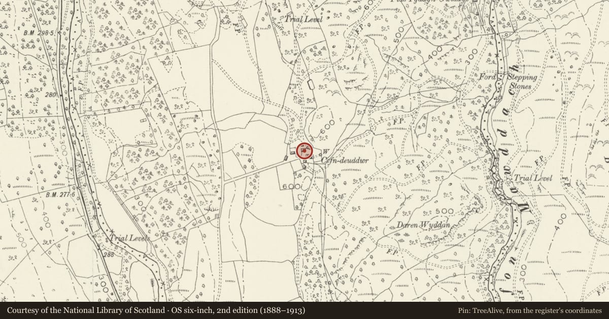
Slide toward Today to fade the historical sheet and see the modern map underneath.
David Rumsey Map Collection, Stanford LibrariesDavid Rumsey Map Collection, Stanford LibrariesDavid Rumsey Map Collection, Stanford LibrariesLlyfrgell Genedlaethol Cymru – The National Library of WalesDavid Rumsey Map Collection, Stanford Libraries
5 historical maps cover this location, the earliest the 1795 map "To Sir Watkin Williams-Wynn Bart ... the map of the six counties of North Wales is most humbly inscribed by his obedient humble servant" (Llyfrgell Genedlaethol Cymru – The National Library of Wales).
Historical maps covering this location
- 1795 · To Sir Watkin Williams-Wynn Bart ... the map of the six counties of North Wales is most… (Llyfrgell Genedlaethol Cymru – The National Library of Wales)
- 1883 · Watershed map England, Wales 3. (David Rumsey Map Collection, Stanford Libraries)
- 1896 · Sheet 7. Ordnance Survey of England and Wales. (David Rumsey Map Collection, Stanford Libraries)
- 1899 · 135 Harlech (Hills) (David Rumsey Map Collection, Stanford Libraries)
- 1901 · Sheet 9 and 10. (David Rumsey Map Collection, Stanford Libraries)
Cadw's description
Location
Immediately to the NW of Cefndeuddwr farmhouse, built into aslight rise to the W; an earlier, now ruined barn lies immediatelyto the E.
Exterior
Mid-late C17 rubble barn, partly built onto rock andwith corrugated iron roof. Wide opposing entrances to the long Nand S sides, that to the latter with timber lintel andpart-contemporary stopped-chamfered pegged oak doorcase withtongue-stops to lintel beam; modern stable doors. 2 tiers of(blocked) ventilation slits. Upper loading bays at gable ends,that to the E with C19 external stone-stepped access.
Interior
4-bay with slate-flagged floor. Largely originalpegged collar trusses with tie beams, that from first truss from Lcut off at the wall.
Reason for designation
Included for group value with other listed items at Cefndeuddwr.
Nearby in the register
- Byre (former Dower House) at CefndeuddwrDomesticunder 1 mi
- Cefndeuddwr FarmhouseDomesticunder 1 mi
- Lower Barn at CefndeuddwrAgriculture and Subsistenceunder 1 mi
- Hermon or Dolfwynog Copper/Gold Bog KilnKilnunder 1 mi
Other entries of the same register within about three miles of this one, by straight line.