Cof Cymru: National Historic Assets of Wales · Wales
Blaenmorw
Manordeifi, Pembrokeshire, Wales
A Grade II listed building in Manordeifi, Pembrokeshire, designated on 24 November 1994.
The record
- Designation
- Listed building, Grade II
- Broad class
- Domestic
- Date of designation
- 24 November 1994
- Community
- Manordeifi
- Unitary authority
- Pembrokeshire
- Country
- Wales
- Coordinates
- 52.02580, -4.57212
- Cadw reference
- 15135
Slide toward Today to fade the historical sheet and see the modern map underneath.
David Rumsey Map Collection, Stanford LibrariesDavid Rumsey Map Collection, Stanford LibrariesDavid Rumsey Map Collection, Stanford LibrariesDavid Rumsey Map Collection, Stanford LibrariesDavid Rumsey Map Collection, Stanford Libraries
5 historical maps cover this location, the earliest the 1608 map "(13) Cambriae Typus." (David Rumsey Map Collection, Stanford Libraries).
Historical maps covering this location
- 1608 · (13) Cambriae Typus. (David Rumsey Map Collection, Stanford Libraries)
- 1830 · V.3:11-15:XV. Britisches Reich. A. Kon: England. b. Frstenthum Wales: Shire: 37-40 (David Rumsey Map Collection, Stanford Libraries)
- 1891 · Sheet 10. Ordnance Survey of England and Wales. . (David Rumsey Map Collection, Stanford Libraries)
- 1898 · 211 Newcastle Emlyn (Hills) (David Rumsey Map Collection, Stanford Libraries)
- 1901 · Sheet 14. (David Rumsey Map Collection, Stanford Libraries)
Cadw's description
Location
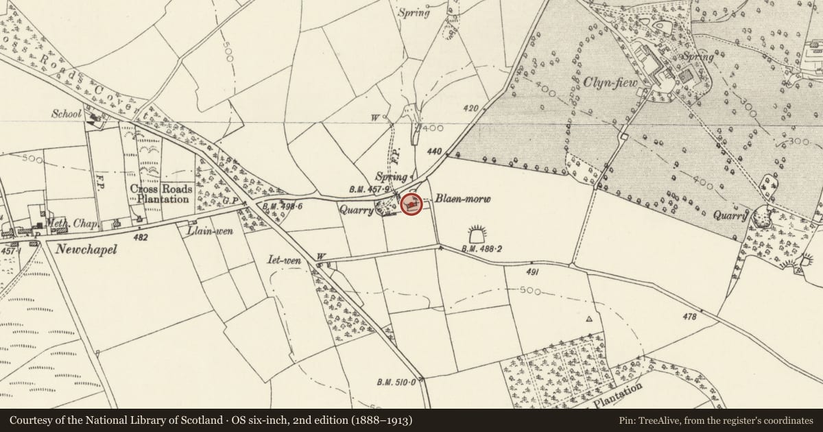
Situated some 700m E of Newchapel, on S side of B 4332.
History
Mid C19 farmhouse of unusual detail, built after 1843 as Tithe Map shows previous farmhouse to have been N of road.
Exterior
Mid C19 farmhouse, whitewashed rubble stone with whitewashed brick dressings, slate roof and brick end stacks. Unusually formal composition of two- storey three-window centre and lower two-storey wings. Brick dressings include nogged eaves to main block, cambered window and door heads, raised flanking piers to openings, reaching up past window heads to eaves above and to a continuous raised string over ground floor, broken forward over each pier. Painted slate sills. Cambered headed hornless 12-pane sashes to ground floor and 9-pane cambered-headed sashes above. Wings are nearly mirrored with slightly shorter inner window and outer door to ground floor, but E wing also has first floor 9-pane sash under eaves and E end brick stack. C20 door. W wing has ground floor window part-blocked and outside E end stairs to loft door.
Reason for designation
Tithe Map 1843.
Nearby in the register
- Capel NewyddReligious, Ritual and Funeraryunder 1 mi
- Large arched outbuilding on NW Side of Ffynone FarmyardAgriculture and Subsistenceunder 1 mi
- Entrance Gates and Piers to FfynoneDomesticunder 1 mi
- Cilwendeg LodgeDomesticunder 1 mi
Other entries of the same register within about three miles of this one, by straight line.