Cof Cymru: National Historic Assets of Wales · Wales
Former Stable Block at Castle Hill Farm
Hawarden, Flintshire, Wales
A Grade II listed building in Ewloe, Hawarden, Flintshire, designated on 16 November 1994.
The record
- Designation
- Listed building, Grade II
- Broad class
- Domestic
- Date of designation
- 16 November 1994
- Locality
- Ewloe
- Community
- Hawarden
- Unitary authority
- Flintshire
- Country
- Wales
- Coordinates
- 53.19858, -3.06303
- Cadw reference
- 15110
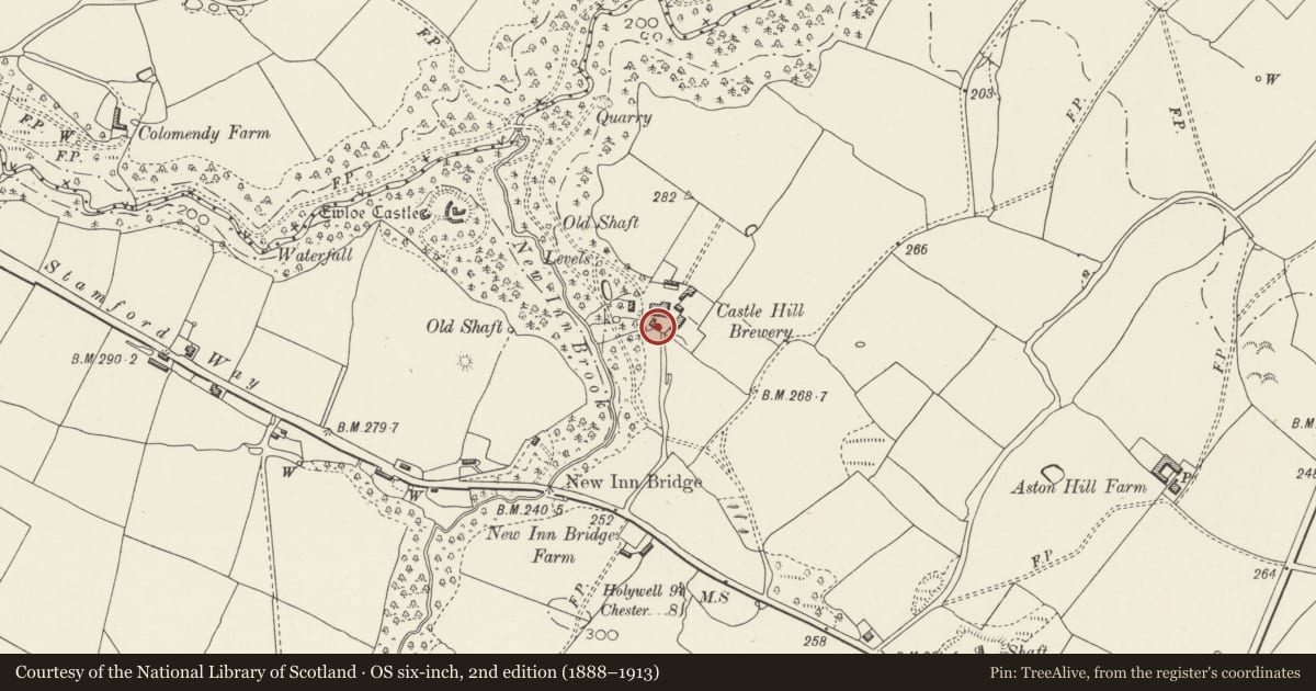
Slide toward Today to fade the historical sheet and see the modern map underneath.
David Rumsey Map Collection, Stanford LibrariesDavid Rumsey Map Collection, Stanford LibrariesDavid Rumsey Map Collection, Stanford LibrariesDavid Rumsey Map Collection, Stanford LibrariesLlyfrgell Genedlaethol Cymru – The National Library of Wales
5 historical maps cover this location, the earliest the 1795 map "To Sir Watkin Williams-Wynn Bart ... the map of the six counties of North Wales is most humbly inscribed by his obedient humble servant" (Llyfrgell Genedlaethol Cymru – The National Library of Wales).
Historical maps covering this location
- 1795 · To Sir Watkin Williams-Wynn Bart ... the map of the six counties of North Wales is most… (Llyfrgell Genedlaethol Cymru – The National Library of Wales)
- 1883 · Watershed map England, Wales 3. (David Rumsey Map Collection, Stanford Libraries)
- 1898 · 108 Flint (Hills) (David Rumsey Map Collection, Stanford Libraries)
- 1898 · 108 Flint (Outline) (David Rumsey Map Collection, Stanford Libraries)
- 1901 · Sheet 9 and 10. (David Rumsey Map Collection, Stanford Libraries)
Cadw's description
Location
Opposite the brewery to the SE.
History
The Castle Hill Farm complex was established in the early C19 as Fox's Brewery and continued as a working brewery until 1950. The surviving buildings date mainly from the second quarter C19 to the late C19, and consist of the owner's house, a brewery range with adjacent malting tower, a large granary with dray house, a stable block and a brewery office. They are ranged loosely around a courtyard
Exterior
A low L-shaped, 2-storey stable block, probably late C18 with later additions. Shallow-pitched slate roof. In 3 main sections, the central part of rubble stone and with 2 plain entrances with plain wooden lintels. Modern boarded door to Left hand one and the door missing to R with a plain shuttered window above. Continuously-roofed with this, a 2-bay brick addition to the L, abutting the yard's W gate pier. Entrance to the R with cambered head and missing door. Plain shuttered window above. To the L on the ground floor, a 2-light window, cambered as before. To the R of the central section an advanced gabled wing, forming an L-shape with the main block. External stepped first floor-access at the gable-end. Ground floor rebuilt in brick in the mid C19. 2 stable-doors with cambered heads, that to the R with replaced boarded door.
Interior
Mid-Victorian cast iron stalls and brick floor.
Reason for designation
Group value with other listed items within the remarkable Fox's Brewery complex.
Nearby in the register
- Adjacent Malting Tower at Castle Hill FarmIndustrialunder 1 mi
- Low attached extensions at Castle Hill FarmDomesticunder 1 mi
- Former Brewery at Castle Hill FarmDomesticunder 1 mi
- Main House at Castle Hill FarmDomesticunder 1 mi
Other entries of the same register within about three miles of this one, by straight line.