Cof Cymru: National Historic Assets of Wales · Wales
Stable Range at Rhyllon Farmhouse
Waen, Denbighshire, Wales
A Grade II listed building in Tai Cochion, Waen, Denbighshire, designated on 12 August 1987.
The record
- Designation
- Listed building, Grade II
- Broad class
- Domestic
- Date of designation
- 12 August 1987
- Locality
- Tai Cochion
- Community
- Waen
- Unitary authority
- Denbighshire
- Country
- Wales
- Coordinates
- 53.26462, -3.43173
- Cadw reference
- 1506
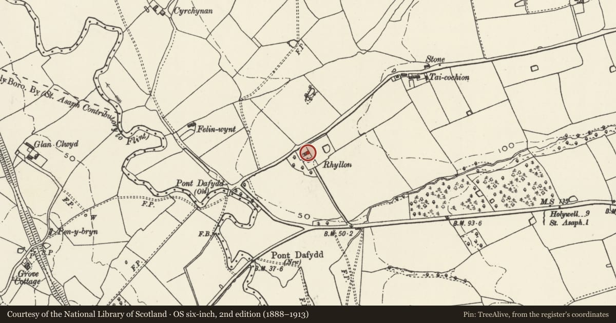
Slide toward Today to fade the historical sheet and see the modern map underneath.
David Rumsey Map Collection, Stanford LibrariesNational Library of ScotlandDavid Rumsey Map Collection, Stanford LibrariesLlyfrgell Genedlaethol Cymru – The National Library of WalesDavid Rumsey Map Collection, Stanford Libraries
5 historical maps cover this location, the earliest the 1795 map "To Sir Watkin Williams-Wynn Bart ... the map of the six counties of North Wales is most humbly inscribed by his obedient humble servant" (Llyfrgell Genedlaethol Cymru – The National Library of Wales).
Historical maps covering this location
- 1795 · To Sir Watkin Williams-Wynn Bart ... the map of the six counties of North Wales is most… (Llyfrgell Genedlaethol Cymru – The National Library of Wales)
- 1830 · V.3:11-15:XV. Britisches Reich. A. Kon: England. b. Frstenthum Wales: Shire: 37-40 (David Rumsey Map Collection, Stanford Libraries)
- 1883 · Watershed map England, Wales 3. (David Rumsey Map Collection, Stanford Libraries)
- 1901 · Sheet 9 and 10. (David Rumsey Map Collection, Stanford Libraries)
- 1963 · Map No. 36 - Local Government Commission for Wales : [Definitive maps showing proposed… (National Library of Scotland)
Cadw's description
Location
Immediately to N of Rhyllon House forming the S side of the farmyard.
History
Probably C18, with C19/20 additions.
Exterior
A stable range of two storeys in three bays, mostly in brickwork, with a slate roof. In the front elevation (toward the house) there are two doorways near the left, the one to the right being taller. Small-paned casement windows at left, and above the taller doorway. The right gable is of stone, and there are later garage extensions at each end.
At rear are a small projecting chimney stack, a blocked doorway, two fixed windows and two loft hatches. Modern sliding garage doors at left.
Interior
Interior retains cobbled floors and boarded doors with circular ventilators; relocated stable fittings. Overlapping purlins to simple trusses.
Reason for designation
Group value with Rhyllon House.
Nearby in the register
- Rhyllon FarmhouseDomesticunder 1 mi
- Pont Dafydd (old)Bridgeunder 1 mi
- Pont DafyddTransportunder 1 mi
- Summerhouse in the grounds of The BrynGardens, Parks and Urban Spacesunder 1 mi
Other entries of the same register within about three miles of this one, by straight line.