Cof Cymru: National Historic Assets of Wales · Wales
Milestone in wall at Entrance to Cawrence
Llangoedmor, Ceredigion, Wales
A Grade II listed building in Pont-rhyd-arberth, Llangoedmor, Ceredigion, designated on 10 August 1994.
The record
- Designation
- Listed building, Grade II
- Broad class
- Transport
- Date of designation
- 10 August 1994
- Locality
- Pont-rhyd-arberth
- Community
- Llangoedmor
- Unitary authority
- Ceredigion
- Country
- Wales
- Coordinates
- 52.07813, -4.59371
- Cadw reference
- 14793
Slide toward Today to fade the historical sheet and see the modern map underneath.
David Rumsey Map Collection, Stanford LibrariesDavid Rumsey Map Collection, Stanford LibrariesDavid Rumsey Map Collection, Stanford LibrariesDavid Rumsey Map Collection, Stanford LibrariesDavid Rumsey Map Collection, Stanford Libraries
5 historical maps cover this location, the earliest the 1608 map "(13) Cambriae Typus." (David Rumsey Map Collection, Stanford Libraries).
Historical maps covering this location
- 1608 · (13) Cambriae Typus. (David Rumsey Map Collection, Stanford Libraries)
- 1636 · Cornubia : Devonia, Somersetus, Dorcestria, Wiltonia, Glocestria ... (David Rumsey Map Collection, Stanford Libraries)
- 1637 · Particular description of Wales. Cambria seu Wallia (David Rumsey Map Collection, Stanford Libraries)
- 1830 · V.3:11-15:XV. Britisches Reich. A. Kon: England. b. Frstenthum Wales: Shire: 37-40 (David Rumsey Map Collection, Stanford Libraries)
- 1899 · 194 Llangranog (Hills) (David Rumsey Map Collection, Stanford Libraries)
Cadw's description
Location
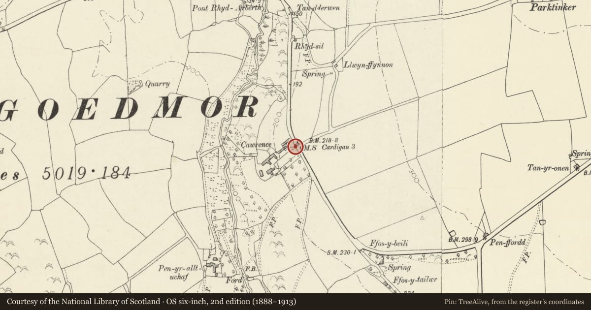
Situated at head of drive to Cawrence, some 500m S of Pontrhydarberth.
Exterior
Early C19 milestone, set into rubble stone retaining wall. Whitewashed with 'To Cardigan 3 Miles' inscribed.
Reason for designation
One of a series of milestones from the turnpike era surviving in this part of the Teifi Valley.
Nearby in the register
- Outbuilding to NE of Penrallt UchafDomesticunder 1 mi
- Attached Barn range to Penrallt UchafAgriculture and Subsistenceunder 1 mi
- Penrallt UchafDomesticunder 1 mi
- LlwyngrawysDomesticunder 1 mi
Other entries of the same register within about three miles of this one, by straight line.