Cof Cymru: National Historic Assets of Wales · Wales
Schoolhouse
Llangoedmor, Ceredigion, Wales
A Grade II listed building in Llangoedmor, Ceredigion, designated on 10 August 1994.
The record
- Designation
- Listed building, Grade II
- Broad class
- Domestic
- Date of designation
- 10 August 1994
- Locality
- Llangoedmor
- Community
- Llangoedmor
- Unitary authority
- Ceredigion
- Country
- Wales
- Coordinates
- 52.08124, -4.62790
- Cadw reference
- 14772
Slide toward Today to fade the historical sheet and see the modern map underneath.
David Rumsey Map Collection, Stanford LibrariesDavid Rumsey Map Collection, Stanford LibrariesDavid Rumsey Map Collection, Stanford LibrariesDavid Rumsey Map Collection, Stanford LibrariesDavid Rumsey Map Collection, Stanford Libraries
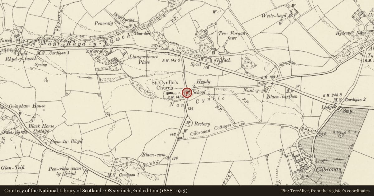
5 historical maps cover this location, the earliest the 1608 map "(13) Cambriae Typus." (David Rumsey Map Collection, Stanford Libraries).
Historical maps covering this location
- 1608 · (13) Cambriae Typus. (David Rumsey Map Collection, Stanford Libraries)
- 1637 · Particular description of Wales. Cambria seu Wallia (David Rumsey Map Collection, Stanford Libraries)
- 1830 · V.3:11-15:XV. Britisches Reich. A. Kon: England. b. Frstenthum Wales: Shire: 37-40 (David Rumsey Map Collection, Stanford Libraries)
- 1898 · 193 Cardigan (Hills) (David Rumsey Map Collection, Stanford Libraries)
- 1901 · Sheet 13. (David Rumsey Map Collection, Stanford Libraries)
Cadw's description
Location
Situated on corner opposite churchyard entry.
History
1848-9 former school (now Church Hall) and teacher's house, built and probably designed by William Jenkins of Blaenbarthen, Llangoedmor.
Exterior
Rubble stone with slate roofs. Former school is two-storey with three-window range of C20 stained wood casement-pairs, the surrounds chamfered with cut Cilgerran stone voussoirs and slate sills. Door to left with chamfered surround and triangular Cilgerran stone head. Two ventilators on roof ridge.
School House is one and a half storey, with gabled centre broken forward, C20 bargeboards on timber corbels, first-floor stained wood casement pair with top-lights, ground floor triple casement with top-lights, both windows with cut stone voussoirs to flat heads, and slate painted sills; C20 half-glazed door to left with cambered head and stone voussoirs. A rear wing has brick ridge stack and C20 metal windows in end gable. To front right is single storey outbuilding, former stable with centre door and stone voussoirs.
Reason for designation
Included as an unaltered part of the village centre and a school building of relatively early date.
Nearby in the register
- The Old SchoolEducationunder 1 mi
- Churchyard gates and gatepiersReligious, Ritual and Funeraryunder 1 mi
- Church of St CynlloReligious, Ritual and Funeraryunder 1 mi
- TreforganDomesticunder 1 mi
Other entries of the same register within about three miles of this one, by straight line.