Cof Cymru: National Historic Assets of Wales · Wales
Gunpowder Magazine
Holyhead, Isle of Anglesey, Wales
A Grade II listed building in Breakwater Quarry, Holyhead, Isle of Anglesey, designated on 25 July 1994.
The record
- Designation
- Listed building, Grade II
- Broad class
- Industrial
- Date of designation
- 25 July 1994
- Locality
- Breakwater Quarry
- Community
- Holyhead
- Unitary authority
- Isle of Anglesey
- Country
- Wales
- Coordinates
- 53.31787, -4.66007
- Cadw reference
- 14755
Slide toward Today to fade the historical sheet and see the modern map underneath.
David Rumsey Map Collection, Stanford LibrariesDavid Rumsey Map Collection, Stanford LibrariesDavid Rumsey Map Collection, Stanford LibrariesDavid Rumsey Map Collection, Stanford LibrariesDavid Rumsey Map Collection, Stanford Libraries
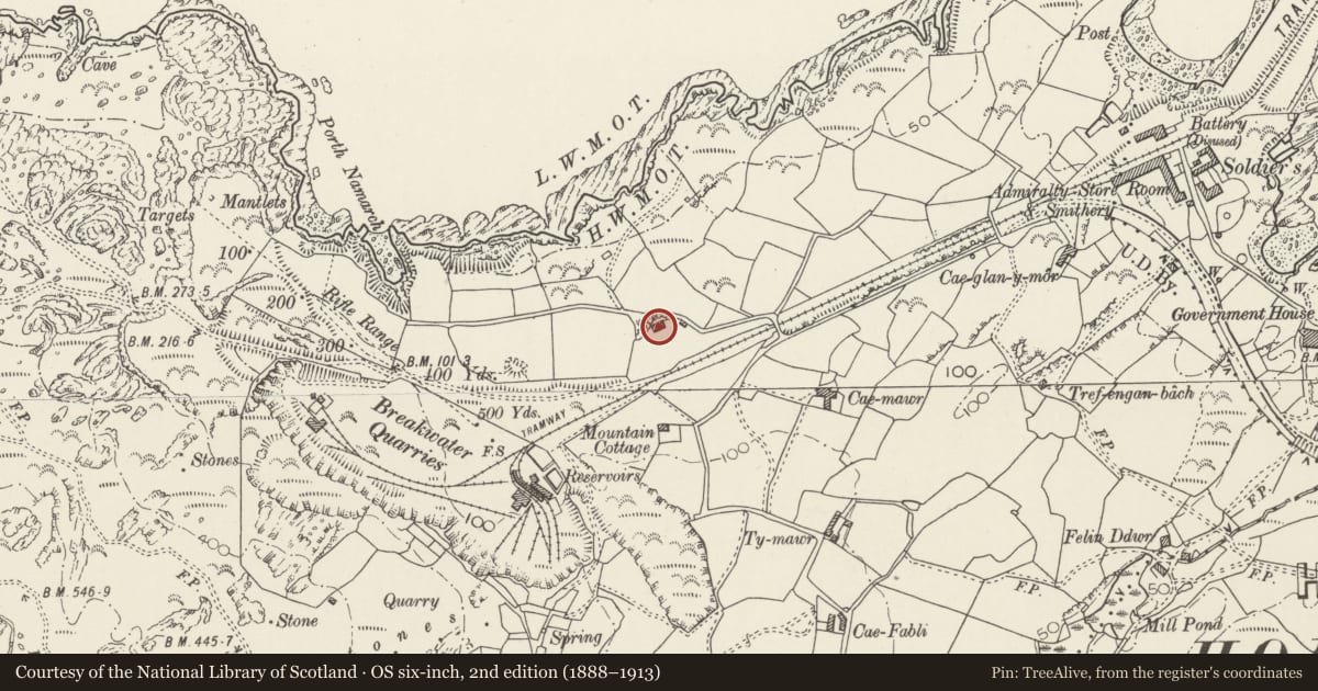
5 historical maps cover this location, the earliest the 1883 map "Watershed map England, Wales 3." (David Rumsey Map Collection, Stanford Libraries).
Historical maps covering this location
- 1883 · Watershed map England, Wales 3. (David Rumsey Map Collection, Stanford Libraries)
- 1899 · 92 South Stack (Hills) (David Rumsey Map Collection, Stanford Libraries)
- 1899 · 92 South Stack (Outline) (David Rumsey Map Collection, Stanford Libraries)
- 1901 · Sheet 9 and 10. (David Rumsey Map Collection, Stanford Libraries)
- 1919 · Sheet 41. Anglesey. (David Rumsey Map Collection, Stanford Libraries)
Cadw's description
Location
To N of road to Breakwater Country Park, approximately 200m W of bridge over road.
History
Mid C19 gunpowder magazine built to store explosives for Breakwater quarries.
Exterior
Grey stone, Front (S) has porch with monopitch roof, doorway with steel door, and small window to R. Ends each have three buttresses, small window in L wall; plain rear. Interior has two chambers separated by thick walls; brick vaults.
Reason for designation
Included of scarce example of building type, illustrating engineering history of quarry and Great Breakwater.
Nearby in the register
- Cottage on corner of Pentre Pella (including Foregardem Wall)Domesticunder 1 mi
- Soldier's Point HouseDomesticunder 1 mi
- Screen Wall to Soldier's Point HouseDomesticunder 1 mi
- Porthyfelin HouseDomesticunder 1 mi
Other entries of the same register within about three miles of this one, by straight line.