Cof Cymru: National Historic Assets of Wales · Wales
Palace Gardens
St. Asaph, Denbighshire, Wales
A Grade II listed building in St. Asaph, Denbighshire, designated on 24 November 1987.
The record
- Designation
- Listed building, Grade II
- Broad class
- Domestic
- Date of designation
- 24 November 1987
- Community
- St. Asaph
- Unitary authority
- Denbighshire
- Country
- Wales
- Coordinates
- 53.25607, -3.44547
- Cadw reference
- 1472
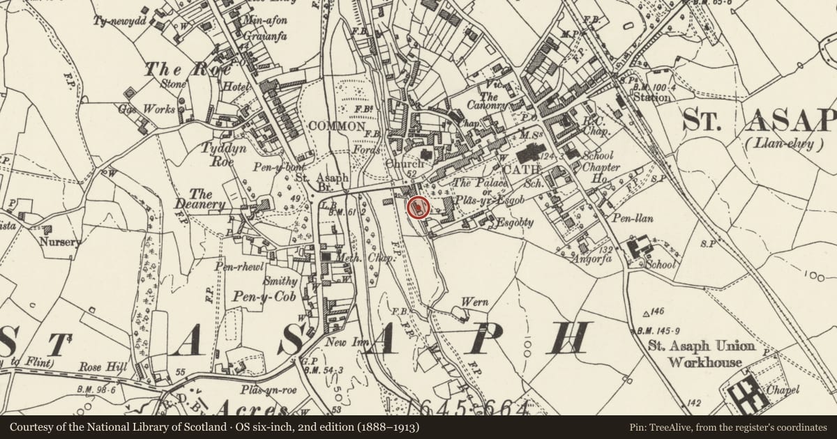
Slide toward Today to fade the historical sheet and see the modern map underneath.
David Rumsey Map Collection, Stanford LibrariesDavid Rumsey Map Collection, Stanford LibrariesLlyfrgell Genedlaethol Cymru – The National Library of WalesDavid Rumsey Map Collection, Stanford LibrariesDavid Rumsey Map Collection, Stanford Libraries
5 historical maps cover this location, the earliest the 1608 map "(13) Cambriae Typus." (David Rumsey Map Collection, Stanford Libraries).
Historical maps covering this location
- 1608 · (13) Cambriae Typus. (David Rumsey Map Collection, Stanford Libraries)
- 1795 · To Sir Watkin Williams-Wynn Bart ... the map of the six counties of North Wales is most… (Llyfrgell Genedlaethol Cymru – The National Library of Wales)
- 1830 · V.3:11-15:XV. Britisches Reich. A. Kon: England. b. Frstenthum Wales: Shire: 37-40 (David Rumsey Map Collection, Stanford Libraries)
- 1883 · Watershed map England, Wales 3. (David Rumsey Map Collection, Stanford Libraries)
- 1901 · Sheet 9 and 10. (David Rumsey Map Collection, Stanford Libraries)
Cadw's description
Location
Detached at end of cobbled Great Yard, reached off the bottom of the High Street.
History
Formerly the coach house to Bishop Bagot's Palace of 1791 with which it is probably contemporary.
Exterior
Flemish bond brickwork; 2-storey, 2-window advanced gabled centre with pediment treatment including blind roundel. Outshot outer bays with continuous cill band. Slate roofs, gable parapets and brick chimney stack to left, stone stack to rear. Cambered brick voussoirs to sash windows with glazing bars; filled in segmental headed coaching entrances to centre with cornices. Half glazed door to left. 2-storey, 3-window rear elevation with similar pediment treatment and cill band. Cambered openings to 1st floor, small pane sliding sash outer windows. Tall voussoir arched recesses with boarded door to left and paired horned sash windows to right; blocked window and half glazed door to either side.
A water-powered corn mill formerly existed below to W, line of mill race still visible.
Reason for designation
Group value with The Old Palace and listed outbuildings.
Nearby in the register
- Tithe Barn HouseDomesticunder 1 mi
- Lodge & Gatepiers at driveway to the Old PalaceDomesticunder 1 mi
- The Old PalaceReligious, Ritual and Funeraryunder 1 mi
- Railings & Boundary Walls to St. Kentigern & St. Asaph Parish ChurchReligious, Ritual and Funeraryunder 1 mi
Other entries of the same register within about three miles of this one, by straight line.