Cof Cymru: National Historic Assets of Wales · Wales
Elwy Bank including D.P. Nash
St. Asaph, Denbighshire, Wales
A Grade II listed building in St Asaph, Denbighshire, designated on 16 November 1962.
The record
- Designation
- Listed building, Grade II
- Broad class
- Commercial
- Date of designation
- 16 November 1962
- Locality
- St Asaph
- Community
- St. Asaph
- Unitary authority
- Denbighshire
- Country
- Wales
- Coordinates
- 53.25694, -3.44405
- Cadw reference
- 1464
Slide toward Today to fade the historical sheet and see the modern map underneath.
David Rumsey Map Collection, Stanford LibrariesDavid Rumsey Map Collection, Stanford LibrariesLlyfrgell Genedlaethol Cymru – The National Library of WalesDavid Rumsey Map Collection, Stanford LibrariesDavid Rumsey Map Collection, Stanford Libraries
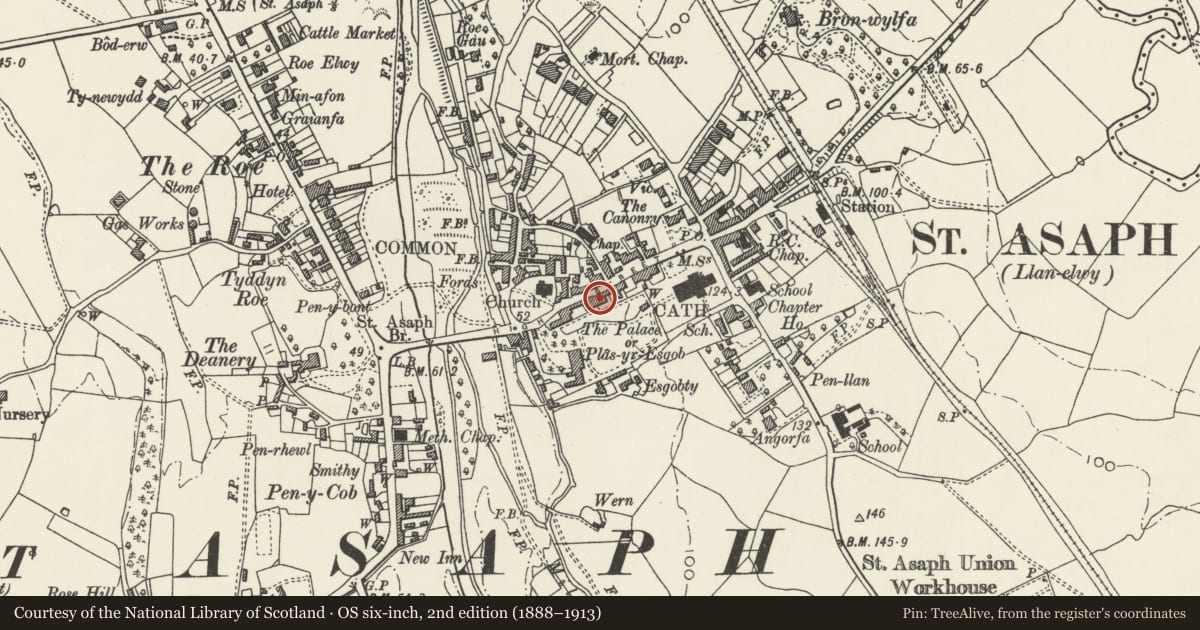
5 historical maps cover this location, the earliest the 1608 map "(13) Cambriae Typus." (David Rumsey Map Collection, Stanford Libraries).
Historical maps covering this location
- 1608 · (13) Cambriae Typus. (David Rumsey Map Collection, Stanford Libraries)
- 1795 · To Sir Watkin Williams-Wynn Bart ... the map of the six counties of North Wales is most… (Llyfrgell Genedlaethol Cymru – The National Library of Wales)
- 1830 · V.3:11-15:XV. Britisches Reich. A. Kon: England. b. Frstenthum Wales: Shire: 37-40 (David Rumsey Map Collection, Stanford Libraries)
- 1883 · Watershed map England, Wales 3. (David Rumsey Map Collection, Stanford Libraries)
- 1901 · Sheet 9 and 10. (David Rumsey Map Collection, Stanford Libraries)
Cadw's description
Location
Set in the slope midway along the street, formerly the Bank of St Asaph.
History
Mid C18.
Exterior
3 + 1 window roughcast front, the larger part of which is symmetrical with plinth; slate roof with undulating ridge continuous with properties to right, red brick chimney stacks. Architraves to windows, lugged and with keystones to 1st and ground floors; casement windows to 2nd floor, horned sash windows below. Broad segmental arched entrance, with architrave and keystone, to centre of 3-window section; marginal glazing bars to side lights flanking 6-panel door. Bracketed oriel to left with horned sash windows and boarded roof (in poor condition at time of inspection December 1986); modern shop front retains fascia with bracket ends.
Interior
Drawing room is said to retain murals, beneath the modern wallpaper, depicting important historical figures including Handel and Nelson. Egg and Dart cornice in hall, stop chamfered beam to parlour and said to retain original roof timbers.
Reason for designation
Group value with other listed items in the High Street.
Nearby in the register
- Beulah House (K&M Massey, including St. Asaph Video)Commercialunder 1 mi
- Glasgow House including County Cleaners, Halifax Building Society & Shoe Repairs)Commercialunder 1 mi
- Conservative ClubRecreationalunder 1 mi
- Midland BankCommercialunder 1 mi
Other entries of the same register within about three miles of this one, by straight line.