Cof Cymru: National Historic Assets of Wales · Wales
Conservative Club
St. Asaph, Denbighshire, Wales
A Grade II listed building in St. Asaph, Denbighshire, designated on 16 November 1962.
The record
- Designation
- Listed building, Grade II
- Broad class
- Recreational
- Date of designation
- 16 November 1962
- Community
- St. Asaph
- Unitary authority
- Denbighshire
- Country
- Wales
- Coordinates
- 53.25707, -3.44431
- Cadw reference
- 1455
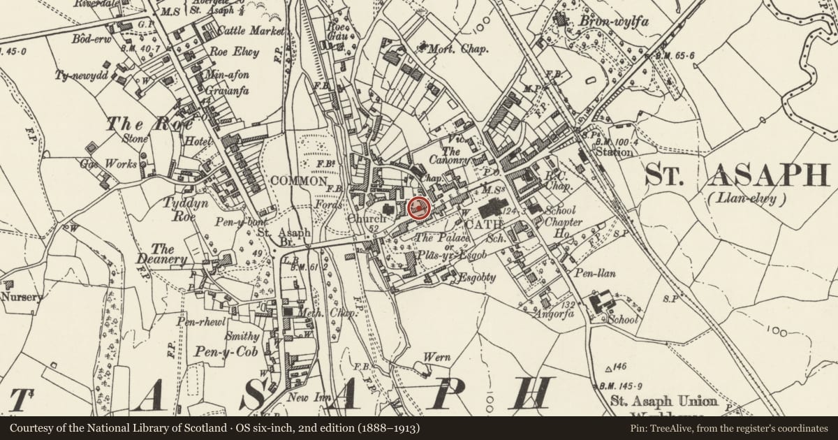
Slide toward Today to fade the historical sheet and see the modern map underneath.
David Rumsey Map Collection, Stanford LibrariesDavid Rumsey Map Collection, Stanford LibrariesLlyfrgell Genedlaethol Cymru – The National Library of WalesDavid Rumsey Map Collection, Stanford LibrariesDavid Rumsey Map Collection, Stanford Libraries
5 historical maps cover this location, the earliest the 1608 map "(13) Cambriae Typus." (David Rumsey Map Collection, Stanford Libraries).
Historical maps covering this location
- 1608 · (13) Cambriae Typus. (David Rumsey Map Collection, Stanford Libraries)
- 1795 · To Sir Watkin Williams-Wynn Bart ... the map of the six counties of North Wales is most… (Llyfrgell Genedlaethol Cymru – The National Library of Wales)
- 1830 · V.3:11-15:XV. Britisches Reich. A. Kon: England. b. Frstenthum Wales: Shire: 37-40 (David Rumsey Map Collection, Stanford Libraries)
- 1883 · Watershed map England, Wales 3. (David Rumsey Map Collection, Stanford Libraries)
- 1901 · Sheet 9 and 10. (David Rumsey Map Collection, Stanford Libraries)
Cadw's description
Exterior
1455
Set into the slope, with public terrace to right and set forward from adjoining property to left.
Long divided 3-storey front; probably mid C18, later alterations. 4-window roughcast range to right with brick end pilaster and modern brick plinth; largely later Victorian 5-window pebbledash range to left with earlier origins indicated by wrapround end pilaster (not full height) and 1st floor cill band.
Slate roofs, gable parapets to ends of right hand range (front verges only) and cusped bargeboards to left end. Almost flush small pane sash windows, some horned, to right with cambered heads to 1st and 2nd floors; boarded door. Mainly recessed sash windows without glazing bars to left, to fixed glazed windows to ground floor beside half glazed door; boarded cellar door to left.
Pebbledash right end wall with corbelled chimney breast. Yard to rear.
Group value with other listed items in the High Street.
Nearby in the register
- Including Yu's ChineseCommercialunder 1 mi
- 1 High StreetCommercialunder 1 mi
- 1A High StreetCommercialunder 1 mi
- Beulah House (K&M Massey, including St. Asaph Video)Commercialunder 1 mi
Other entries of the same register within about three miles of this one, by straight line.