Cof Cymru: National Historic Assets of Wales · Wales
19 Eaton Crescent
Uplands, Swansea, Wales
A Grade II listed building in Uplands, Swansea, designated on 25 July 1994.
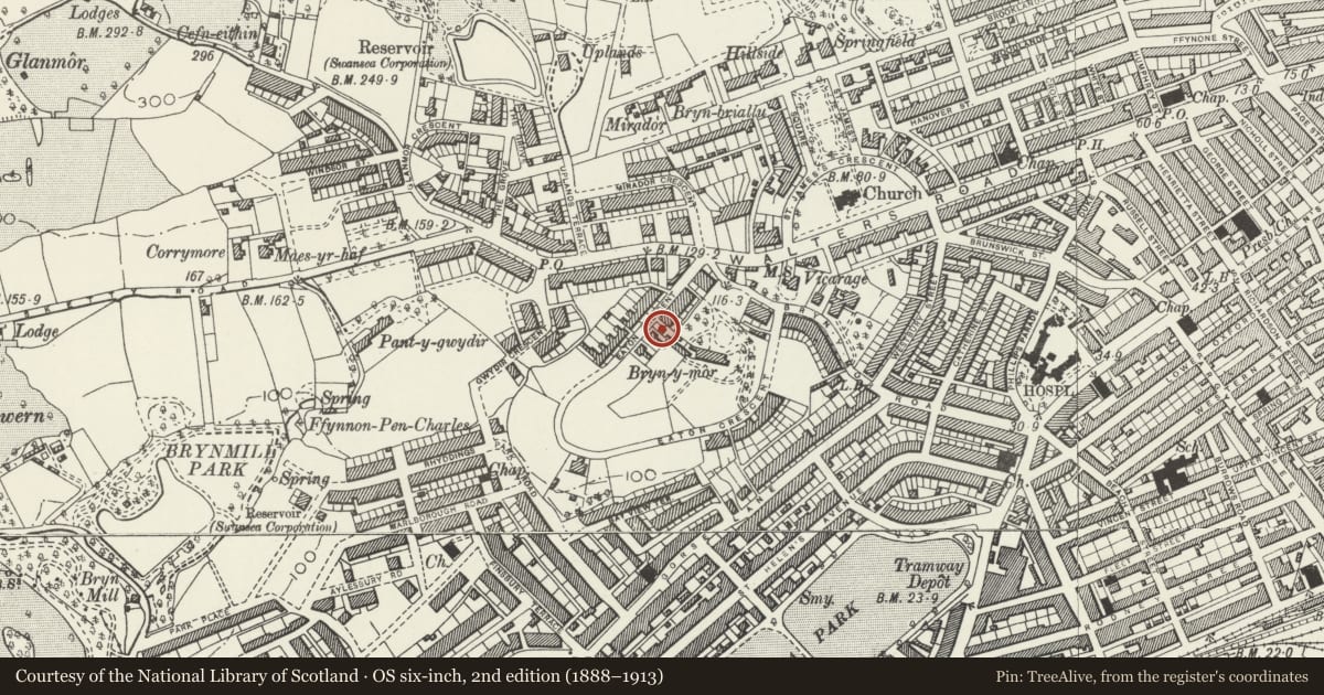
The record
- Designation
- Listed building, Grade II
- Broad class
- Religious, Ritual and Funerary
- Date of designation
- 25 July 1994
- Community
- Uplands
- Unitary authority
- Swansea
- Country
- Wales
- Coordinates
- 51.61734, -3.96422
- Cadw reference
- 14565
Slide toward Today to fade the historical sheet and see the modern map underneath.
David Rumsey Map Collection, Stanford LibrariesDavid Rumsey Map Collection, Stanford LibrariesDavid Rumsey Map Collection, Stanford LibrariesDavid Rumsey Map Collection, Stanford LibrariesDavid Rumsey Map Collection, Stanford Libraries
5 historical maps cover this location, the earliest the 1636 map "Cornubia : Devonia, Somersetus, Dorcestria, Wiltonia, Glocestria ..." (David Rumsey Map Collection, Stanford Libraries).
Historical maps covering this location
- 1636 · Cornubia : Devonia, Somersetus, Dorcestria, Wiltonia, Glocestria ... (David Rumsey Map Collection, Stanford Libraries)
- 1637 · The fourth table of England. Cornub. Devonia, Somerset etc. (David Rumsey Map Collection, Stanford Libraries)
- 1865 · England and Wales. England No. 6. (David Rumsey Map Collection, Stanford Libraries)
- 1891 · Sheet 10. Ordnance Survey of England and Wales. . (David Rumsey Map Collection, Stanford Libraries)
- 1897 · 247 Swansea (Hills) (David Rumsey Map Collection, Stanford Libraries)
Cadw's description
Location
On SE side of NW branch of Eaton Crescent, adjacent to entrance lane to Stella Maris Convent.
History
Mid C19 house. Perhaps former gardener’s house to Brynymor, now Stella Maris Convent.
Exterior
Two storey, with lower 2-storey wing at right angles to R. Stucco, slate roofs, rendered chimney stacks. Gable facing road has pinnacle and cusped bargeboard; horned sash window to first floor, splayed bay to ground floor. To R, lower wing has chimney to R; small sash window to each floor, and porch with monopitch roof, bracketed cornice over entrance doorway.
To rear, smaller gable and Gothic-arched windows to rear and lane.
Reason for designation
Interesting example of small-scale ornamental domestic architecture.
Nearby in the register
- Stella Maris ConventEducationunder 1 mi
- Ffynone VillaDomesticunder 1 mi
- Belgrave GardensDomesticunder 1 mi
- Belgrave GardensDomesticunder 1 mi
Other entries of the same register within about three miles of this one, by straight line.