Cof Cymru: National Historic Assets of Wales · Wales
1A High Street
St. Asaph, Denbighshire, Wales
A Grade II listed building in St. Asaph, Denbighshire, designated on 24 September 1951.
The record
- Designation
- Listed building, Grade II
- Broad class
- Commercial
- Date of designation
- 24 September 1951
- Community
- St. Asaph
- Unitary authority
- Denbighshire
- Country
- Wales
- Coordinates
- 53.25700, -3.44458
- Cadw reference
- 1453
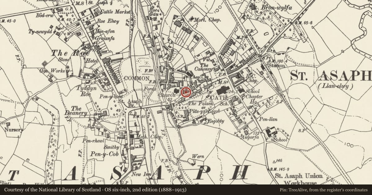
Slide toward Today to fade the historical sheet and see the modern map underneath.
David Rumsey Map Collection, Stanford LibrariesDavid Rumsey Map Collection, Stanford LibrariesLlyfrgell Genedlaethol Cymru – The National Library of WalesDavid Rumsey Map Collection, Stanford LibrariesDavid Rumsey Map Collection, Stanford Libraries
5 historical maps cover this location, the earliest the 1608 map "(13) Cambriae Typus." (David Rumsey Map Collection, Stanford Libraries).
Historical maps covering this location
- 1608 · (13) Cambriae Typus. (David Rumsey Map Collection, Stanford Libraries)
- 1795 · To Sir Watkin Williams-Wynn Bart ... the map of the six counties of North Wales is most… (Llyfrgell Genedlaethol Cymru – The National Library of Wales)
- 1830 · V.3:11-15:XV. Britisches Reich. A. Kon: England. b. Frstenthum Wales: Shire: 37-40 (David Rumsey Map Collection, Stanford Libraries)
- 1883 · Watershed map England, Wales 3. (David Rumsey Map Collection, Stanford Libraries)
- 1901 · Sheet 9 and 10. (David Rumsey Map Collection, Stanford Libraries)
Cadw's description
Location
Set into the slope near the bottom of the street, detached to left and set back from the Conservative Club to right.
History
Later C17/early C18 structure, with later alterations.
Exterior
Rendered, part scribed, 6-window front with broad end pilaster strips and band course to Nos 1 and 1a. Tall hipped slate roof with central brick chimney stack to ridge and coved cornice eaves; four pitched roof slate hung dormers with modern windows. Georgian 12-pane sash windows to 1st floor. Altered ground floor; modern advanced shop fronts and doors, to left end with console bracketed hood with panelled soffit. Steep gabled brick rear elevation with extensions and lean to outshot; retains small-pane sash windows to Nos 1 and 1a, No 1b has modern windows.
Interior
Interior of No 1 retains largely original roof trusses, C18 staircase with turned balusters and swept up handrail with wave profile; panelled doors; fireplace in basement to rear has stopped chamfered lintel.
Reason for designation
Group value with other listed items in the High Street.
Nearby in the register
- 1 High StreetCommercialunder 1 mi
- Including Yu's ChineseCommercialunder 1 mi
- Kinmel Arms P.H.Commercialunder 1 mi
- Conservative ClubRecreationalunder 1 mi
Other entries of the same register within about three miles of this one, by straight line.