Cof Cymru: National Historic Assets of Wales · Wales
The Pendre Inn
Cilgerran, Pembrokeshire, Wales
A Grade II listed building in Cilgerran, Pembrokeshire, designated on 15 April 1994.
The record
- Designation
- Listed building, Grade II
- Broad class
- Commercial
- Date of designation
- 15 April 1994
- Community
- Cilgerran
- Unitary authority
- Pembrokeshire
- Country
- Wales
- Coordinates
- 52.05439, -4.63084
- Cadw reference
- 14503
Slide toward Today to fade the historical sheet and see the modern map underneath.
David Rumsey Map Collection, Stanford LibrariesDavid Rumsey Map Collection, Stanford LibrariesDavid Rumsey Map Collection, Stanford LibrariesDavid Rumsey Map Collection, Stanford LibrariesDavid Rumsey Map Collection, Stanford Libraries
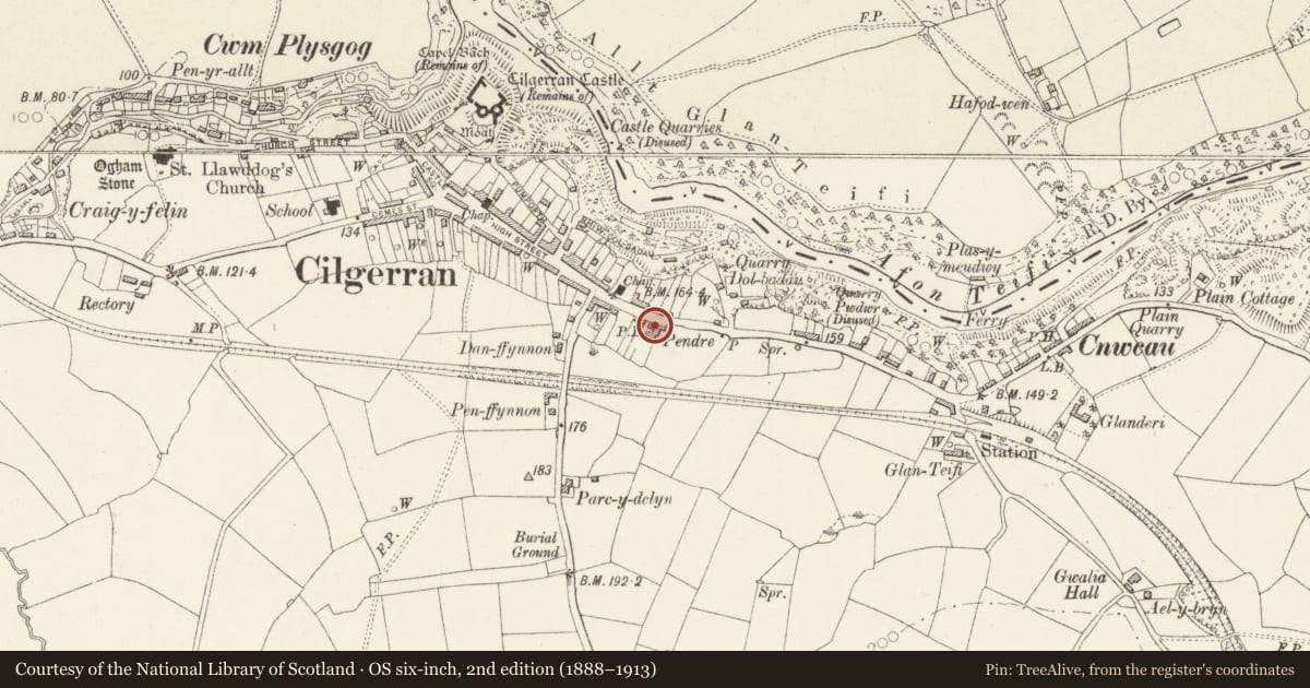
5 historical maps cover this location, the earliest the 1608 map "(13) Cambriae Typus." (David Rumsey Map Collection, Stanford Libraries).
Historical maps covering this location
- 1608 · (13) Cambriae Typus. (David Rumsey Map Collection, Stanford Libraries)
- 1636 · Cornubia : Devonia, Somersetus, Dorcestria, Wiltonia, Glocestria ... (David Rumsey Map Collection, Stanford Libraries)
- 1830 · V.3:11-15:XV. Britisches Reich. A. Kon: England. b. Frstenthum Wales: Shire: 37-40 (David Rumsey Map Collection, Stanford Libraries)
- 1898 · 193 Cardigan (Hills) (David Rumsey Map Collection, Stanford Libraries)
- 1901 · Sheet 13. (David Rumsey Map Collection, Stanford Libraries)
Cadw's description
Location
Situated at E end of street, some 100m E of Rhos Hill road.
Exterior
C18 inn, possibly earlier, whitewashed rubble stone with imitation slate roof and brick stacks. One and a half storeys. L-plan with projecting gable to right, brick end stacks and ridge stack and W end lean-to. Gable has 12-pane sash each floor with timber lintel and hornless sash to lower window and stone voussoirs and horned sash above. To left, painted brick porch and 12-pane sash to ground floor, projecting slate shelf course at lintel level, and first floor pair of 12-pane sashes breaking eaves under flat dormer. E end service range with brick E stack, slightly lower roof line and 12-pane sash over large casement pair with timber lintel. Outshut rear to main part.
Interior
Porch gives into room behind main stack, former E fireplace removed for access into service range. W room has timber-lintel E side fireplace and some rough joists. Two W side doors into lean-to and a third added.
Reason for designation
Vernacular public house of substantial picturesque character.
Nearby in the register
- Vestry and Forecourt RailingsReligious, Ritual and Funeraryunder 1 mi
- Penuel Baptist ChapelReligious, Ritual and Funeraryunder 1 mi
- OakleighDomesticunder 1 mi
- DinsdaleDomesticunder 1 mi
Other entries of the same register within about three miles of this one, by straight line.