Cof Cymru: National Historic Assets of Wales · Wales
Mary Short Memorial Drinking Fountain
St. Asaph, Denbighshire, Wales
A Grade II listed building in St. Asaph, Denbighshire, designated on 24 November 1987.
The record
- Designation
- Listed building, Grade II
- Broad class
- Commemorative
- Date of designation
- 24 November 1987
- Community
- St. Asaph
- Unitary authority
- Denbighshire
- Country
- Wales
- Coordinates
- 53.25659, -3.44615
- Cadw reference
- 1446
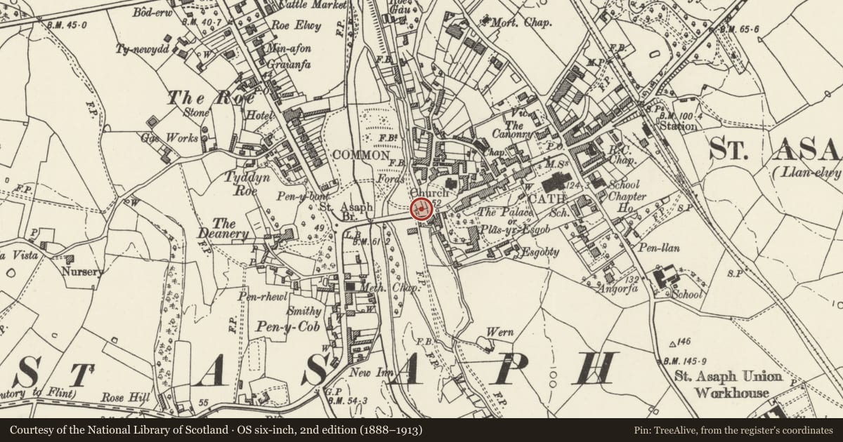
Slide toward Today to fade the historical sheet and see the modern map underneath.
David Rumsey Map Collection, Stanford LibrariesDavid Rumsey Map Collection, Stanford LibrariesLlyfrgell Genedlaethol Cymru – The National Library of WalesDavid Rumsey Map Collection, Stanford LibrariesDavid Rumsey Map Collection, Stanford Libraries
5 historical maps cover this location, the earliest the 1608 map "(13) Cambriae Typus." (David Rumsey Map Collection, Stanford Libraries).
Historical maps covering this location
- 1608 · (13) Cambriae Typus. (David Rumsey Map Collection, Stanford Libraries)
- 1795 · To Sir Watkin Williams-Wynn Bart ... the map of the six counties of North Wales is most… (Llyfrgell Genedlaethol Cymru – The National Library of Wales)
- 1830 · V.3:11-15:XV. Britisches Reich. A. Kon: England. b. Frstenthum Wales: Shire: 37-40 (David Rumsey Map Collection, Stanford Libraries)
- 1883 · Watershed map England, Wales 3. (David Rumsey Map Collection, Stanford Libraries)
- 1901 · Sheet 9 and 10. (David Rumsey Map Collection, Stanford Libraries)
Cadw's description
Location
At the roadside at the east end of the bridge.
History
Robust granite memorial to Mary Short, probably erected by her husband Bishop Vowler short (Bishop 1846-70).
Exterior
Polygonal piers forward at either end with stepped parapet over tablet set into broad foliage - trailed border and inscibed with biblical messages. Lions head to centre has fountain spout with chain, cup lost; trefoil scalloped low basin.
Nearby in the register
- Lodge & Gatepiers at driveway to the Old PalaceDomesticunder 1 mi
- Tithe Barn HouseDomesticunder 1 mi
- Sundial in the Churchyard to St .Kentigern & St .Asaph Parish ChurchGardens, Parks and Urban Spacesunder 1 mi
- Railings & Boundary Walls to St. Kentigern & St. Asaph Parish ChurchReligious, Ritual and Funeraryunder 1 mi
Other entries of the same register within about three miles of this one, by straight line.