Cof Cymru: National Historic Assets of Wales · Wales
Pen-y-Llan House
Overton, Wrexham, Wales
A Grade II listed building in Overton, Wrexham, designated on 15 March 1994.
The record
- Designation
- Listed building, Grade II
- Broad class
- Commercial
- Date of designation
- 15 March 1994
- Community
- Overton
- Unitary authority
- Wrexham
- Country
- Wales
- Coordinates
- 52.96912, -2.93549
- Cadw reference
- 14443
Slide toward Today to fade the historical sheet and see the modern map underneath.
David Rumsey Map Collection, Stanford LibrariesDavid Rumsey Map Collection, Stanford LibrariesDavid Rumsey Map Collection, Stanford LibrariesDavid Rumsey Map Collection, Stanford LibrariesDavid Rumsey Map Collection, Stanford Libraries
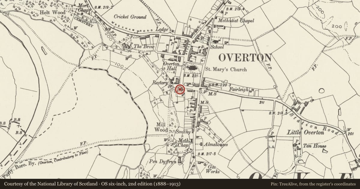
5 historical maps cover this location, the earliest the 1608 map "(13) Cambriae Typus." (David Rumsey Map Collection, Stanford Libraries).
Historical maps covering this location
- 1608 · (13) Cambriae Typus. (David Rumsey Map Collection, Stanford Libraries)
- 1637 · Particular description of Wales. Cambria seu Wallia (David Rumsey Map Collection, Stanford Libraries)
- 1830 · V.3:11-15:XV.Britisches Reich. A. Kon: England. a. England ab sich: Shire:15-17, 33 (David Rumsey Map Collection, Stanford Libraries)
- 1883 · Watershed map England, Wales 3. (David Rumsey Map Collection, Stanford Libraries)
- 1901 · Sheet 9 and 10. (David Rumsey Map Collection, Stanford Libraries)
Cadw's description
Location
On the corner of Pen-y-Llan Street and High Street, prominently sited to face down High Street.
History
House with former shop attached to east side. Early C19, the shop building probably somewhat later. The buildings are recorded as house and malt kiln in the Tithe survey of 1838, and it is possible that the shop building represents the rebuilding or remodelling of a former malthouse.
Exterior
Brick with slate roof. Two-storeys, 2-window range with entrance set slightly to left of centre. Six-panelled door with overlight in renewed pedimented case. Flanking windows on each floor are 12-pane sashes with fine glazing bars and painted flat-arched stone heads. Oriel window to first floor in right hand gable return. Coped gables with end wall stacks. The shop building may be a slightly later addition, and is set forward of the house. Two-storeys, single window range, with ground floor entirely occupied by shop front which has doorway recessed to left and window divided by 2 slim mullions, beneath continuous fascia. Four-pane sash window with painted flat arched head above. Hipped slate roof.
Nearby in the register
- Wall with two former OutbuildingsDomesticunder 1 mi
- Saint Mary's HouseDomesticunder 1 mi
- Bryn-y-Pys Estate OfficeDomesticunder 1 mi
- 1st Outbuilding to Gwydyr HouseDomesticunder 1 mi
Other entries of the same register within about three miles of this one, by straight line.