Cof Cymru: National Historic Assets of Wales · Wales
28 Commercial Row
Pembroke Dock, Pembrokeshire, Wales
A Grade II listed building in Pembroake Dock, Pembroke Dock, Pembrokeshire, designated on 18 February 1994.
The record
- Designation
- Listed building, Grade II
- Broad class
- Commercial
- Date of designation
- 18 February 1994
- Town
- Pembroake Dock
- Community
- Pembroke Dock
- Unitary authority
- Pembrokeshire
- Country
- Wales
- Coordinates
- 51.69264, -4.94805
- Cadw reference
- 14352
Slide toward Today to fade the historical sheet and see the modern map underneath.
David Rumsey Map Collection, Stanford LibrariesDavid Rumsey Map Collection, Stanford LibrariesDavid Rumsey Map Collection, Stanford LibrariesDavid Rumsey Map Collection, Stanford LibrariesDavid Rumsey Map Collection, Stanford Libraries
5 historical maps cover this location, the earliest the 1636 map "Cornubia : Devonia, Somersetus, Dorcestria, Wiltonia, Glocestria ..." (David Rumsey Map Collection, Stanford Libraries).
Historical maps covering this location
- 1636 · Cornubia : Devonia, Somersetus, Dorcestria, Wiltonia, Glocestria ... (David Rumsey Map Collection, Stanford Libraries)
- 1865 · England and Wales. England No. 6. (David Rumsey Map Collection, Stanford Libraries)
- 1891 · Sheet 10. Ordnance Survey of England and Wales. . (David Rumsey Map Collection, Stanford Libraries)
- 1898 · 228 Haverfordwest (Hills) (David Rumsey Map Collection, Stanford Libraries)
- 1901 · Sheet 13. (David Rumsey Map Collection, Stanford Libraries)
Cadw's description
Location
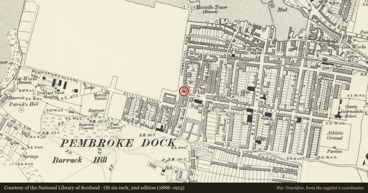
Situated on corner of Commercial Row and Albion Square.
History
Earlier C19 pair of houses plus a shop with flat above, altered early C20.
Commercial Row was built up during 1820's, completed by 1848 (Meyrick estate map). This row originally had cornice and parapet, channelled ground floor and outer quoins. The windows were small-paned sashes. A late C19 postcard shows no oriel on No 27, and that over the shop with slated roof. The upper windows had sill brackets and sill band.
Exterior
Two-storey two-window range to No 27 and four-window range to Nos 27A and 28. Stucco front, unpainted to No 27, which has slate roof and rendered S end stack, while the rest has imitation slate roofs. Windows are 4-pane sashes in moulded architraves, and doors to 27 and 27A are in pilastered surrounds with entablature and cornice. No 27 has timber oriel to first floor left and 6-panel door to ground floor right. Nos 27A and 28 have three first-floor sashes and timber oriel window to right; ground floor sash to left, C20 4-panel door and large mid to later C19 shop front to right. Plate glass shop windows framed by pilasters with rosettes carrying full-length fascia with cornice, inscribed in decorative lettering 'Moore & Co. Chemists'. Door between shop windows is C20, with overlight.
S end wall, to Albion Square has similar canted oriel, but with slate roof. Three windows below. SE rear wing.
Reason for designation
Included for prominent location opposite Dockyard wall and for fine shop front.
Nearby in the register
- 27 & 27ACommercialunder 1 mi
- The Market (formerly only NE elevation listed)Commercialunder 1 mi
- 18 Commercial RowCommercialunder 1 mi
- Former Dockyard ChapelReligious, Ritual and Funeraryunder 1 mi
Other entries of the same register within about three miles of this one, by straight line.