Cof Cymru: National Historic Assets of Wales · Wales
Red Lion P.H.
St. Asaph, Denbighshire, Wales
A Grade II listed building in St. Asaph, Denbighshire, designated on 24 September 1951.
The record
- Designation
- Listed building, Grade II
- Broad class
- Commercial
- Date of designation
- 24 September 1951
- Community
- St. Asaph
- Unitary authority
- Denbighshire
- Country
- Wales
- Coordinates
- 53.25724, -3.44422
- Cadw reference
- 1435
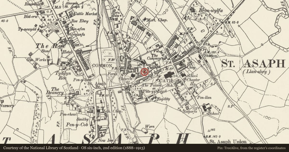
Slide toward Today to fade the historical sheet and see the modern map underneath.
David Rumsey Map Collection, Stanford LibrariesDavid Rumsey Map Collection, Stanford LibrariesLlyfrgell Genedlaethol Cymru – The National Library of WalesDavid Rumsey Map Collection, Stanford LibrariesDavid Rumsey Map Collection, Stanford Libraries
5 historical maps cover this location, the earliest the 1608 map "(13) Cambriae Typus." (David Rumsey Map Collection, Stanford Libraries).
Historical maps covering this location
- 1608 · (13) Cambriae Typus. (David Rumsey Map Collection, Stanford Libraries)
- 1795 · To Sir Watkin Williams-Wynn Bart ... the map of the six counties of North Wales is most… (Llyfrgell Genedlaethol Cymru – The National Library of Wales)
- 1830 · V.3:11-15:XV. Britisches Reich. A. Kon: England. b. Frstenthum Wales: Shire: 37-40 (David Rumsey Map Collection, Stanford Libraries)
- 1883 · Watershed map England, Wales 3. (David Rumsey Map Collection, Stanford Libraries)
- 1901 · Sheet 9 and 10. (David Rumsey Map Collection, Stanford Libraries)
Cadw's description
Location
Set back between the rear of the Midland Bank and Felton House on right; narrow open courtyard to the front.
History
Probably late C16/early C17 in origin with later alterations.
Exterior
2-storey, 4-window roughcast front with plinth, 1st floor cill-band and brick eaves band. Renewed slate roof, brick gable parapet, probably renewed, to right end with quarter round kneeler; rendered chimney stacks. Irregularly spaced windows, 2 attic dormers with hipped roofs and small pane casements. 12-pane windows to 1st floor, fixed to left, sash to right both nearly flush frames, earlier small 2-light window further to right. 'The Red Lion' lettering over porch offset to left, imitation crenellated parapet with large red lion over rounded edges and arched entrance with modern door. Ground floor has small pane sash to right of porch with glazing bars removed to the lower sash. To right a former doorway with cambered head has been blocked and a small-pane fixed window inserted. 1 bay cross range forward to left with similar detail.
Right gable-end retains a massive chimney breast with wrapround bandcourse, also to left end. Modern extension to right and lower rendered cross range.
Interior
Interior retains some stop-chamfered beams and boarded doors to bars. 1st floor is said to have been used as a theatre in the late C18/early C19 - a programme is retained dated 1806.
Reason for designation
Group value with listed items on High Street.
Nearby in the register
- Midland BankCommercialunder 1 mi
- Conservative ClubRecreationalunder 1 mi
- Including Yu's ChineseCommercialunder 1 mi
- 1 High StreetCommercialunder 1 mi
Other entries of the same register within about three miles of this one, by straight line.