Cof Cymru: National Historic Assets of Wales · Wales
Rhiannon House
Pembroke Dock, Pembrokeshire, Wales
A Grade II listed building in Pembroke Dock, Pembrokeshire, designated on 18 February 1994.
The record
- Designation
- Listed building, Grade II
- Broad class
- Domestic
- Date of designation
- 18 February 1994
- Locality
- Pembroke Dock
- Community
- Pembroke Dock
- Unitary authority
- Pembrokeshire
- Country
- Wales
- Coordinates
- 51.69163, -4.94133
- Cadw reference
- 14348
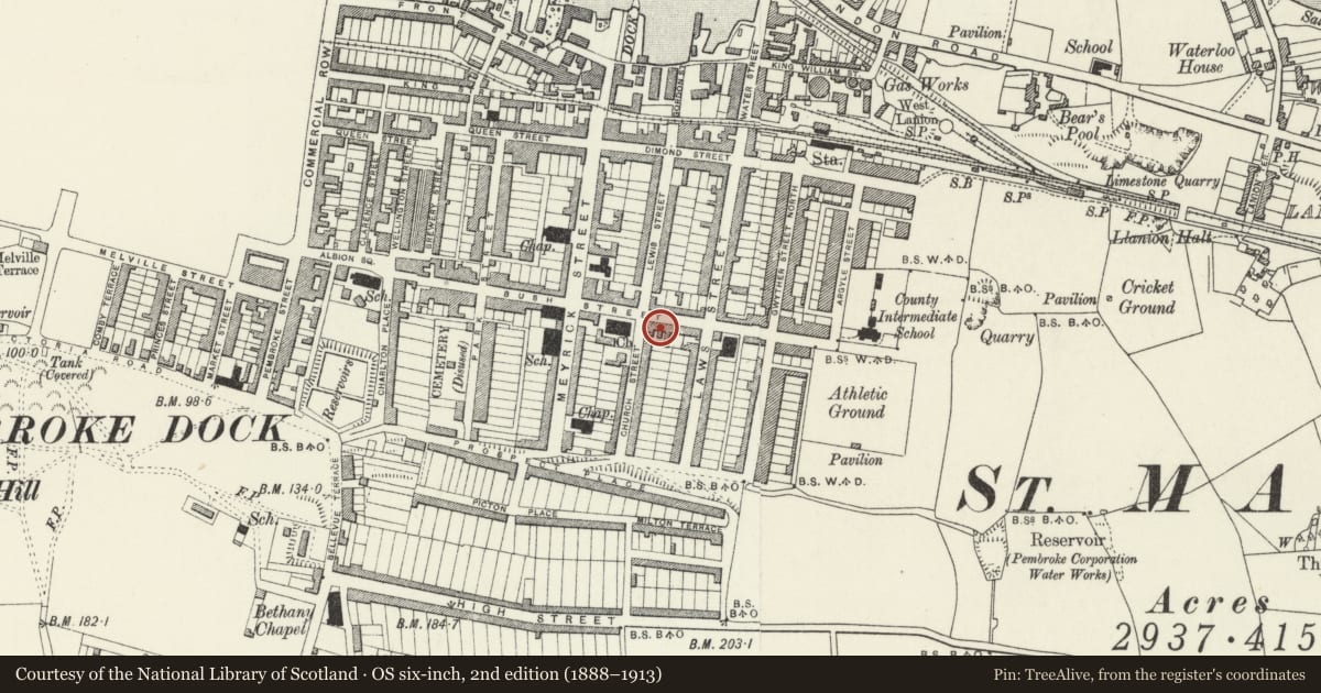
Slide toward Today to fade the historical sheet and see the modern map underneath.
David Rumsey Map Collection, Stanford LibrariesDavid Rumsey Map Collection, Stanford LibrariesDavid Rumsey Map Collection, Stanford LibrariesDavid Rumsey Map Collection, Stanford LibrariesDavid Rumsey Map Collection, Stanford Libraries
5 historical maps cover this location, the earliest the 1636 map "Cornubia : Devonia, Somersetus, Dorcestria, Wiltonia, Glocestria ..." (David Rumsey Map Collection, Stanford Libraries).
Historical maps covering this location
- 1636 · Cornubia : Devonia, Somersetus, Dorcestria, Wiltonia, Glocestria ... (David Rumsey Map Collection, Stanford Libraries)
- 1865 · England and Wales. England No. 6. (David Rumsey Map Collection, Stanford Libraries)
- 1891 · Sheet 10. Ordnance Survey of England and Wales. . (David Rumsey Map Collection, Stanford Libraries)
- 1898 · 228 Haverfordwest (Hills) (David Rumsey Map Collection, Stanford Libraries)
- 1901 · Sheet 13. (David Rumsey Map Collection, Stanford Libraries)
Cadw's description
Location
Situated at NE corner of Church Street, E of Parish Church.
History
Circa 1850 3-storey house. Nos 50-66 Bush Street formed an unusually grand row of stuccoed late Georgian style buildings, but apart from these and No 64 all are much altered. Nos 50-2 may be the corner buildings marked on 1848 Meyrick estate map, when rest of row was not built up. Illustrated in c1900 postcard, when No 50 had different shopfront and shopfront to No 52 had different glazing.
Exterior
Has lost original cornice, has margin glazed sashes to first floor and C20 windows in imitation on second. Ground floor has mid to later C19 shopfront with fascia and cornice right across, double-fronted shop to left with top-lights to shop windows, door with overlight to centre and double ledged doors to right to through carriageway.
Reason for designation
One of a pair of buildings forming the end of an unusually grand row of late Georgian style buildings.
Group value with church and War Memorial.
Nearby in the register
- Cambria HouseDomesticunder 1 mi
- The War MemorialCommemorativeunder 1 mi
- Nos 64 & 64A,Commercialunder 1 mi
- Section 2 of Churchyard Railings at Church of Saint JohnReligious, Ritual and Funeraryunder 1 mi
Other entries of the same register within about three miles of this one, by straight line.