Cof Cymru: National Historic Assets of Wales · Wales
Section 2 of Churchyard Railings at Church of Saint John
Pembroke Dock, Pembrokeshire, Wales
A Grade II listed building in Pembroke Dock, Pembrokeshire, designated on 18 February 1994.
The record
- Designation
- Listed building, Grade II
- Broad class
- Religious, Ritual and Funerary
- Date of designation
- 18 February 1994
- Community
- Pembroke Dock
- Unitary authority
- Pembrokeshire
- Country
- Wales
- Coordinates
- 51.69149, -4.94183
- Cadw reference
- 14345
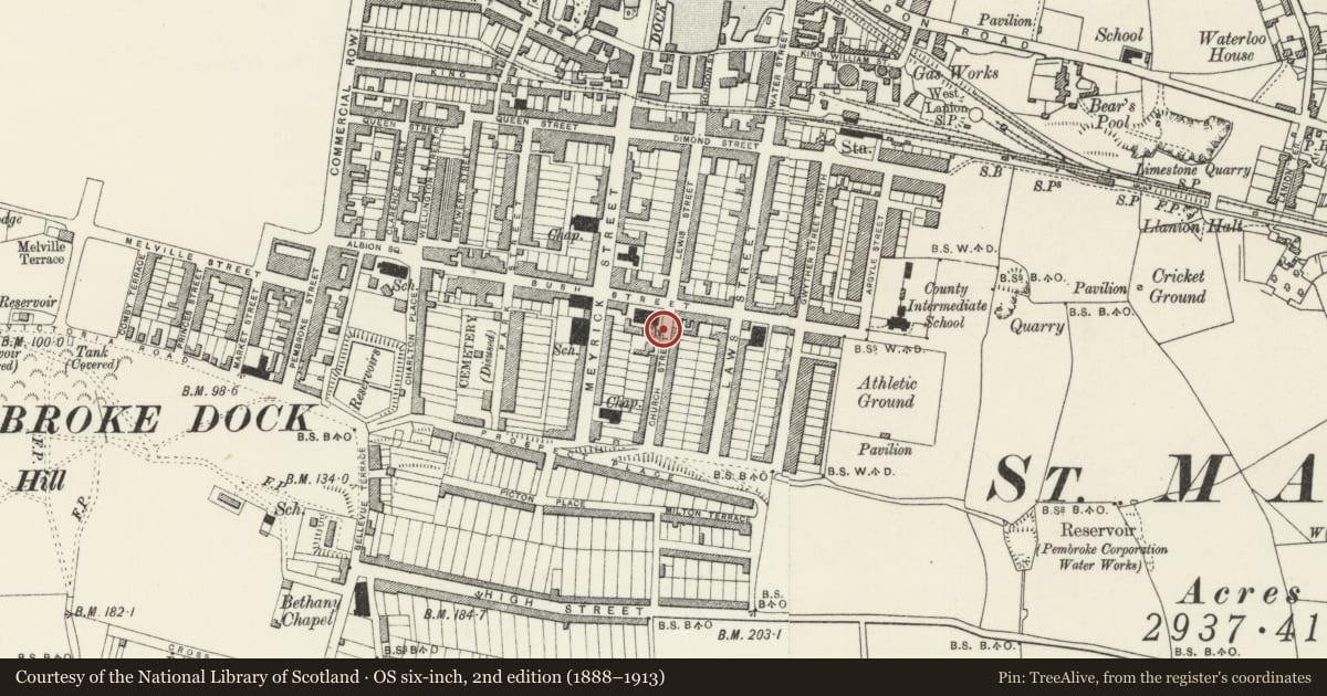
Slide toward Today to fade the historical sheet and see the modern map underneath.
David Rumsey Map Collection, Stanford LibrariesDavid Rumsey Map Collection, Stanford LibrariesDavid Rumsey Map Collection, Stanford LibrariesDavid Rumsey Map Collection, Stanford LibrariesDavid Rumsey Map Collection, Stanford Libraries
5 historical maps cover this location, the earliest the 1636 map "Cornubia : Devonia, Somersetus, Dorcestria, Wiltonia, Glocestria ..." (David Rumsey Map Collection, Stanford Libraries).
Historical maps covering this location
- 1636 · Cornubia : Devonia, Somersetus, Dorcestria, Wiltonia, Glocestria ... (David Rumsey Map Collection, Stanford Libraries)
- 1865 · England and Wales. England No. 6. (David Rumsey Map Collection, Stanford Libraries)
- 1891 · Sheet 10. Ordnance Survey of England and Wales. . (David Rumsey Map Collection, Stanford Libraries)
- 1898 · 228 Haverfordwest (Hills) (David Rumsey Map Collection, Stanford Libraries)
- 1901 · Sheet 13. (David Rumsey Map Collection, Stanford Libraries)
Cadw's description
Location
Situated on N and E sides of church, along Bush and Church Streets.
History
Mid to later C19 and early C20, two sets of low walls and iron rails, interrupted for 1921 War Memorial.
Exterior
To Bush Street: C19 railings, squared rubble low walls with stone coping and low spearhead rails. Two grey stone gatepiers with cross-gabled caps opposite N porch. Small W end pier.
To Church Street: Early C20 railings, with more ornate spearheads, terminated at pair of heavy C19 ashlar piers with cusped cross-gables and iron gates, in line with S porch.
Circa 1900 photos show rubble stone wall to Church Street.
Reason for designation
Included for group value.
Nearby in the register
- The War MemorialCommemorativeunder 1 mi
- Church of Saint John the EvangelistReligious, Ritual and Funeraryunder 1 mi
- Cambria HouseDomesticunder 1 mi
- The VicarageDomesticunder 1 mi
Other entries of the same register within about three miles of this one, by straight line.