Cof Cymru: National Historic Assets of Wales · Wales
Llys Isfryn Farmhouse
Prestatyn, Denbighshire, Wales
A Grade II listed building in Meliden, Prestatyn, Denbighshire, designated on 19 June 1950.
The record
- Designation
- Listed building, Grade II
- Broad class
- Domestic
- Date of designation
- 19 June 1950
- Locality
- Meliden
- Town
- Prestatyn
- Community
- Prestatyn
- Unitary authority
- Denbighshire
- Country
- Wales
- Coordinates
- 53.32159, -3.40970
- Cadw reference
- 1425
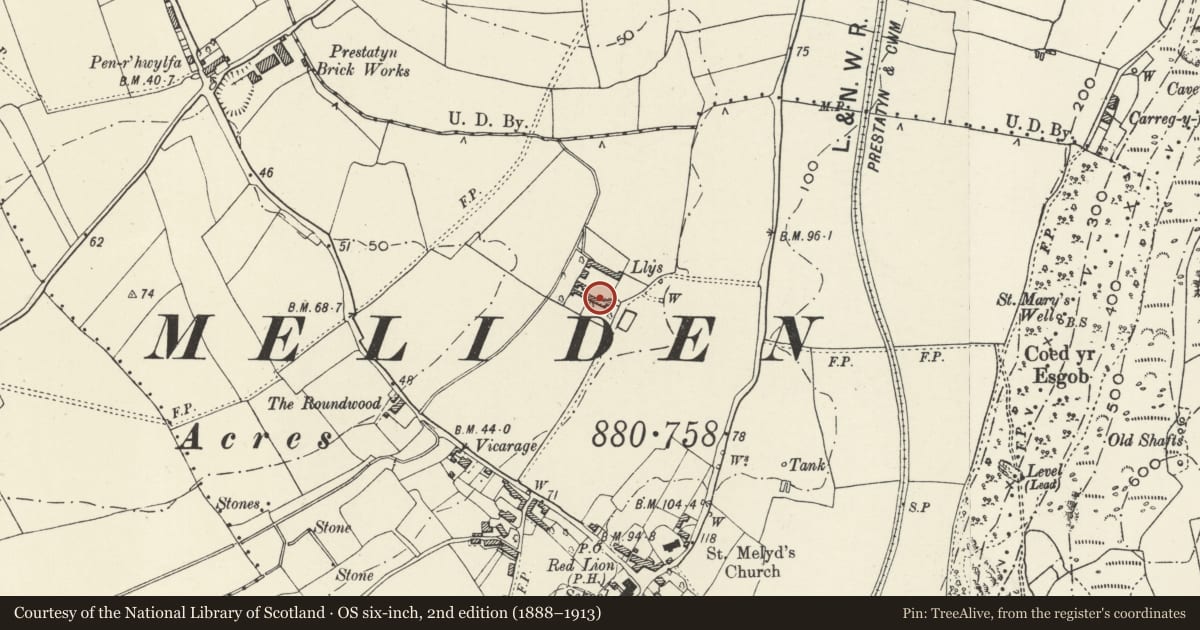
Slide toward Today to fade the historical sheet and see the modern map underneath.
David Rumsey Map Collection, Stanford LibrariesDavid Rumsey Map Collection, Stanford LibrariesDavid Rumsey Map Collection, Stanford LibrariesNational Library of ScotlandNational Library of Scotland
5 historical maps cover this location, the earliest the 1883 map "Watershed map England, Wales 3." (David Rumsey Map Collection, Stanford Libraries).
Historical maps covering this location
- 1883 · Watershed map England, Wales 3. (David Rumsey Map Collection, Stanford Libraries)
- 1885 · OS One-Inch (Hills) 1885-1903 (National Library of Scotland)
- 1898 · 95 Rhyl (Hills) (David Rumsey Map Collection, Stanford Libraries)
- 1901 · Sheet 9 and 10. (David Rumsey Map Collection, Stanford Libraries)
- 1930 · OS Popular Edition 1919-1947 (National Library of Scotland)
Cadw's description
Location
In Llys farmyard about 300 m to the north east of Ffordd Penrhwylfa and 200 m west of Meliden Road.
History
The Llys farmhouse occupies the site of an early episcopal palace in which Edward I is reputed to have held a conclave. The house is probably of the late C16, retaining a round-arched doorway and and arch-braced roof. At the rear there is a three-light mullioned window. The exterior generally has roughcast and whitewash of the C19.
Exterior
Roughcast and whitewashed house of two storeys at the corner of a farmyard group. A three-light mullioned window is said to survive at the rear.
This house was not surveyed due to foot-and-mouth disease restrictions.
Interior
Said to contain good ceiling beams and an arch-braced roof.
Reason for designation
Listed as a house retaining significant C16 detail.
Nearby in the register
- Prestatyn Roman SiteSettlementunder 1 mi
- The PrioryDomesticunder 1 mi
- Church of St MelydReligious, Ritual and Funeraryunder 1 mi
- Lychgate at Church of St MelydReligious, Ritual and Funeraryunder 1 mi
Other entries of the same register within about three miles of this one, by straight line.