Cof Cymru: National Historic Assets of Wales · Wales
Gatepiers and Gates adjoining Glaspant Lodge
Cenarth, Carmarthenshire, Wales
A Grade II listed building in Cenarth, Carmarthenshire, designated on 2 March 1994.
The record
- Designation
- Listed building, Grade II
- Broad class
- Domestic
- Date of designation
- 2 March 1994
- Community
- Cenarth
- Unitary authority
- Carmarthenshire
- Country
- Wales
- Coordinates
- 51.99782, -4.50279
- Cadw reference
- 14242
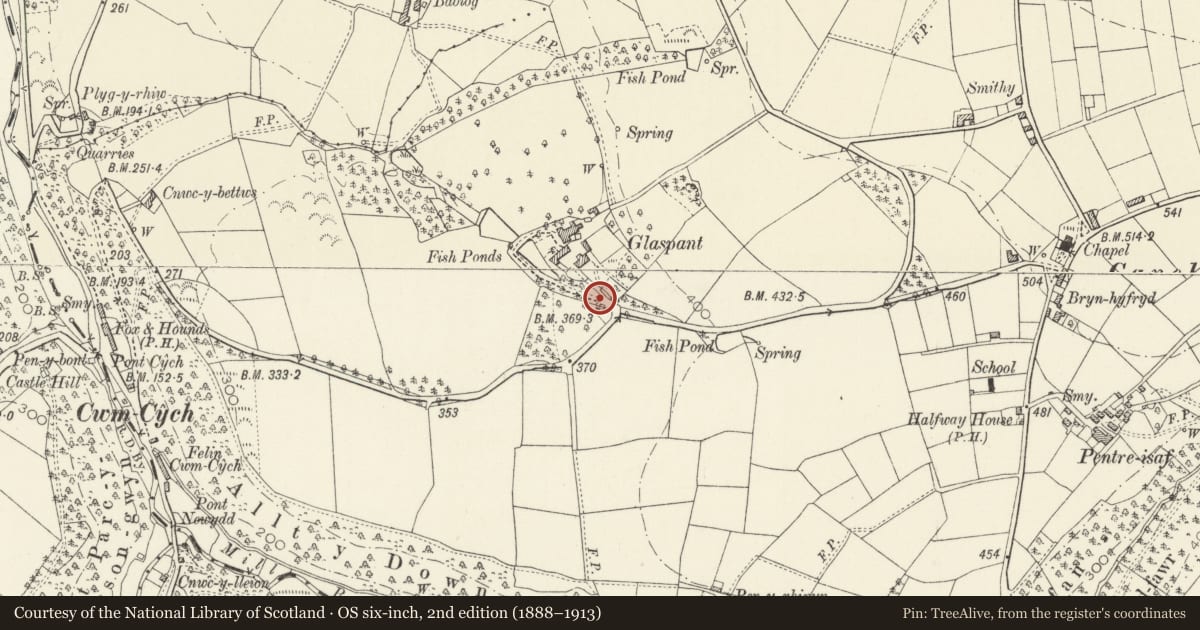
Slide toward Today to fade the historical sheet and see the modern map underneath.
David Rumsey Map Collection, Stanford LibrariesDavid Rumsey Map Collection, Stanford LibrariesDavid Rumsey Map Collection, Stanford LibrariesDavid Rumsey Map Collection, Stanford LibrariesDavid Rumsey Map Collection, Stanford Libraries
5 historical maps cover this location, the earliest the 1636 map "Cornubia : Devonia, Somersetus, Dorcestria, Wiltonia, Glocestria ..." (David Rumsey Map Collection, Stanford Libraries).
Historical maps covering this location
- 1636 · Cornubia : Devonia, Somersetus, Dorcestria, Wiltonia, Glocestria ... (David Rumsey Map Collection, Stanford Libraries)
- 1860 · 41. Caermathen. (David Rumsey Map Collection, Stanford Libraries)
- 1891 · Sheet 10. Ordnance Survey of England and Wales. . (David Rumsey Map Collection, Stanford Libraries)
- 1898 · 211 Newcastle Emlyn (Hills) (David Rumsey Map Collection, Stanford Libraries)
- 1901 · Sheet 14. (David Rumsey Map Collection, Stanford Libraries)
Cadw's description
Location
Situated adjoining Glaspant Lodge, at entry to former main drive to Glaspant (now overgrown).
Exterior
Early C19 entrance gates, two square piers in slate blocks, rusticated with moulded plinths, fluted frieze with horizontal flutings at angles and shallow slate pyramid caps with ball finials. Paired wrought iron gates with dog-bars, scrolled spearhead finials and top-rails ramped down to centre.
Reason for designation
Included as part of the early C19 estate improvements at Glaspant.
Nearby in the register
- Barn at GlaspantAgriculture and Subsistenceunder 1 mi
- GlaspantDomesticunder 1 mi
- Lower Rear Range at GlaspantDomesticunder 1 mi
- Rehoboth ChapelReligious, Ritual and Funeraryunder 1 mi
Other entries of the same register within about three miles of this one, by straight line.