Cof Cymru: National Historic Assets of Wales · Wales
Giulio's Restaurant
Carreghofa, Powys, Wales
A Grade II listed building in Llanymynech, Carreghofa, Powys, designated on 5 April 1993.
The record
- Designation
- Listed building, Grade II
- Broad class
- Domestic
- Date of designation
- 5 April 1993
- Locality
- Llanymynech
- Community
- Carreghofa
- Unitary authority
- Powys
- Country
- Wales
- Coordinates
- 52.78085, -3.08970
- Cadw reference
- 14197
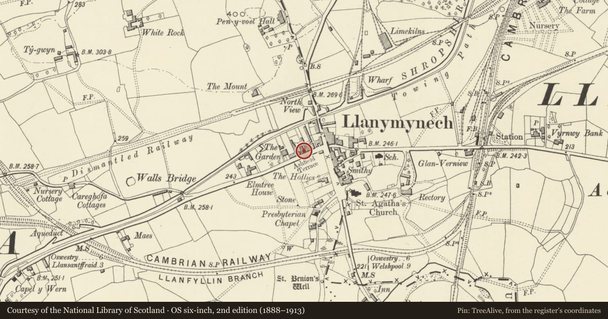
Slide toward Today to fade the historical sheet and see the modern map underneath.
David Rumsey Map Collection, Stanford LibrariesDavid Rumsey Map Collection, Stanford LibrariesDavid Rumsey Map Collection, Stanford LibrariesDavid Rumsey Map Collection, Stanford LibrariesLlyfrgell Genedlaethol Cymru – The National Library of Wales
5 historical maps cover this location, the earliest the 1795 map "To Sir Watkin Williams-Wynn Bart ... the map of the six counties of North Wales is most humbly inscribed by his obedient humble servant" (Llyfrgell Genedlaethol Cymru – The National Library of Wales).
Historical maps covering this location
- 1795 · To Sir Watkin Williams-Wynn Bart ... the map of the six counties of North Wales is most… (Llyfrgell Genedlaethol Cymru – The National Library of Wales)
- 1883 · Watershed map England, Wales 3. (David Rumsey Map Collection, Stanford Libraries)
- 1897 · 137 Oswestry (Hills) (David Rumsey Map Collection, Stanford Libraries)
- 1901 · Sheet 9 and 10. (David Rumsey Map Collection, Stanford Libraries)
- 1916 · Sheet 60. Shrewsbury. (David Rumsey Map Collection, Stanford Libraries)
Cadw's description
Location
Situated in Canal Road about 100 metres west of Llanymynech crossroads.
History
Mid C19 pair of three-storey, double-fronted houses.
Exterior
Rubble stone with brick facings to front elevation and east gable; west gable partially slate-hung. Two brick end stacks and central ridge stack. Two windows, small-paned sashes under painted stone flat arches. Plain pilaster door surrounds with shallow leaded canopies. Six-panelled front door to left hand house, modern glazed door to left gable also low decorative balustraded iron railings on stone base. Right hand house has modern timber and glazed shop front with small glazed door to right side.
Reason for designation
This pair of houses and Ashfield Terrace form a well-preserved group, together with the Gardd.
Nearby in the register
- Ashfield StoresDomesticunder 1 mi
- Nos 1-7 (Consec) Ashfield TerraceDomesticunder 1 mi
- No 1 The Gardd including outbuilding to rearDomesticunder 1 mi
- No 2 The Gardd including outbuilding to rearDomesticunder 1 mi
Other entries of the same register within about three miles of this one, by straight line.