Cof Cymru: National Historic Assets of Wales · Wales
Cwm Cottage
Margam, Neath Port Talbot, Wales
A Grade II listed building in Margam, Port Talbot, Neath Port Talbot, designated on 24 February 1975.
The record
- Designation
- Listed building, Grade II
- Broad class
- Domestic
- Date of designation
- 24 February 1975
- Locality
- Margam
- Town
- Port Talbot
- Community
- Margam
- Unitary authority
- Neath Port Talbot
- Country
- Wales
- Coordinates
- 51.56109, -3.73464
- Cadw reference
- 14165
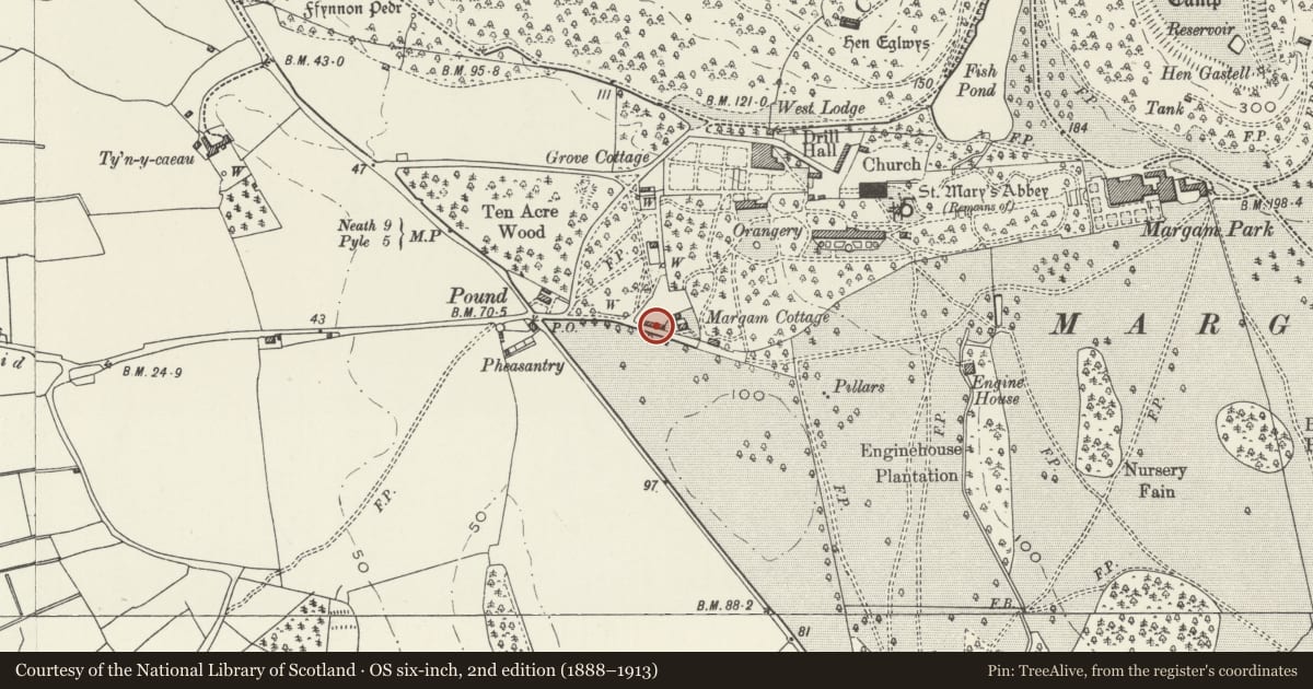
Slide toward Today to fade the historical sheet and see the modern map underneath.
David Rumsey Map Collection, Stanford LibrariesDavid Rumsey Map Collection, Stanford LibrariesDavid Rumsey Map Collection, Stanford LibrariesNational Library of ScotlandNational Library of Scotland
5 historical maps cover this location, the earliest the 1636 map "Cornubia : Devonia, Somersetus, Dorcestria, Wiltonia, Glocestria ..." (David Rumsey Map Collection, Stanford Libraries).
Historical maps covering this location
- 1636 · Cornubia : Devonia, Somersetus, Dorcestria, Wiltonia, Glocestria ... (David Rumsey Map Collection, Stanford Libraries)
- 1637 · The fourth table of England. Cornub. Devonia, Somerset etc. (David Rumsey Map Collection, Stanford Libraries)
- 1865 · England and Wales. England No. 6. (David Rumsey Map Collection, Stanford Libraries)
- 1885 · OS One-Inch (Hills) 1885-1903 (National Library of Scotland)
- 1930 · OS Popular Edition 1919-1947 (National Library of Scotland)
Cadw's description
Location
On a track which runs R (close to A48 junction) off the lane to the abbey church. The track was formerly a road running along the S side of Margam Park, but is now a cul-de-sac.
History
Shown on a survey of the Margam estate of 1814. Formerly had a thatched roof.
Exterior
Three-window 2-storey cottage facing S. Constructed of roughcast rubble stone under a C20 tiled roof with rendered end stacks. Irregularly spaced 2-light multi-pane wooden casement windows in rendered surrounds, with keystones to lower storey. Flat-headed planked door to L of centre flanked by windows. Further window to R. The windows to the upper storey are under shallow eye-brow dormer heads. Below the central window is a small date-stone reading: H / EM / 1693.
Late C20 2-window extension to L end with further end stack. Similar windows and eye-brow dormers. Half-lit French doors in W gable end with side lights, offset to R of the stack. The rear elevation of the house has 4 late C20 wooden windows to the ground floor and 3 raked half-dormers to the upper storey with 2-light casement windows. The extension to the R is 2-window with a planked door to the L. It appears to incorporate part of an earlier single-storey structure of brick and stone.
Interior
No access to interior at time of inspection (7/7/99).
Reason for designation
Listed for its early date and association with Margam Park. Group value with surrounding buildings and structures.
Nearby in the register
- Margam CottageDomesticunder 1 mi
- Ornamental PoolGardens, Parks and Urban Spacesunder 1 mi
- Former Changing RoomGardens, Parks and Urban Spacesunder 1 mi
- 2 Grove CottagesDomesticunder 1 mi
Other entries of the same register within about three miles of this one, by straight line.