Cof Cymru: National Historic Assets of Wales · Wales
Bryngwyn-mawr Farmhouse
Tremeirchion, Denbighshire, Wales
A Grade II listed building in Bryngwyn-mawr, Rhuallt, Tremeirchion, Denbighshire, designated on 16 November 1962.
The record
- Designation
- Listed building, Grade II
- Broad class
- Domestic
- Date of designation
- 16 November 1962
- Locality
- Bryngwyn-mawr, Rhuallt
- Community
- Tremeirchion
- Unitary authority
- Denbighshire
- Country
- Wales
- Coordinates
- 53.26673, -3.36545
- Cadw reference
- 1415
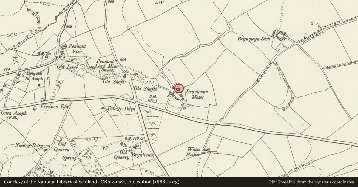
Slide toward Today to fade the historical sheet and see the modern map underneath.
David Rumsey Map Collection, Stanford LibrariesDavid Rumsey Map Collection, Stanford LibrariesLlyfrgell Genedlaethol Cymru – The National Library of WalesDavid Rumsey Map Collection, Stanford LibrariesNational Library of Scotland
5 historical maps cover this location, the earliest the 1795 map "To Sir Watkin Williams-Wynn Bart ... the map of the six counties of North Wales is most humbly inscribed by his obedient humble servant" (Llyfrgell Genedlaethol Cymru – The National Library of Wales).
Historical maps covering this location
- 1795 · To Sir Watkin Williams-Wynn Bart ... the map of the six counties of North Wales is most… (Llyfrgell Genedlaethol Cymru – The National Library of Wales)
- 1830 · V.3:11-15:XV. Britisches Reich. A. Kon: England. b. Frstenthum Wales: Shire: 37-40 (David Rumsey Map Collection, Stanford Libraries)
- 1883 · Watershed map England, Wales 3. (David Rumsey Map Collection, Stanford Libraries)
- 1901 · Sheet 9 and 10. (David Rumsey Map Collection, Stanford Libraries)
- 1930 · OS Popular Edition 1919-1947 (National Library of Scotland)
Cadw's description
Location
Set back at the east side of a minor road about 2 km north-north-east of Tremeirchion Parish Church.
History
A probably mid-C17 farmhouse, mentioned in Lhuyd's Parochialia c.1699; it appears to be of two units with end and lateral chimneys. The stairs are in a rear-projecting turret also of the C17. A plaque in the porch may have carried a coat of arms.
Surveyed in 1962 but not visited during 2001 resurvey due to Foot and Mouth precautions; exterior and interior descriptions retained.
Exterior
C17 with alterations and additions, 3-storey, 3-window stone farmhouse, with plinth. Massive projecting chimney, north. Near-flush-frame sash windows, with glazing bars mostly missing. Studded entrance door with obtuse-angled head with enriched spandrils and stopped moulded jambs, at back of (formerly recessed) porch with mullion windows (now filled in). Moulded sunk-panelled square stone tablet above entrance, with surface decayed.
Interior
Lozenge paving. Stopped bevelled beams. Wide boarded door with old strap hinges. Wide fireplaces filled in. Staircase in gabled projection, north, with heavy turned balusters, narrow moulded rail and heavy square newels. First floor - old flooring. Arched fireplace. Condition good.
Reason for designation
A vernacular farmhouse of the C17 with lateral chimney and stairs at rear.
Nearby in the register
- Pennant Mines Winding Engine House & Chimney, RhualltEngine Houseunder 1 mi
- Pennant Lead Mine Winding Engine HouseIndustrialunder 1 mi
- Criafol Round BarrowRound Barrowunder 1 mi
- Two Round Barrows on Moel Maen EfaRound Barrowunder 1 mi
Other entries of the same register within about three miles of this one, by straight line.