Cof Cymru: National Historic Assets of Wales · Wales
Garden Wall to east of Pentrebane Farmhouse
St. Fagans, Cardiff, Wales
A Grade II listed building in Pentrebane, Cardiff, St. Fagans, designated on 6 October 1977.
The record
- Designation
- Listed building, Grade II
- Broad class
- Domestic
- Date of designation
- 6 October 1977
- Locality
- Pentrebane
- Town
- Cardiff
- Community
- St. Fagans
- Unitary authority
- Cardiff
- Country
- Wales
- Coordinates
- 51.49907, -3.26721
- Cadw reference
- 13924
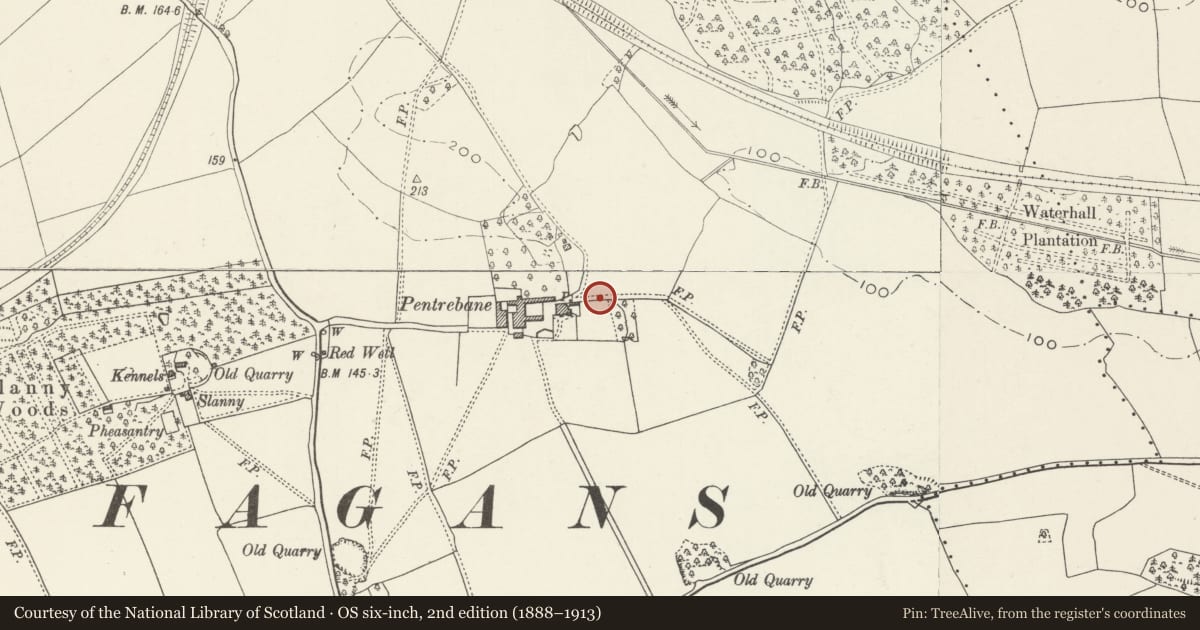
Slide toward Today to fade the historical sheet and see the modern map underneath.
David Rumsey Map Collection, Stanford LibrariesDavid Rumsey Map Collection, Stanford LibrariesDavid Rumsey Map Collection, Stanford LibrariesDavid Rumsey Map Collection, Stanford LibrariesDavid Rumsey Map Collection, Stanford Libraries
5 historical maps cover this location, the earliest the 1636 map "Cornubia : Devonia, Somersetus, Dorcestria, Wiltonia, Glocestria ..." (David Rumsey Map Collection, Stanford Libraries).
Historical maps covering this location
- 1636 · Cornubia : Devonia, Somersetus, Dorcestria, Wiltonia, Glocestria ... (David Rumsey Map Collection, Stanford Libraries)
- 1637 · The fourth table of England. Cornub. Devonia, Somerset etc. (David Rumsey Map Collection, Stanford Libraries)
- 1865 · England and Wales. England No. 6. (David Rumsey Map Collection, Stanford Libraries)
- 1898 · 263 Cardiff (Hills) (David Rumsey Map Collection, Stanford Libraries)
- 1913 · Sheet 110. Cardiff & Mouth of the Severn. (David Rumsey Map Collection, Stanford Libraries)
Cadw's description
Location
To the east of the farmhouse, approached off the road to Pentrebane and about 1000m north of St Fagans village.
History
Possibly early C18 in origin and thus contemporary with the apparently early C18 farmhouse.
Exterior
To the east of Pentrebane Farmhouse, the northern wall of a former walled garden remains, The southern aspect of the wall is of red brick with red brick capping and limestone plinth and the northern aspect of the wall is of stone. The wall is pierced by three rusticated semi-elliptical arches each surmounted by a shaped gable. To the rear of the centre arch there is a semi-circular arched recess with walls of brick, formerly housing two circular lunettes; rear also has stone-flagged floor and lean-to slate roof. At the time of resurvey the wall was in very poor condition. The east return wall also survives in part.
Reason for designation
Included as an interesting C18 garden feature having historic associations and group value with the nearby Pentrebane Farmhouse and Barn.
Nearby in the register
- Pentrebane FarmhouseDomesticunder 1 mi
- Barn to west of Pentrebane FarmhouseAgriculture and Subsistenceunder 1 mi
- Cowhouse at Pen-hefyd FarmAgriculture and Subsistenceunder 1 mi
- Rose CottageDomesticunder 1 mi
Other entries of the same register within about three miles of this one, by straight line.