Cof Cymru: National Historic Assets of Wales · Wales
The Old Post Office Restaurant
St. Fagans, Cardiff, Wales
A Grade II listed building in St Fagans, Cardiff, designated on 28 January 1963.
The record
- Designation
- Listed building, Grade II
- Broad class
- Domestic
- Date of designation
- 28 January 1963
- Locality
- St Fagans
- Town
- Cardiff
- Community
- St. Fagans
- Unitary authority
- Cardiff
- Country
- Wales
- Coordinates
- 51.48727, -3.26788
- Cadw reference
- 13873
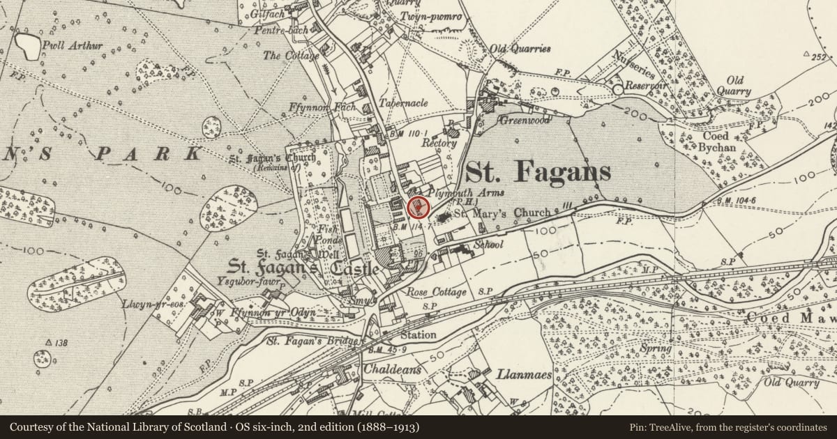
Slide toward Today to fade the historical sheet and see the modern map underneath.
David Rumsey Map Collection, Stanford LibrariesDavid Rumsey Map Collection, Stanford LibrariesDavid Rumsey Map Collection, Stanford LibrariesDavid Rumsey Map Collection, Stanford LibrariesDavid Rumsey Map Collection, Stanford Libraries
5 historical maps cover this location, the earliest the 1636 map "Cornubia : Devonia, Somersetus, Dorcestria, Wiltonia, Glocestria ..." (David Rumsey Map Collection, Stanford Libraries).
Historical maps covering this location
- 1636 · Cornubia : Devonia, Somersetus, Dorcestria, Wiltonia, Glocestria ... (David Rumsey Map Collection, Stanford Libraries)
- 1637 · The fourth table of England. Cornub. Devonia, Somerset etc. (David Rumsey Map Collection, Stanford Libraries)
- 1865 · England and Wales. England No. 6. (David Rumsey Map Collection, Stanford Libraries)
- 1898 · 263 Cardiff (Hills) (David Rumsey Map Collection, Stanford Libraries)
- 1913 · Sheet 110. Cardiff & Mouth of the Severn. (David Rumsey Map Collection, Stanford Libraries)
Cadw's description
Location
Part of a group of historic buildings in the main street of St Fagans village.
History
Northern two-storey part with C18 or earlier core; southern single storey part of C19 date; rear additions of the 1990s.
Exterior
Northern part, elevation to street with cement rendered cladding, slate gabled roof with flanking red brick stacks. Two storeys, four 3-panes wide sash windows on first floor; on ground floor a five panes wide sash window, one with horns, to each side of doorway with stone porch and six-panelled door.
Southern part of one storey. Elevation to the street has slate gabled roof, former doorway converted to a window to left hand and a 3-light stone mullion-and-transom window to the right hand, with wall letter box with GR cipher to the right of this.
Rear elevation with conservatory and other additions of the 1990s as part of its conversion to a restaurant.
Interior
Within, hallway with stone flagged floor and archway, and with blocked window opening in north wall. North ground floor room formerly with winding wood stair against north wall, also with ceiling beams; former dairy wing in rear wing to east of hallway; upstairs, roof trusses partly visible.
Reason for designation
Included as a part of the important group of historic estate buildings at the centre of St. Fagans village.
Nearby in the register
- Telephone Call-box adjoining Old Post OfficeCommunicationsunder 1 mi
- Eastern & Western Walls of Rose Garden at St Fagans CastleDomesticunder 1 mi
- The Plymouth Arms P HCommercialunder 1 mi
- Wall of the Churchyard of the Church of St Mary the Blessed Virgin with the attached War MemorialReligious, Ritual and Funeraryunder 1 mi
Other entries of the same register within about three miles of this one, by straight line.