Cof Cymru: National Historic Assets of Wales · Wales
Wall of the Churchyard of the Church of St Mary the Blessed Virgin with the attached War Memorial
St. Fagans, Cardiff, Wales
A Grade II listed building in St Fagans, Cardiff, designated on 28 January 1963.
The record
- Designation
- Listed building, Grade II
- Broad class
- Religious, Ritual and Funerary
- Date of designation
- 28 January 1963
- Locality
- St Fagans
- Town
- Cardiff
- Community
- St. Fagans
- Unitary authority
- Cardiff
- Country
- Wales
- Coordinates
- 51.48708, -3.26754
- Cadw reference
- 13872
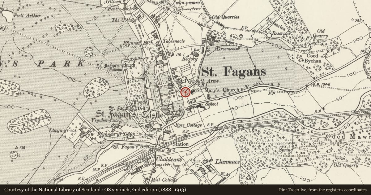
Slide toward Today to fade the historical sheet and see the modern map underneath.
David Rumsey Map Collection, Stanford LibrariesDavid Rumsey Map Collection, Stanford LibrariesDavid Rumsey Map Collection, Stanford LibrariesDavid Rumsey Map Collection, Stanford LibrariesDavid Rumsey Map Collection, Stanford Libraries
5 historical maps cover this location, the earliest the 1636 map "Cornubia : Devonia, Somersetus, Dorcestria, Wiltonia, Glocestria ..." (David Rumsey Map Collection, Stanford Libraries).
Historical maps covering this location
- 1636 · Cornubia : Devonia, Somersetus, Dorcestria, Wiltonia, Glocestria ... (David Rumsey Map Collection, Stanford Libraries)
- 1637 · The fourth table of England. Cornub. Devonia, Somerset etc. (David Rumsey Map Collection, Stanford Libraries)
- 1865 · England and Wales. England No. 6. (David Rumsey Map Collection, Stanford Libraries)
- 1898 · 263 Cardiff (Hills) (David Rumsey Map Collection, Stanford Libraries)
- 1913 · Sheet 110. Cardiff & Mouth of the Severn. (David Rumsey Map Collection, Stanford Libraries)
Cadw's description
Location
In the centre of St Fagans village.
History
Probably late C19 but with later alterations and repairs. Lychgate incorporated in the wall in 1885 (qv) and War Memorial added in c1920.
Exterior
Low stone rubble wall with roughly embattled coping but with rendered coping towards south end on south-west side of churchyard. The wall incorporates both the War Memorial, and the Lychgate (qv) and then curves round to follow Greenwood Lane where there is another small gate. The War Memorial dates from c1920 and is an unadorned design in unpolished granite with a plinth of three steps which carries an obelisk type shaft and a cross-head.
Reason for designation
Included as a part of the important group of historic estate buildings at the centre of St. Fagans village.
Nearby in the register
- Lychgate at entrance to Churchyard of Church of St Mary the Blessed VirginReligious, Ritual and Funeraryunder 1 mi
- Eastern & Western Walls of Rose Garden at St Fagans CastleDomesticunder 1 mi
- Telephone Call-box adjoining Old Post OfficeCommunicationsunder 1 mi
- Church of St Mary the Blessed VirginReligious, Ritual and Funeraryunder 1 mi
Other entries of the same register within about three miles of this one, by straight line.