Cof Cymru: National Historic Assets of Wales · Wales
Lychgate at entrance to Churchyard of Church of St Mary the Blessed Virgin
St. Fagans, Cardiff, Wales
A Grade II listed building in St Fagans, Cardiff, designated on 6 October 1977.
The record
- Designation
- Listed building, Grade II
- Broad class
- Religious, Ritual and Funerary
- Date of designation
- 6 October 1977
- Locality
- St Fagans
- Town
- Cardiff
- Community
- St. Fagans
- Unitary authority
- Cardiff
- Country
- Wales
- Coordinates
- 51.48697, -3.26747
- Cadw reference
- 13870
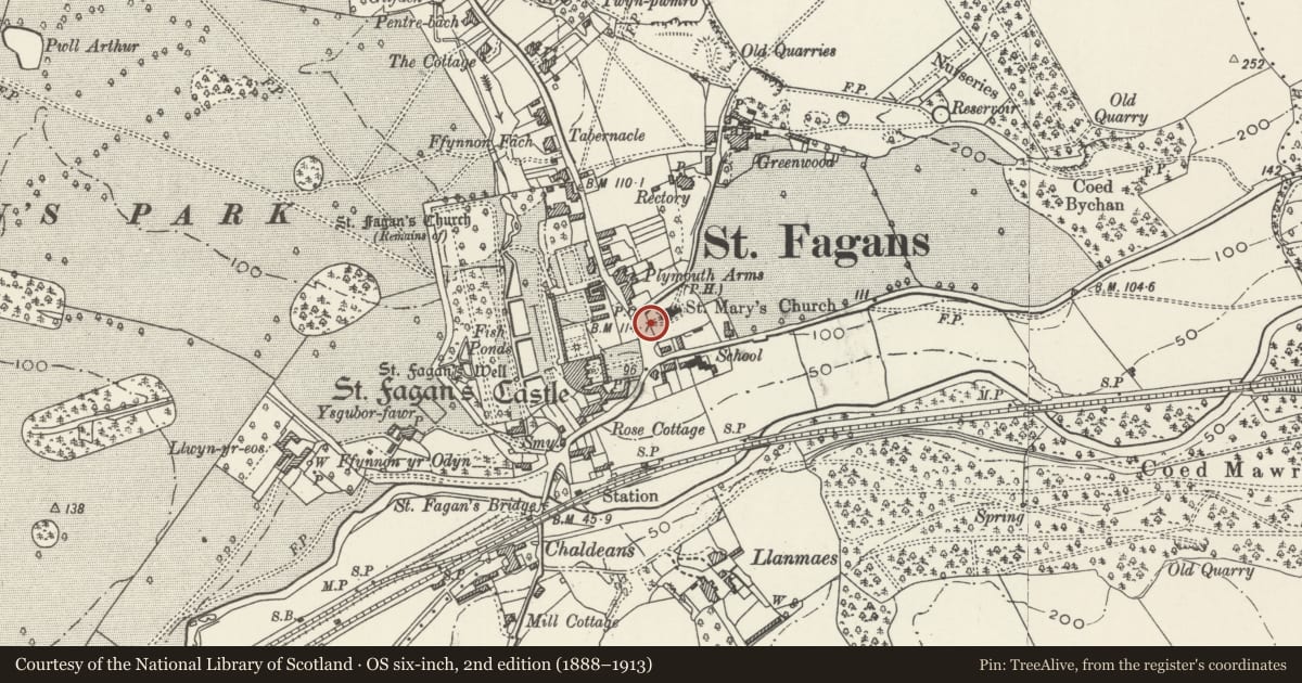
Slide toward Today to fade the historical sheet and see the modern map underneath.
David Rumsey Map Collection, Stanford LibrariesDavid Rumsey Map Collection, Stanford LibrariesDavid Rumsey Map Collection, Stanford LibrariesDavid Rumsey Map Collection, Stanford LibrariesDavid Rumsey Map Collection, Stanford Libraries
5 historical maps cover this location, the earliest the 1636 map "Cornubia : Devonia, Somersetus, Dorcestria, Wiltonia, Glocestria ..." (David Rumsey Map Collection, Stanford Libraries).
Historical maps covering this location
- 1636 · Cornubia : Devonia, Somersetus, Dorcestria, Wiltonia, Glocestria ... (David Rumsey Map Collection, Stanford Libraries)
- 1637 · The fourth table of England. Cornub. Devonia, Somerset etc. (David Rumsey Map Collection, Stanford Libraries)
- 1865 · England and Wales. England No. 6. (David Rumsey Map Collection, Stanford Libraries)
- 1898 · 263 Cardiff (Hills) (David Rumsey Map Collection, Stanford Libraries)
- 1913 · Sheet 110. Cardiff & Mouth of the Severn. (David Rumsey Map Collection, Stanford Libraries)
Cadw's description
Location
In the centre of St Fagans village.
History
1885. Given by Mr Robert Forrest.
Exterior
Squared limestone walls. Welsh slate gabled roof with scissors truss and with arch-braced king post at each end; trefoil headed arcading between roof and side walls. Cross on outer face of gable. Pair of wooden gates in south-west side.
Reason for designation
Included as a part of the important group of historic estate buildings at the centre of St. Fagans village.
Nearby in the register
- Wall of the Churchyard of the Church of St Mary the Blessed Virgin with the attached War MemorialReligious, Ritual and Funeraryunder 1 mi
- Church of St Mary the Blessed VirginReligious, Ritual and Funeraryunder 1 mi
- Eastern & Western Walls of Rose Garden at St Fagans CastleDomesticunder 1 mi
- Telephone Call-box adjoining Old Post OfficeCommunicationsunder 1 mi
Other entries of the same register within about three miles of this one, by straight line.