Cof Cymru: National Historic Assets of Wales · Wales
The Laurels
Whitchurch, Cardiff, Wales
A Grade II listed building in Whitchurch, Cardiff, designated on 19 May 1975.
The record
- Designation
- Listed building, Grade II
- Broad class
- Domestic
- Date of designation
- 19 May 1975
- Locality
- Whitchurch
- Town
- Cardiff
- Community
- Whitchurch
- Unitary authority
- Cardiff
- Country
- Wales
- Coordinates
- 51.51420, -3.22155
- Cadw reference
- 13776
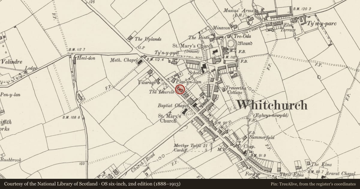
Slide toward Today to fade the historical sheet and see the modern map underneath.
David Rumsey Map Collection, Stanford LibrariesDavid Rumsey Map Collection, Stanford LibrariesDavid Rumsey Map Collection, Stanford LibrariesDavid Rumsey Map Collection, Stanford LibrariesDavid Rumsey Map Collection, Stanford Libraries
5 historical maps cover this location, the earliest the 1636 map "Cornubia : Devonia, Somersetus, Dorcestria, Wiltonia, Glocestria ..." (David Rumsey Map Collection, Stanford Libraries).
Historical maps covering this location
- 1636 · Cornubia : Devonia, Somersetus, Dorcestria, Wiltonia, Glocestria ... (David Rumsey Map Collection, Stanford Libraries)
- 1637 · The fourth table of England. Cornub. Devonia, Somerset etc. (David Rumsey Map Collection, Stanford Libraries)
- 1865 · England and Wales. England No. 6. (David Rumsey Map Collection, Stanford Libraries)
- 1898 · 263 Cardiff (Hills) (David Rumsey Map Collection, Stanford Libraries)
- 1913 · Sheet 110. Cardiff & Mouth of the Severn. (David Rumsey Map Collection, Stanford Libraries)
Cadw's description
Location
On the main road about 100m north of the Church of St. Mary.
History
A small mid C19 villa in Tudor style having group value with the adjoining No 27A.
Exterior
Stuccoed two storey two-bay front with gable with curvilinear bargeboards and cross finial over the left hand bay, Welsh slate roof with ridge tiles. L-shaped plan with rusticated quoins. The northern bay has a sash window with 2 over 2 panes and a square dripmould on first floor; bay window on ground floor. Southern bay with sash window with dripmould on ground floor, gable stack. In south return a further gable over first floor window. Side elevations plain, left return with door, window and two truncated stacks, rear elevation not seen.
Interior
Interior not seen at resurvey (November 2001).
Reason for designation
Included as a mid C19 villa of character having group value with No 27A next door.
Nearby in the register
- Six GablesDomesticunder 1 mi
- Church of St. MaryReligious, Ritual and Funeraryunder 1 mi
- The PinesDomesticunder 1 mi
- Whitchurch War MemorialCommemorativeunder 1 mi
Other entries of the same register within about three miles of this one, by straight line.