Cof Cymru: National Historic Assets of Wales · Wales
Setts paving the Path leading from the Lychgate to the Cathedral
Llandaff, Cardiff, Wales
A Grade II listed building in Llandaff, Cardiff, designated on 19 May 1975.
The record
- Designation
- Listed building, Grade II
- Broad class
- Religious, Ritual and Funerary
- Date of designation
- 19 May 1975
- Locality
- Llandaff
- Town
- Cardiff
- Community
- Llandaff
- Unitary authority
- Cardiff
- Country
- Wales
- Coordinates
- 51.49532, -3.21828
- Cadw reference
- 13708
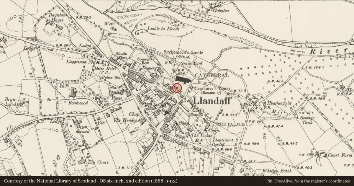
Slide toward Today to fade the historical sheet and see the modern map underneath.
David Rumsey Map Collection, Stanford LibrariesDavid Rumsey Map Collection, Stanford LibrariesDavid Rumsey Map Collection, Stanford LibrariesDavid Rumsey Map Collection, Stanford LibrariesDavid Rumsey Map Collection, Stanford Libraries
5 historical maps cover this location, the earliest the 1636 map "Cornubia : Devonia, Somersetus, Dorcestria, Wiltonia, Glocestria ..." (David Rumsey Map Collection, Stanford Libraries).
Historical maps covering this location
- 1636 · Cornubia : Devonia, Somersetus, Dorcestria, Wiltonia, Glocestria ... (David Rumsey Map Collection, Stanford Libraries)
- 1637 · The fourth table of England. Cornub. Devonia, Somerset etc. (David Rumsey Map Collection, Stanford Libraries)
- 1865 · England and Wales. England No. 6. (David Rumsey Map Collection, Stanford Libraries)
- 1898 · 263 Cardiff (Hills) (David Rumsey Map Collection, Stanford Libraries)
- 1913 · Sheet 110. Cardiff & Mouth of the Severn. (David Rumsey Map Collection, Stanford Libraries)
Cadw's description
Location
Lining the path from the Lychgate to the Cathedral west door.
History
Probably c1870 and contemporary with the Lychgate and adjoining wall and a part of the John Prichard designed improvements to the Cathedral. The surface of river stones is believed to date from the period of George Pace's C20 restoration of the Cathedral.
Exterior
Large river pebbles of Radyr stone line path to south-east of the wall, and extend from Lychgate downhill to the Cathedral. The path is flanked by gutters of pitched pebbles. The path is about 2m in width and about 100m long on a steep slope.
Reason for designation
Included for group value with the Cathedral.
Nearby in the register
- Lychgate and attached wall descending to the CathedralReligious, Ritual and Funeraryunder 1 mi
- No. 2 White HouseDomesticunder 1 mi
- Llandaff Cathedral Bell TowerBell Towerunder 1 mi
- No. 1 White HouseDomesticunder 1 mi
Other entries of the same register within about three miles of this one, by straight line.