Cof Cymru: National Historic Assets of Wales · Wales
Parliament House
Rhuddlan, Denbighshire, Wales
A Grade II listed building in Rhuddlan, Denbighshire, designated on 24 September 1951.
The record
- Designation
- Listed building, Grade II
- Broad class
- Domestic
- Date of designation
- 24 September 1951
- Community
- Rhuddlan
- Unitary authority
- Denbighshire
- Country
- Wales
- Coordinates
- 53.29080, -3.46611
- Cadw reference
- 1367
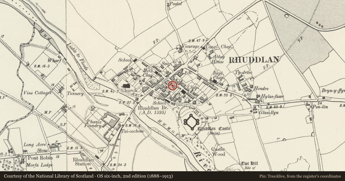
Slide toward Today to fade the historical sheet and see the modern map underneath.
David Rumsey Map Collection, Stanford LibrariesDavid Rumsey Map Collection, Stanford LibrariesNational Library of ScotlandDavid Rumsey Map Collection, Stanford LibrariesLlyfrgell Genedlaethol Cymru – The National Library of Wales
5 historical maps cover this location, the earliest the 1795 map "To Sir Watkin Williams-Wynn Bart ... the map of the six counties of North Wales is most humbly inscribed by his obedient humble servant" (Llyfrgell Genedlaethol Cymru – The National Library of Wales).
Historical maps covering this location
- 1795 · To Sir Watkin Williams-Wynn Bart ... the map of the six counties of North Wales is most… (Llyfrgell Genedlaethol Cymru – The National Library of Wales)
- 1883 · Watershed map England, Wales 3. (David Rumsey Map Collection, Stanford Libraries)
- 1898 · 95 Rhyl (Hills) (David Rumsey Map Collection, Stanford Libraries)
- 1901 · Sheet 9 and 10. (David Rumsey Map Collection, Stanford Libraries)
- 1963 · Map No. 36 - Local Government Commission for Wales : [Definitive maps showing proposed… (National Library of Scotland)
Cadw's description
Location
On the corner with High Street.
Exterior
Formerly a terrace of 4 cottages, but now 2 dwellings, incorporating in the gable wall facing High Street, fragmentary remains of medieval masonry of which an inscribed stone records: 'This fragment is the remains of the building where Edward I held his parliament A.D. 1283, in which was passed the Statute of Rhuddlan, securing to the Principality of Wales its judicial rights and independence'. The C13 doorway and C14 cusped ogee window (both blocked) are not in situ and are probably from the castle. There is no evidence to associate a building on this site with the site of the parliament of 1283. The main elevation to Parliament Street has been heavily modified, but each house has doorway to left, and 3 renewed windows to ground floor (2 windows above) with cambered brick heads.
Reason for designation
Included for the historical associations of the site.
Nearby in the register
- BelmontDomesticunder 1 mi
- Parliament HouseDomesticunder 1 mi
- Bryn Awel and Fondella BuildingNo class recordedunder 1 mi
- Lychgate to ChurchyardReligious, Ritual and Funeraryunder 1 mi
Other entries of the same register within about three miles of this one, by straight line.