Cof Cymru: National Historic Assets of Wales · Wales
Former School Room to Rear of Ebeneser Chapel
Castle, Cardiff, Wales
A Grade II listed building in Castle, Cardiff, designated on 19 May 1975.
The record
- Designation
- Listed building, Grade II
- Broad class
- Religious, Ritual and Funerary
- Date of designation
- 19 May 1975
- Community
- Castle
- Unitary authority
- Cardiff
- Country
- Wales
- Coordinates
- 51.48134, -3.17317
- Cadw reference
- 13669
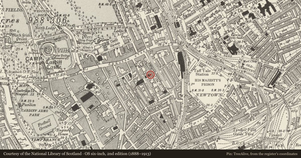
Slide toward Today to fade the historical sheet and see the modern map underneath.
David Rumsey Map Collection, Stanford LibrariesDavid Rumsey Map Collection, Stanford LibrariesDavid Rumsey Map Collection, Stanford LibrariesDavid Rumsey Map Collection, Stanford LibrariesDavid Rumsey Map Collection, Stanford Libraries
5 historical maps cover this location, the earliest the 1636 map "Cornubia : Devonia, Somersetus, Dorcestria, Wiltonia, Glocestria ..." (David Rumsey Map Collection, Stanford Libraries).
Historical maps covering this location
- 1636 · Cornubia : Devonia, Somersetus, Dorcestria, Wiltonia, Glocestria ... (David Rumsey Map Collection, Stanford Libraries)
- 1865 · England and Wales. England No. 6. (David Rumsey Map Collection, Stanford Libraries)
- 1895 · Sheet 11. Ordnance Survey of England and Wales. (David Rumsey Map Collection, Stanford Libraries)
- 1898 · 263 Cardiff (Hills) (David Rumsey Map Collection, Stanford Libraries)
- 1913 · Sheet 110. Cardiff & Mouth of the Severn. (David Rumsey Map Collection, Stanford Libraries)
Cadw's description
Location
To rear of Ebeneser Chapel.
History
1871, by W D Blessley.
Exterior
Rectangular block with Gothic motifs built against apsidal end of church and connected to it on its northern side by a short corridor wing with a six-light unglazed opening in its front wall. Schoolroom faced externally in stone. Slate roof. At northern end of south-west elevation, facing towards Charles Street and to north of corridor wing there is a tall narrow gabled porch flanked to each side by a narrow single light window. At the south end of the same elevation there is a further gabled porch. Church parlour of 1889 built against southern elevation; gabled south-west elevation of church parlour has a flat-roofed ground floor projection with a blind rectangular centre panel flanked to each side by a short paired lancet window. From north to south, rear elevation of schoolroom has two-light windows with daggers over, blocked doorway, two external stone chimneys and a single window.
Reason for designation
Listed for group value with chapel.
Nearby in the register
- Ebeneser Chapel (URC)Religious, Ritual and Funeraryunder 1 mi
- Boundary Walls & Piers to Churchyard of Ebeneser URCReligious, Ritual and Funeraryunder 1 mi
- St David's Roman Catholic CathedralReligious, Ritual and Funeraryunder 1 mi
- 44 Charles StreetDomesticunder 1 mi
Other entries of the same register within about three miles of this one, by straight line.