Cof Cymru: National Historic Assets of Wales · Wales
The Three Tuns
St. Nicholas and Bonvilston, Vale of Glamorgan, Wales
A Grade II listed building in St Nicholas, St. Nicholas and Bonvilston, Vale of Glamorgan, designated on 28 January 1963.
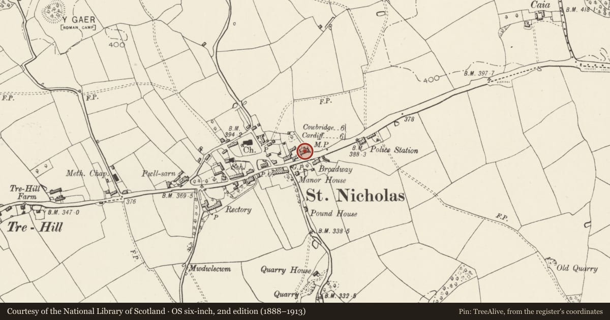
The record
- Designation
- Listed building, Grade II
- Broad class
- Domestic
- Date of designation
- 28 January 1963
- Locality
- St Nicholas
- Community
- St. Nicholas and Bonvilston
- Unitary authority
- Vale of Glamorgan
- Country
- Wales
- Coordinates
- 51.46070, -3.30863
- Cadw reference
- 13637
Slide toward Today to fade the historical sheet and see the modern map underneath.
David Rumsey Map Collection, Stanford LibrariesDavid Rumsey Map Collection, Stanford LibrariesDavid Rumsey Map Collection, Stanford LibrariesDavid Rumsey Map Collection, Stanford LibrariesDavid Rumsey Map Collection, Stanford Libraries
5 historical maps cover this location, the earliest the 1636 map "Cornubia : Devonia, Somersetus, Dorcestria, Wiltonia, Glocestria ..." (David Rumsey Map Collection, Stanford Libraries).
Historical maps covering this location
- 1636 · Cornubia : Devonia, Somersetus, Dorcestria, Wiltonia, Glocestria ... (David Rumsey Map Collection, Stanford Libraries)
- 1637 · The fourth table of England. Cornub. Devonia, Somerset etc. (David Rumsey Map Collection, Stanford Libraries)
- 1865 · England and Wales. England No. 6. (David Rumsey Map Collection, Stanford Libraries)
- 1898 · 263 Cardiff (Hills) (David Rumsey Map Collection, Stanford Libraries)
- 1913 · Sheet 110. Cardiff & Mouth of the Severn. (David Rumsey Map Collection, Stanford Libraries)
Cadw's description
Location
Prominently situated within St. Nicholas Village. Set back from the road frontage by a modern rubble stone wall with flagged courtyard to front.
History
C16 origins, understood to have formerly been an Inn and now in residential use.
Exterior
Two storey house of eight bays, limestone rubble elevations beneath a longstraw thatch roof. To ground floor timber casements of two, three and four small paned lights, with two six over six sashes at the E end. The four-centred arched front door has a Victorian hoodmould over with foliate labels. To first floor eight sashes with glazing bars, two at W end, eight over eight, the remainder six over six; beneath "eyebrows", with exposed timber lintels. Two doorways to front, one to N end and one to S. Assorted casement windows to ground floor. Three rubble chimneys, one gable and two axial.
Interior
Not accessible at time of inspection. (March 1995)
Reason for designation
Listed grade II as a picturesque village house of C16 origins.
Nearby in the register
- Telephone Call-box on corner with road to St Nicholas' ChurchCommunicationsunder 1 mi
- GPO Pillar on corner with Road to St Nicholas' ChurchCommunicationsunder 1 mi
- Parish Church of St NicholasReligious, Ritual and Funeraryunder 1 mi
- Tinkins Hall (former Cory Institute)Religious, Ritual and Funeraryunder 1 mi
Other entries of the same register within about three miles of this one, by straight line.