Cof Cymru: National Historic Assets of Wales · Wales
PIgeon Hose at Nash Manor
Llandow, Vale of Glamorgan, Wales
A Grade II listed building in Nash, Llandow, Vale of Glamorgan, designated on 2 June 1993.
The record
- Designation
- Listed building, Grade II
- Broad class
- Agriculture and Subsistence
- Date of designation
- 2 June 1993
- Locality
- Nash
- Community
- Llandow
- Unitary authority
- Vale of Glamorgan
- Country
- Wales
- Coordinates
- 51.44554, -3.49497
- Cadw reference
- 13486
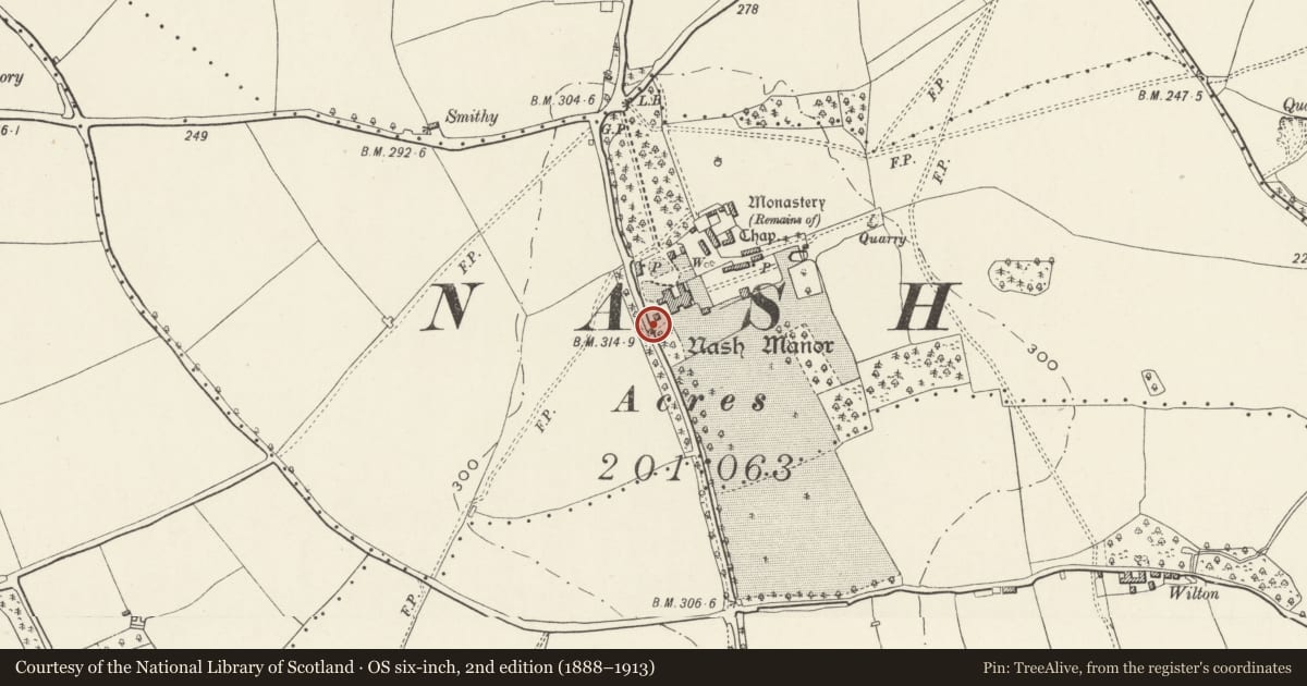
Slide toward Today to fade the historical sheet and see the modern map underneath.
David Rumsey Map Collection, Stanford LibrariesDavid Rumsey Map Collection, Stanford LibrariesDavid Rumsey Map Collection, Stanford LibrariesDavid Rumsey Map Collection, Stanford LibrariesDavid Rumsey Map Collection, Stanford Libraries
5 historical maps cover this location, the earliest the 1636 map "Cornubia : Devonia, Somersetus, Dorcestria, Wiltonia, Glocestria ..." (David Rumsey Map Collection, Stanford Libraries).
Historical maps covering this location
- 1636 · Cornubia : Devonia, Somersetus, Dorcestria, Wiltonia, Glocestria ... (David Rumsey Map Collection, Stanford Libraries)
- 1637 · The fourth table of England. Cornub. Devonia, Somerset etc. (David Rumsey Map Collection, Stanford Libraries)
- 1865 · England and Wales. England No. 6. (David Rumsey Map Collection, Stanford Libraries)
- 1897 · 262 Pontypridd (Hills) (David Rumsey Map Collection, Stanford Libraries)
- 1897 · 262 Pontypridd (Outline) (David Rumsey Map Collection, Stanford Libraries)
Cadw's description
Location
The Pigeon House is immediately beside the roadside boundary wall to the W of the main house; linked to the Pheasant House by a courtyard wall.
History
Nash Manor is set in its own grounds to the N of the Llandow trading estate and 1km S of Llysworney. The entrance to the drive is at the junction of the B4268 and B4270.
Earlier C18, erected by John Carne who was Sheriff of Glamorgan in 1731; built to provide for this important manor house.
Nash Manor is a multi-period country house with long standing associations with the Carne family who were important in Glamorgan for many generations.
Exterior
Square, rubble building with pyramidal slate roof. Entrance is on the N side which has stone voussoirs to the square-headed ground floor openings and brick voussoirs to the taller, round-headed, loft openings which have stone ledges. Tall square-headed opening to E side and pointed arch small-pane window to S. Internally it is limewashed and the loft floor has chamfered beams.
In an advanced state of disrepair at the time of inspection (June 1995).
Reason for designation
Included for group value with Nash Manor and the adjacent Pheasant house.
Nearby in the register
- Pheasant House at Nash ManorDomesticunder 1 mi
- Nash ManorDomesticunder 1 mi
- The RectoryDomesticunder 1 mi
- Milepost at the Carne Arms PHTransportunder 1 mi
Other entries of the same register within about three miles of this one, by straight line.