Cof Cymru: National Historic Assets of Wales · Wales
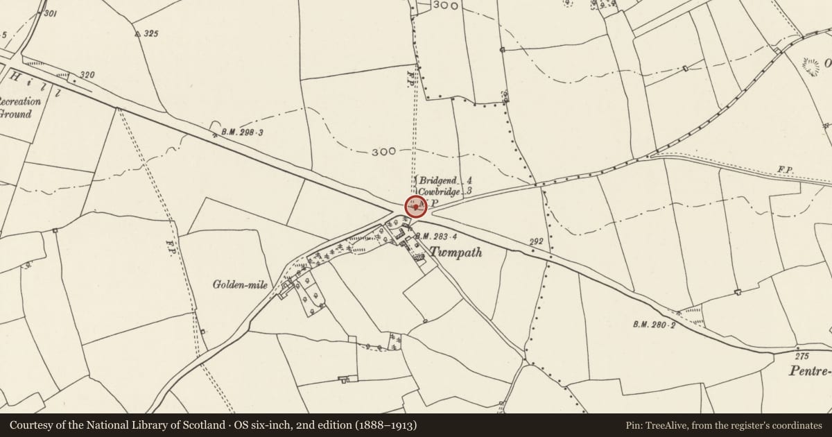
Milepost on north-east side of A48, opposite to Twmpath Farm
Colwinston, Vale of Glamorgan, Wales
A Grade II listed building in Colwinston, Cowbridge / Y Bont-Faen, Vale of Glamorgan, designated on 24 October 1980.
The record
- Designation
- Listed building, Grade II
- Broad class
- Transport
- Date of designation
- 24 October 1980
- Locality
- Colwinston
- Town
- Cowbridge / Y Bont-Faen
- Community
- Colwinston
- Unitary authority
- Vale of Glamorgan
- Country
- Wales
- Coordinates
- 51.47508, -3.50467
- Cadw reference
- 13407
Slide toward Today to fade the historical sheet and see the modern map underneath.
David Rumsey Map Collection, Stanford LibrariesDavid Rumsey Map Collection, Stanford LibrariesDavid Rumsey Map Collection, Stanford LibrariesDavid Rumsey Map Collection, Stanford LibrariesDavid Rumsey Map Collection, Stanford Libraries
5 historical maps cover this location, the earliest the 1636 map "Cornubia : Devonia, Somersetus, Dorcestria, Wiltonia, Glocestria ..." (David Rumsey Map Collection, Stanford Libraries).
Historical maps covering this location
- 1636 · Cornubia : Devonia, Somersetus, Dorcestria, Wiltonia, Glocestria ... (David Rumsey Map Collection, Stanford Libraries)
- 1637 · The fourth table of England. Cornub. Devonia, Somerset etc. (David Rumsey Map Collection, Stanford Libraries)
- 1865 · England and Wales. England No. 6. (David Rumsey Map Collection, Stanford Libraries)
- 1897 · 262 Pontypridd (Hills) (David Rumsey Map Collection, Stanford Libraries)
- 1897 · 262 Pontypridd (Outline) (David Rumsey Map Collection, Stanford Libraries)
Cadw's description
Location
On north-east side of A48, opposite to Twmpath Farm and the junction to Colwinston village.
History
Dated 1835 and erected by the Cowbridge District Turnpike Trust
Exterior
Ornately moulded cast-iron milepost in Gothic style, one of a series on the A48 to the West of Cardiff. Rectangular panels at the base, the lower one with date '1835' and the upper one with the words 'Colwinston Parish'. Behind and above this, a tall crowning tablet with rounded head and the inscription 'Cowbridge District' at the top. Two pointed panels protrude from the lower part of this tablet, the left hand one inscribed 'To Cowbridge 3' and the right hand one inscribed 'To Bridgend 4'. A segmental panel inscribed 'London 173' below these and above rectangular panels at base. See similar listed mileposts in City of Cardiff, namely, in Cowbridge Road East and West and in the Museum of Welsh Life at St Fagans.
Reason for designation
Included as a particularly elaborate turnpike milepost which is one of a series on the A48.
Nearby in the register
- East Garden House of Pwll-y-wrachDomesticunder 1 mi
- Pwll-y-wrachDomesticunder 1 mi
- West Garden House at Pwll-y-wrachDomesticunder 1 mi
- Mynydd BychanSettlementunder 1 mi
Other entries of the same register within about three miles of this one, by straight line.