Cof Cymru: National Historic Assets of Wales · Wales
West Garden House at Pwll-y-wrach
Colwinston, Vale of Glamorgan, Wales
A Grade II listed building in Colwinston, Cowbridge / Y Bont-Faen, Vale of Glamorgan, designated on 23 July 2003.
The record
- Designation
- Listed building, Grade II
- Broad class
- Domestic
- Date of designation
- 23 July 2003
- Locality
- Colwinston
- Town
- Cowbridge / Y Bont-Faen
- Community
- Colwinston
- Unitary authority
- Vale of Glamorgan
- Country
- Wales
- Coordinates
- 51.46788, -3.50900
- Cadw reference
- 81334
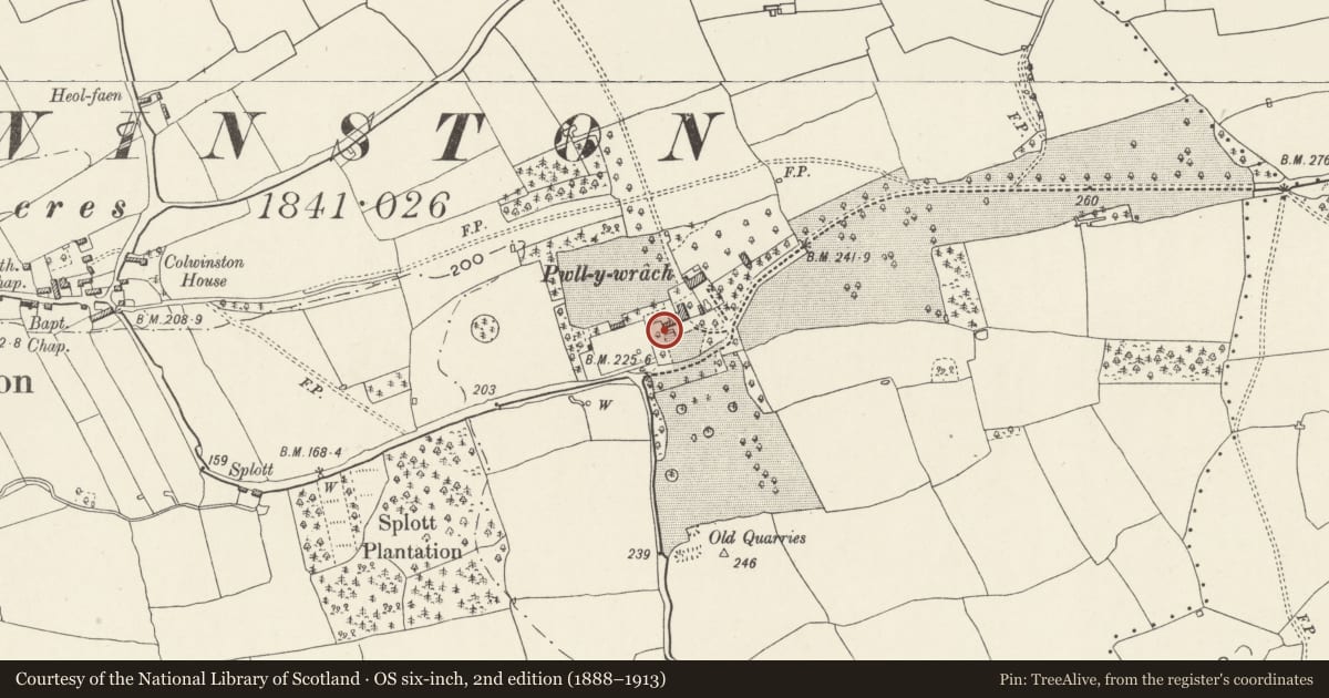
Slide toward Today to fade the historical sheet and see the modern map underneath.
David Rumsey Map Collection, Stanford LibrariesDavid Rumsey Map Collection, Stanford LibrariesDavid Rumsey Map Collection, Stanford LibrariesDavid Rumsey Map Collection, Stanford LibrariesDavid Rumsey Map Collection, Stanford Libraries
5 historical maps cover this location, the earliest the 1636 map "Cornubia : Devonia, Somersetus, Dorcestria, Wiltonia, Glocestria ..." (David Rumsey Map Collection, Stanford Libraries).
Historical maps covering this location
- 1636 · Cornubia : Devonia, Somersetus, Dorcestria, Wiltonia, Glocestria ... (David Rumsey Map Collection, Stanford Libraries)
- 1637 · The fourth table of England. Cornub. Devonia, Somerset etc. (David Rumsey Map Collection, Stanford Libraries)
- 1865 · England and Wales. England No. 6. (David Rumsey Map Collection, Stanford Libraries)
- 1897 · 262 Pontypridd (Hills) (David Rumsey Map Collection, Stanford Libraries)
- 1897 · 262 Pontypridd (Outline) (David Rumsey Map Collection, Stanford Libraries)
Cadw's description
Location
In line with the main elevation of the house and about 30m to the west.
History
Late C18, contemporary with the main build of the house which may be c1770, extended and converted into a pool-house in the late C20.
Exterior
Smooth rendered walls with stone window surround and Welsh slate roof. Single storey, originally single room square building now extended. The south wall has a keyed Palladian window with 3-pane sidelights flanking a 4 over 4 pane sash. Pyramid roof with stone finial. The original single room plan is now extended to the north into a late C20 pool-house.
Interior
Interior not available at resurvey, but now extended and converted to a late C20 pool-house.
Reason for designation
Included for its group value with Pwll-y-wrach.
Nearby in the register
- Pwll-y-wrachDomesticunder 1 mi
- East Garden House of Pwll-y-wrachDomesticunder 1 mi
- The SagesDomesticunder 1 mi
- Village HouseDomesticunder 1 mi
Other entries of the same register within about three miles of this one, by straight line.