Cof Cymru: National Historic Assets of Wales · Wales
Outbuilding at Plas Iolyn
Pentrefoelas, Conwy, Wales
A Grade II listed building in Tre Brys, Pentrefoelas, Conwy, designated on 23 June 1967.
The record
- Designation
- Listed building, Grade II
- Broad class
- Domestic
- Date of designation
- 23 June 1967
- Locality
- Tre Brys
- Town
- Pentrefoelas
- Community
- Pentrefoelas
- Unitary authority
- Conwy
- Country
- Wales
- Coordinates
- 53.03863, -3.66888
- Cadw reference
- 133
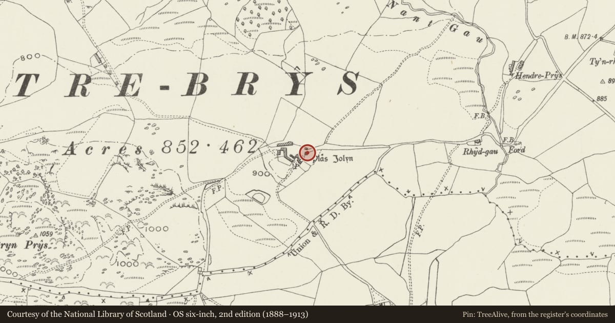
Slide toward Today to fade the historical sheet and see the modern map underneath.
David Rumsey Map Collection, Stanford LibrariesDavid Rumsey Map Collection, Stanford LibrariesLlyfrgell Genedlaethol Cymru – The National Library of WalesDavid Rumsey Map Collection, Stanford LibrariesDavid Rumsey Map Collection, Stanford Libraries
5 historical maps cover this location, the earliest the 1795 map "To Sir Watkin Williams-Wynn Bart ... the map of the six counties of North Wales is most humbly inscribed by his obedient humble servant" (Llyfrgell Genedlaethol Cymru – The National Library of Wales).
Historical maps covering this location
- 1795 · To Sir Watkin Williams-Wynn Bart ... the map of the six counties of North Wales is most… (Llyfrgell Genedlaethol Cymru – The National Library of Wales)
- 1830 · V.3:11-15:XV. Britisches Reich. A. Kon: England. b. Frstenthum Wales: Shire: 37-40 (David Rumsey Map Collection, Stanford Libraries)
- 1883 · Watershed map England, Wales 3. (David Rumsey Map Collection, Stanford Libraries)
- 1898 · 120 Corwen (Hills) (David Rumsey Map Collection, Stanford Libraries)
- 1901 · Sheet 9 and 10. (David Rumsey Map Collection, Stanford Libraries)
Cadw's description
Location
The building stands apart, E of the house, on sloping ground, now the garden, and near the approach drive.
History
The building is probably C17 in origin, perhaps originally part of a carthouse, but appears to have been reduced in size. It is now used as a garden room. Plas Iolyn farmhouse was once the major sub-medieval house of this district.
Exterior
Rubble stonework with slated roof, 2 storeys. A single doorway in the N gable gives access to the lower storey. It has a rectangular headed doorway with continuous chamfer. The upper floor is reached by an external flight of 5 steps at right angles to the W side, and has a battened stable door. The S gable is set at at a distinct angle.
Interior
The interior is of 2 bays, with a central chamfered and stopped floor beam, and a second parallel beam at the start of the angled wall, chamfered on one side only.
Reason for designation
Included as part of the group of important farm buildings associated with the historically important farmstead of Plas Iolyn.
Nearby in the register
- Plas IolynDomesticunder 1 mi
- Washhouse and outbuilding at Plas IolynDomesticunder 1 mi
- Animal house and attached yard at Plas IolynAgriculture and Subsistenceunder 1 mi
- Great Barn at Plas Iolyn (also known as Esgubor Ddegwm)Agriculture and Subsistenceunder 1 mi
Other entries of the same register within about three miles of this one, by straight line.