Cof Cymru: National Historic Assets of Wales · Wales
Glanthaw, including forecourt wall and railings
Cowbridge with Llanblethian, Vale of Glamorgan, Wales
A Grade II listed building in Cowbridge, Cowbridge with Llanblethian, Vale of Glamorgan, designated on 3 February 1981.
The record
- Designation
- Listed building, Grade II
- Broad class
- Domestic
- Date of designation
- 3 February 1981
- Locality
- Cowbridge
- Community
- Cowbridge with Llanblethian
- Unitary authority
- Vale of Glamorgan
- Country
- Wales
- Coordinates
- 51.46138, -3.44572
- Cadw reference
- 13199
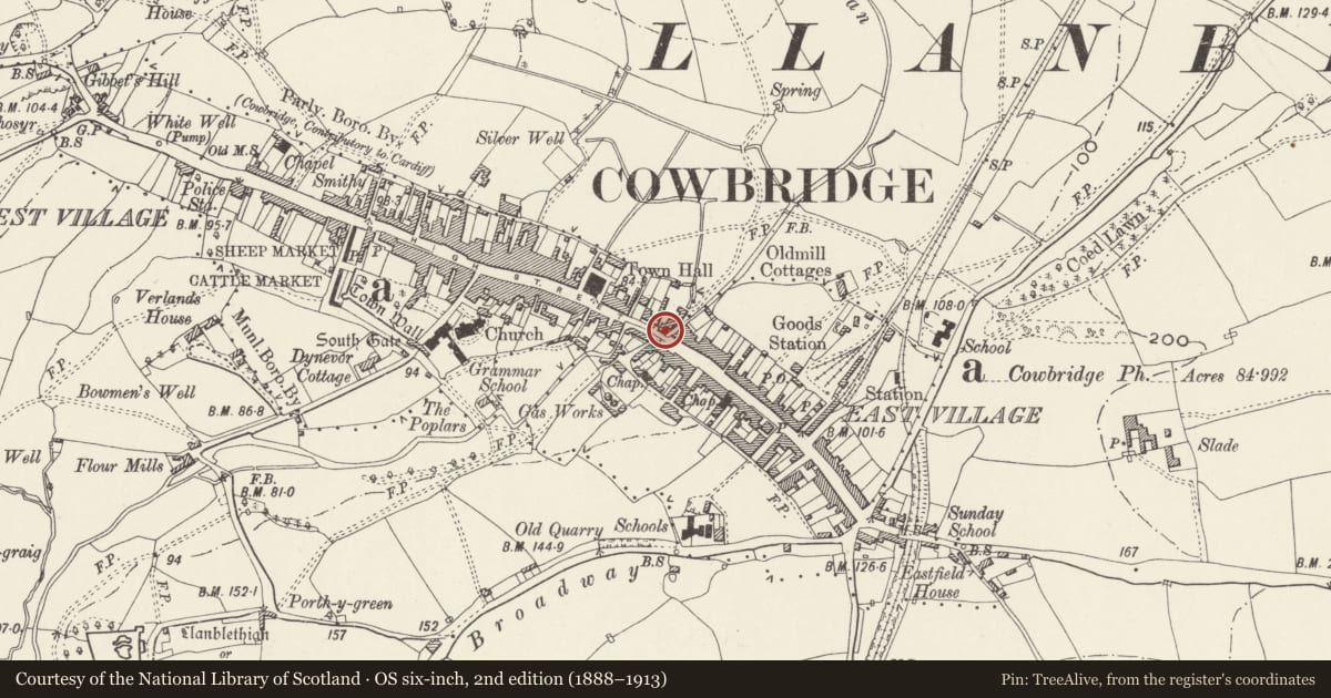
Slide toward Today to fade the historical sheet and see the modern map underneath.
David Rumsey Map Collection, Stanford LibrariesDavid Rumsey Map Collection, Stanford LibrariesDavid Rumsey Map Collection, Stanford LibrariesDavid Rumsey Map Collection, Stanford LibrariesDavid Rumsey Map Collection, Stanford Libraries
5 historical maps cover this location, the earliest the 1636 map "Cornubia : Devonia, Somersetus, Dorcestria, Wiltonia, Glocestria ..." (David Rumsey Map Collection, Stanford Libraries).
Historical maps covering this location
- 1636 · Cornubia : Devonia, Somersetus, Dorcestria, Wiltonia, Glocestria ... (David Rumsey Map Collection, Stanford Libraries)
- 1637 · The fourth table of England. Cornub. Devonia, Somerset etc. (David Rumsey Map Collection, Stanford Libraries)
- 1865 · England and Wales. England No. 6. (David Rumsey Map Collection, Stanford Libraries)
- 1897 · 262 Pontypridd (Hills) (David Rumsey Map Collection, Stanford Libraries)
- 1897 · 262 Pontypridd (Outline) (David Rumsey Map Collection, Stanford Libraries)
Cadw's description
Location
Opposite junction with The Limes.
History
Probably late C18 with later alterations.
Exterior
Two storey house with stone walls. Three bay front elevation with pebbledash cladding; slate roof finish, the gable stacks built up in late C19 or later yellow brick. Top-hung casement windows. Central doorway with cornice on fluted consoles and half-glazed modern door. Outshut to rear to left hand lean-to to rear at right hand and rear wing with SE colour-washed stone wall with window above the rear wing abutting the south wing of the Old Brewery (see separate item).
Forecourt enclosed by rendered stone dwarf wall and C19 iron railings with spiked and scroll finials, which return to house on NW side and which abut bridge and parapet wall on SE; C19 iron gate with similar railing.
Reason for designation
Late C18 house retaining overall character.
Nearby in the register
- The Old Brewery BuildingIndustrialunder 1 mi
- 70 EastgateDomesticunder 1 mi
- Eastgate GalleryDomesticunder 1 mi
- ColoursDomesticunder 1 mi
Other entries of the same register within about three miles of this one, by straight line.