Cof Cymru: National Historic Assets of Wales · Wales
70 Eastgate
Cowbridge with Llanblethian, Vale of Glamorgan, Wales
A Grade II listed building in Cowbridge, Cowbridge with Llanblethian, Vale of Glamorgan, designated on 3 February 1981.
The record
- Designation
- Listed building, Grade II
- Broad class
- Domestic
- Date of designation
- 3 February 1981
- Town
- Cowbridge
- Community
- Cowbridge with Llanblethian
- Unitary authority
- Vale of Glamorgan
- Country
- Wales
- Coordinates
- 51.46106, -3.44564
- Cadw reference
- 13197
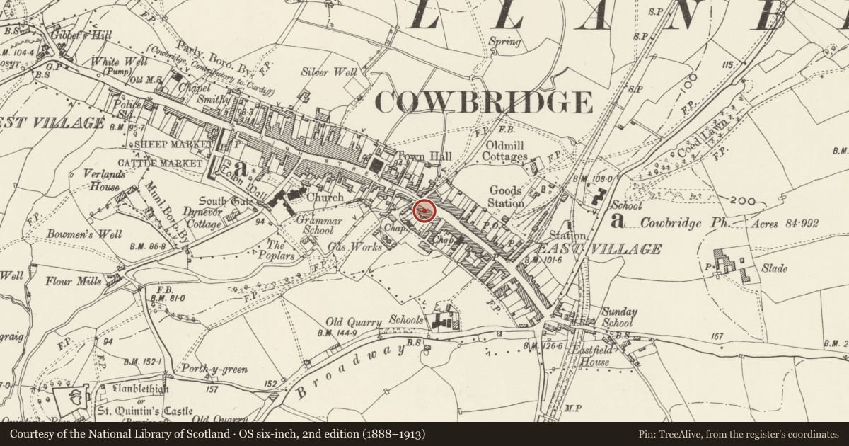
Slide toward Today to fade the historical sheet and see the modern map underneath.
David Rumsey Map Collection, Stanford LibrariesDavid Rumsey Map Collection, Stanford LibrariesDavid Rumsey Map Collection, Stanford LibrariesDavid Rumsey Map Collection, Stanford LibrariesDavid Rumsey Map Collection, Stanford Libraries
5 historical maps cover this location, the earliest the 1636 map "Cornubia : Devonia, Somersetus, Dorcestria, Wiltonia, Glocestria ..." (David Rumsey Map Collection, Stanford Libraries).
Historical maps covering this location
- 1636 · Cornubia : Devonia, Somersetus, Dorcestria, Wiltonia, Glocestria ... (David Rumsey Map Collection, Stanford Libraries)
- 1637 · The fourth table of England. Cornub. Devonia, Somerset etc. (David Rumsey Map Collection, Stanford Libraries)
- 1865 · England and Wales. England No. 6. (David Rumsey Map Collection, Stanford Libraries)
- 1897 · 262 Pontypridd (Hills) (David Rumsey Map Collection, Stanford Libraries)
- 1897 · 262 Pontypridd (Outline) (David Rumsey Map Collection, Stanford Libraries)
Cadw's description
Location
Towards W end of street, near junction with The Limes.
History
Much altered but originated as C17 hearth-passage house with hall chimney backing on to entrance, and passage in outer room.
Exterior
Four bay front elevation with ground floor of exposed stone rubble and stuccoed first floor. Slate gabled roof with stone stack to left hand and pebbledash stack to right hand. On ground floor, from left hand, firstly, square-headed doorway with modern hood and modern glazed door; modern shop window; thirdly, original chamfered stone doorway with late C20 hood and, fourthly, large canted shop window. Four sash windows with glazing bars on first floor.
Modern rear wing.
Interior
Inside, ground floor with massive stopped and chamfered beams; central chimney with SE fireplace with bressumer.
Reason for designation
Included for surviving original internal structure of original front wing.
Nearby in the register
- Eastgate GalleryDomesticunder 1 mi
- ColoursDomesticunder 1 mi
- Glanthaw, including forecourt wall and railingsDomesticunder 1 mi
- The Old Brewery BuildingIndustrialunder 1 mi
Other entries of the same register within about three miles of this one, by straight line.