Cof Cymru: National Historic Assets of Wales · Wales
Gate piers, gates and railings at main entrance to Llanharan House
Llanharan, Rhondda Cynon Taff, Wales
A Grade II listed building in Llanharan, Rhondda Cynon Taff, designated on 22 February 1963.
The record
- Designation
- Listed building, Grade II
- Broad class
- Domestic
- Date of designation
- 22 February 1963
- Locality
- Llanharan
- Community
- Llanharan
- Unitary authority
- Rhondda Cynon Taff
- Country
- Wales
- Coordinates
- 51.53713, -3.43047
- Cadw reference
- 13158
Slide toward Today to fade the historical sheet and see the modern map underneath.
David Rumsey Map Collection, Stanford LibrariesDavid Rumsey Map Collection, Stanford LibrariesDavid Rumsey Map Collection, Stanford LibrariesDavid Rumsey Map Collection, Stanford LibrariesDavid Rumsey Map Collection, Stanford Libraries
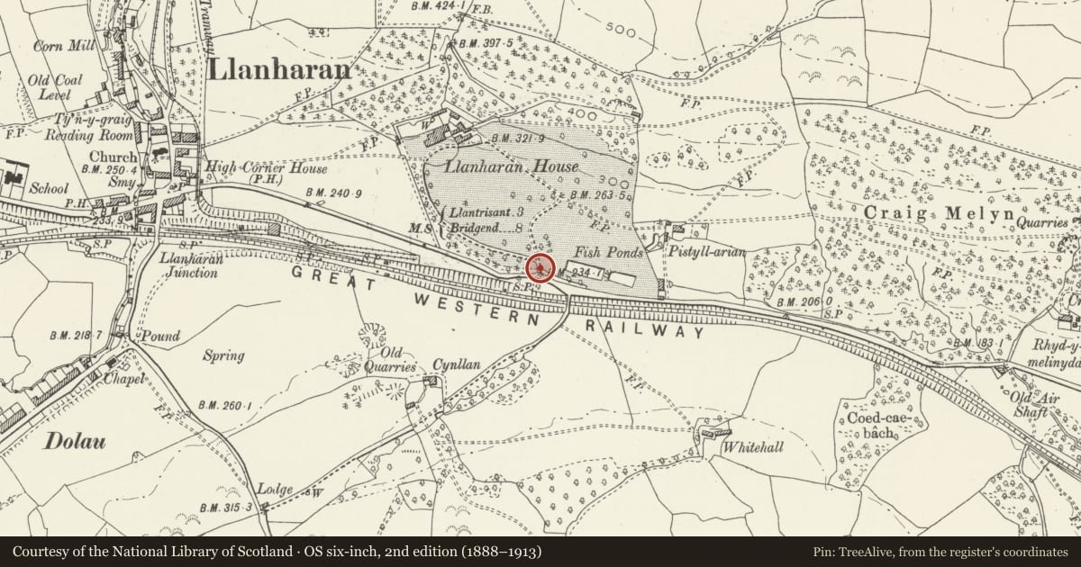
5 historical maps cover this location, the earliest the 1636 map "Cornubia : Devonia, Somersetus, Dorcestria, Wiltonia, Glocestria ..." (David Rumsey Map Collection, Stanford Libraries).
Historical maps covering this location
- 1636 · Cornubia : Devonia, Somersetus, Dorcestria, Wiltonia, Glocestria ... (David Rumsey Map Collection, Stanford Libraries)
- 1637 · The fourth table of England. Cornub. Devonia, Somerset etc. (David Rumsey Map Collection, Stanford Libraries)
- 1865 · England and Wales. England No. 6. (David Rumsey Map Collection, Stanford Libraries)
- 1895 · Sheet 11. Ordnance Survey of England and Wales. (David Rumsey Map Collection, Stanford Libraries)
- 1907 · 248 Pontypridd (Hills) (David Rumsey Map Collection, Stanford Libraries)
Cadw's description
Location
To the SE and below the main house; set back on the N side of the A473.
History
Built in the period 1856-75 by John Blandy-Jenkins and first shown on the Ordnance Survey of 1875. The pier on the E side of the gateway was rebuilt after 1995.
Llanharan House was built by Rees Powell before 1750 and was subsequently enlarged by Richard Hoare Jenkins in the early C19, with additions by the Blandy-Jenkins family later in the C19. The park and garden, S and W of the house respectively, were laid out by Rees Powell in the C18 but the present structural components were mainly added in the period 1856-75 by John Blandy-Jenkins.
Exterior
Comprising rusticated main piers with ball finials, and Baroque style cast iron gates with overthrow. Dwarf flanking walls of coursed stone curve round to outer rusticated piers, and are swept up at the ends below cast iron railings.
Reason for designation
Listed as a fine classical gateway and for group value with Llanharan House and other associated listed items.
Nearby in the register
- Squires OverbridgeNo class recordedunder 1 mi
- Stable block at Llanharan HouseDomesticunder 1 mi
- Courtyard wall linking house and stable block at Llanharan HouseGardens, Parks and Urban Spacesunder 1 mi
- Entrance steps to Llanharan HouseGardens, Parks and Urban Spacesunder 1 mi
Other entries of the same register within about three miles of this one, by straight line.