Cof Cymru: National Historic Assets of Wales · Wales
Courtyard wall linking house and stable block at Llanharan House
Llanharan, Rhondda Cynon Taff, Wales
A Grade II listed building in Llanharan, Rhondda Cynon Taff, designated on 14 November 2000.
The record
- Designation
- Listed building, Grade II
- Broad class
- Gardens, Parks and Urban Spaces
- Date of designation
- 14 November 2000
- Locality
- Llanharan
- Community
- Llanharan
- Unitary authority
- Rhondda Cynon Taff
- Country
- Wales
- Coordinates
- 51.53914, -3.43261
- Cadw reference
- 24372
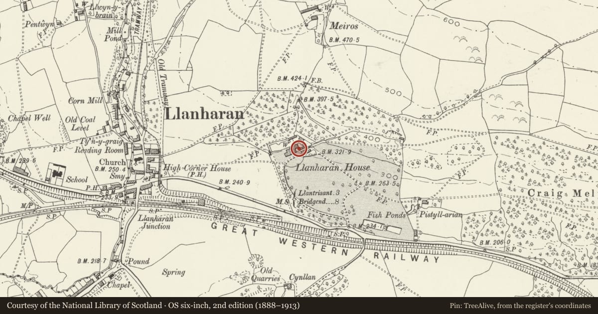
Slide toward Today to fade the historical sheet and see the modern map underneath.
David Rumsey Map Collection, Stanford LibrariesDavid Rumsey Map Collection, Stanford LibrariesDavid Rumsey Map Collection, Stanford LibrariesDavid Rumsey Map Collection, Stanford LibrariesDavid Rumsey Map Collection, Stanford Libraries
5 historical maps cover this location, the earliest the 1636 map "Cornubia : Devonia, Somersetus, Dorcestria, Wiltonia, Glocestria ..." (David Rumsey Map Collection, Stanford Libraries).
Historical maps covering this location
- 1636 · Cornubia : Devonia, Somersetus, Dorcestria, Wiltonia, Glocestria ... (David Rumsey Map Collection, Stanford Libraries)
- 1637 · The fourth table of England. Cornub. Devonia, Somerset etc. (David Rumsey Map Collection, Stanford Libraries)
- 1865 · England and Wales. England No. 6. (David Rumsey Map Collection, Stanford Libraries)
- 1895 · Sheet 11. Ordnance Survey of England and Wales. (David Rumsey Map Collection, Stanford Libraries)
- 1907 · 248 Pontypridd (Hills) (David Rumsey Map Collection, Stanford Libraries)
Cadw's description
Location
On the E side of the house.
History
Built in the period 1856-75 by John Blandy-Jenkins to conceal the service buildings and courtyard from the approach to the house. The wall is first shown on the 1875 Ordnance Survey.
Llanharan House was built by Rees Powell before 1750 and was subsequently enlarged by Richard Hoare Jenkins in the early C19, with additions by the Blandy-Jenkins family later in the C19.
Exterior
A high coped wall of rubble stone extending from the E side of the house to the SW corner of the stable block. It begins at right angles to the house, then is swept up to a higher level under a ball finial, and curves round where it is continuous with the projecting rear wing of the stable block. Beyond this it curves back to the SW angle of the main stable range below stone finials.
Reason for designation
Listed for group value with Llanharan House and other associated listed items.
Nearby in the register
- Old Laundry at Llanharan HouseDomesticunder 1 mi
- Llanharan HouseDomesticunder 1 mi
- Entrance steps to Llanharan HouseGardens, Parks and Urban Spacesunder 1 mi
- Stable block at Llanharan HouseDomesticunder 1 mi
Other entries of the same register within about three miles of this one, by straight line.