Cof Cymru: National Historic Assets of Wales · Wales
Trefasser Isaf
Pencaer, Pembrokeshire, Wales
A Grade II listed building in Trefasser, Llanwnda, Pencaer, Pembrokeshire, designated on 14 July 1993.
The record
- Designation
- Listed building, Grade II
- Broad class
- Domestic
- Date of designation
- 14 July 1993
- Locality
- Trefasser
- Town
- Llanwnda
- Community
- Pencaer
- Unitary authority
- Pembrokeshire
- Country
- Wales
- Coordinates
- 51.99973, -5.06625
- Cadw reference
- 12994
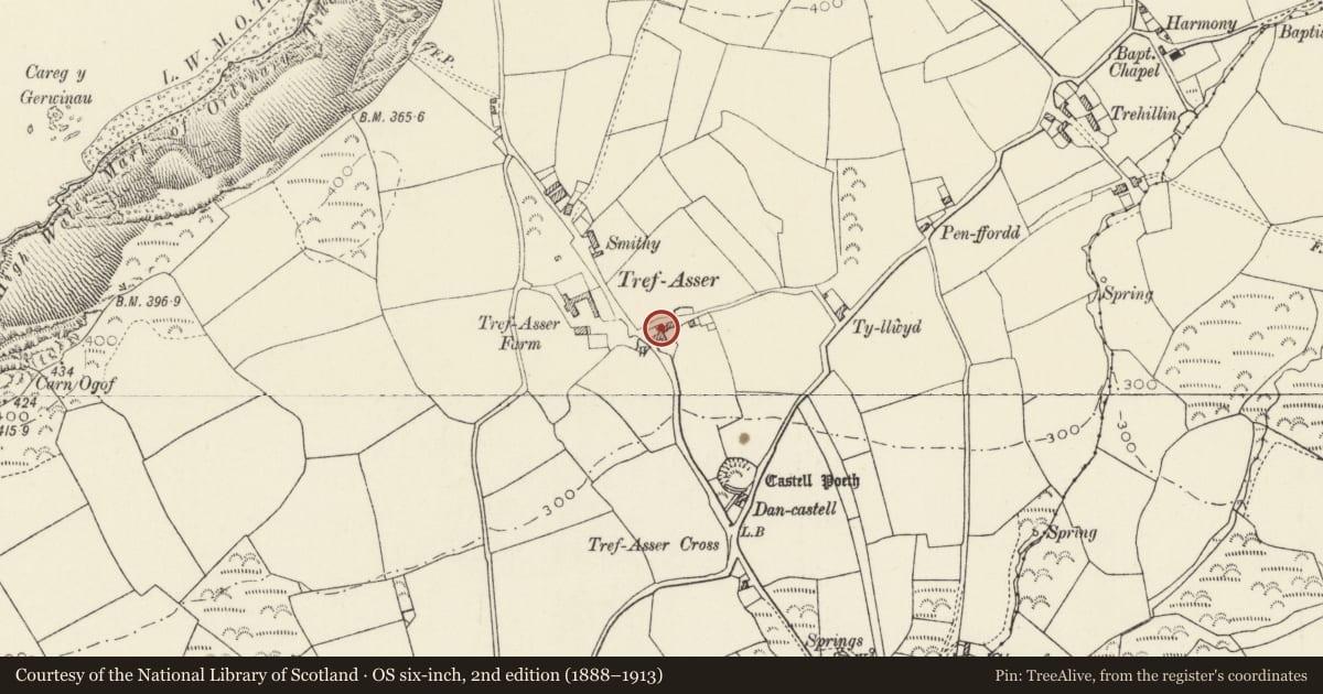
Slide toward Today to fade the historical sheet and see the modern map underneath.
David Rumsey Map Collection, Stanford LibrariesDavid Rumsey Map Collection, Stanford LibrariesDavid Rumsey Map Collection, Stanford LibrariesDavid Rumsey Map Collection, Stanford LibrariesDavid Rumsey Map Collection, Stanford Libraries
5 historical maps cover this location, the earliest the 1608 map "(13) Cambriae Typus." (David Rumsey Map Collection, Stanford Libraries).
Historical maps covering this location
- 1608 · (13) Cambriae Typus. (David Rumsey Map Collection, Stanford Libraries)
- 1636 · Cornubia : Devonia, Somersetus, Dorcestria, Wiltonia, Glocestria ... (David Rumsey Map Collection, Stanford Libraries)
- 1637 · Particular description of Wales. Cambria seu Wallia (David Rumsey Map Collection, Stanford Libraries)
- 1898 · 209 St David's (Hills) (David Rumsey Map Collection, Stanford Libraries)
- 1901 · Sheet 13. (David Rumsey Map Collection, Stanford Libraries)
Cadw's description
Location
Situated in Trefasser, some 300m N of Trefasser Cross, at junction with minor lane from east.
Exterior
Farmhouse: Earlier C19 farmhouse in rubble stone with grouted slate roof and stone end wall stacks, larger to south end. Two-storey three-window range of 12-pane horned sashes with painted slate sills and red brick cambered heads. Centre C20 door with similar head. Incised on stone by doorway is "1869 JáSáRees". Whitewashed N end wall, outshut rear, with imitation slate roof. Outbuilding attached to right with long outshut roof to front and two doors to rear.
Outside Kitchen: Forward at right angles to SW is single-storey outside kitchen in rubble stone with grouted slate roof and stone end stacks. One window to left of centre, door in E end wall. A rubble wall to right has low opening, possibly a goose shelter.
Garden enclosed by whitewashed rubble stone wall.
Reason for designation
A traditional farmhouse, apparently the same as that marked on 1845 Tithe Map, but just possibly rebuilt in traditional style in 1869.
Nearby in the register
- L-Plan Outbuildings attached to right of Trefasser IsafDomesticunder 1 mi
- Castell PoethEnclosureunder 1 mi
- Trehilyn EastDomesticunder 1 mi
- Low attached Outbuilding to right of Trehilyn EastAgriculture and Subsistenceunder 1 mi
Other entries of the same register within about three miles of this one, by straight line.