Cof Cymru: National Historic Assets of Wales · Wales
Trehilyn East
Pencaer, Pembrokeshire, Wales
A Grade II listed building in Llanwnda, Pencaer, Pembrokeshire, designated on 14 July 1993.
The record
- Designation
- Listed building, Grade II
- Broad class
- Domestic
- Date of designation
- 14 July 1993
- Locality
- Llanwnda
- Community
- Pencaer
- Unitary authority
- Pembrokeshire
- Country
- Wales
- Coordinates
- 52.00246, -5.05795
- Cadw reference
- 12972
Slide toward Today to fade the historical sheet and see the modern map underneath.
David Rumsey Map Collection, Stanford LibrariesDavid Rumsey Map Collection, Stanford LibrariesDavid Rumsey Map Collection, Stanford LibrariesDavid Rumsey Map Collection, Stanford LibrariesDavid Rumsey Map Collection, Stanford Libraries
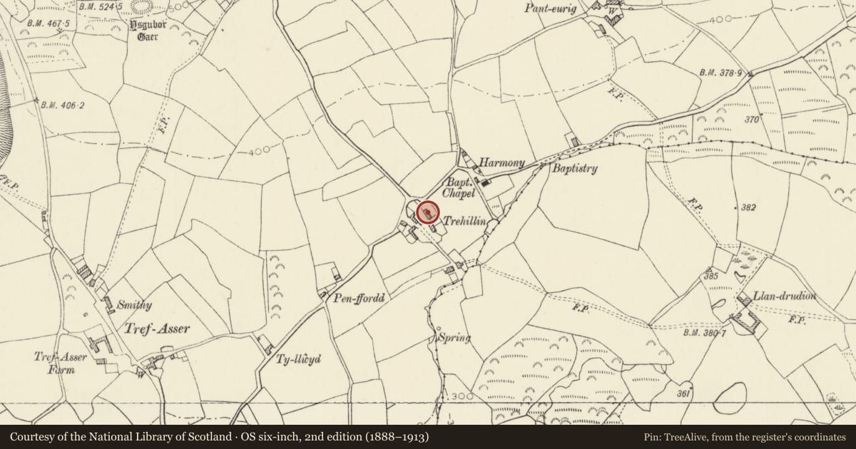
5 historical maps cover this location, the earliest the 1608 map "(13) Cambriae Typus." (David Rumsey Map Collection, Stanford Libraries).
Historical maps covering this location
- 1608 · (13) Cambriae Typus. (David Rumsey Map Collection, Stanford Libraries)
- 1636 · Cornubia : Devonia, Somersetus, Dorcestria, Wiltonia, Glocestria ... (David Rumsey Map Collection, Stanford Libraries)
- 1637 · Particular description of Wales. Cambria seu Wallia (David Rumsey Map Collection, Stanford Libraries)
- 1898 · 209 St David's (Hills) (David Rumsey Map Collection, Stanford Libraries)
- 1901 · Sheet 13. (David Rumsey Map Collection, Stanford Libraries)
Cadw's description
Location
Situated on S side of lane some 100m W of Harmony Chapel and opposite junction with lane to Strumble Head.
History
Marked on 1845 Tithe Map as owned and occupied by Stephen Crunn.
Exterior
Early C19 farmhouse in whitewashed rubble stone with grouted slate roof and end wall stone stacks. Two-storey three-window front, slightly asymmetrical, with C19 4-pane sashes, painted slate sills and painted brick cambered heads. Ground floor left window is not aligned with window above. C20 door with similar painted brick head. Outshut rear with hipped-roof to projecting stair tower and 18-pane window. Lower service range attached to right with large S end stone stack, first floor centre 4-pane over ground floor C20 window, door with painted brick head to left. Single-storey outbuilding attached to right with ledged door and square window. Service range and outbuilding have outshut rears.
House front yard is enclosed by whitewashed rubble stone walls with square piers opposite main door.
Nearby in the register
- Low attached Outbuilding to right of Trehilyn EastAgriculture and Subsistenceunder 1 mi
- Low Cottage attached to W.End of PanteurigDomesticunder 1 mi
- Cartshed to S.of PanteurigAgriculture and Subsistenceunder 1 mi
- PanteurigDomesticunder 1 mi
Other entries of the same register within about three miles of this one, by straight line.