Cof Cymru: National Historic Assets of Wales · Wales
Hand Hotel
Chirk, Wrexham, Wales
A Grade II listed building in Chirk, Wrexham, designated on 11 February 1976.
The record
- Designation
- Listed building, Grade II
- Broad class
- Commercial
- Date of designation
- 11 February 1976
- Locality
- Chirk
- Town
- Wrexham
- Community
- Chirk
- Unitary authority
- Wrexham
- Country
- Wales
- Coordinates
- 52.93251, -3.05669
- Cadw reference
- 1298
Slide toward Today to fade the historical sheet and see the modern map underneath.
David Rumsey Map Collection, Stanford LibrariesDavid Rumsey Map Collection, Stanford LibrariesDavid Rumsey Map Collection, Stanford LibrariesLlyfrgell Genedlaethol Cymru – The National Library of WalesDavid Rumsey Map Collection, Stanford Libraries
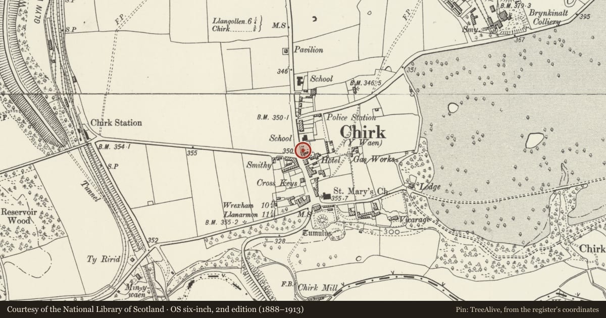
5 historical maps cover this location, the earliest the 1608 map "(13) Cambriae Typus." (David Rumsey Map Collection, Stanford Libraries).
Historical maps covering this location
- 1608 · (13) Cambriae Typus. (David Rumsey Map Collection, Stanford Libraries)
- 1795 · To Sir Watkin Williams-Wynn Bart ... the map of the six counties of North Wales is most… (Llyfrgell Genedlaethol Cymru – The National Library of Wales)
- 1883 · Watershed map England, Wales 3. (David Rumsey Map Collection, Stanford Libraries)
- 1898 · 121 Wrexham (Hills) (David Rumsey Map Collection, Stanford Libraries)
- 1901 · Sheet 9 and 10. (David Rumsey Map Collection, Stanford Libraries)
Cadw's description
Location
The hotel is placed at the N end of Church Street, facing down Station Avenue.
History
The hotel was built as a hostelry on the Holyhead Road in the mid C18, largely to serve travellers on the road to and from Ireland. It has been extended to the N in the late C19. The building adjoining to the S and still retained by the hotel is probably the late C17 or early C18 precursor, later the town house for the Chirk Estate. Since altered. The hostelry's former brewery in the back range, of c1790, was demolished for new accommodation.
Exterior
Built in red brick to Flemish bond, set on a stone plinth, and having stone sill bands to ground and first floors, and a hipped slate roof. The main early block is of 3 storeys and cellars, 5 bays, comprising a 3-bay centre set slightly forward of the single end bays. Central entrance, a Tuscan portico set on a half-round step, and carrying a flat topped entablature. Pair of panelled doors with a 5-paned overlight. The ground and first floors are of the same height and similarly glazed as usual for hostelries, tripartite 12-pane sashes with gauged brick lintels, now rendered. The top floor has shorter windows of similar width, 9-pane sashes. Stone moulded eaves. Large rebuilt chimney stacks set in from the end bays. Above the portico, a cast iron bracket for the inn sign. The extension to the N is similar in style, 2 and a half bays. To the rear, a C19 range at right angles with steep pitched roof.
Interior
The interior has been considerably altered.
Reason for designation
Included as a fine example of an C18 hostelry with contemporary fenestration, set in the Conservation Area of Chirk.
Nearby in the register
- War MemorialCommemorativeunder 1 mi
- 1 Hand TerraceDomesticunder 1 mi
- 2 Hand TerraceDomesticunder 1 mi
- 3 Hand TerraceDomesticunder 1 mi
Other entries of the same register within about three miles of this one, by straight line.