Cof Cymru: National Historic Assets of Wales · Wales
2 Hand Terrace
Chirk, Wrexham, Wales
A Grade II listed building in Chirk, Wrexham, designated on 29 July 1998.
The record
- Designation
- Listed building, Grade II
- Broad class
- Domestic
- Date of designation
- 29 July 1998
- Locality
- Chirk
- Town
- Wrexham
- Community
- Chirk
- Unitary authority
- Wrexham
- Country
- Wales
- Coordinates
- 52.93311, -3.05669
- Cadw reference
- 20217
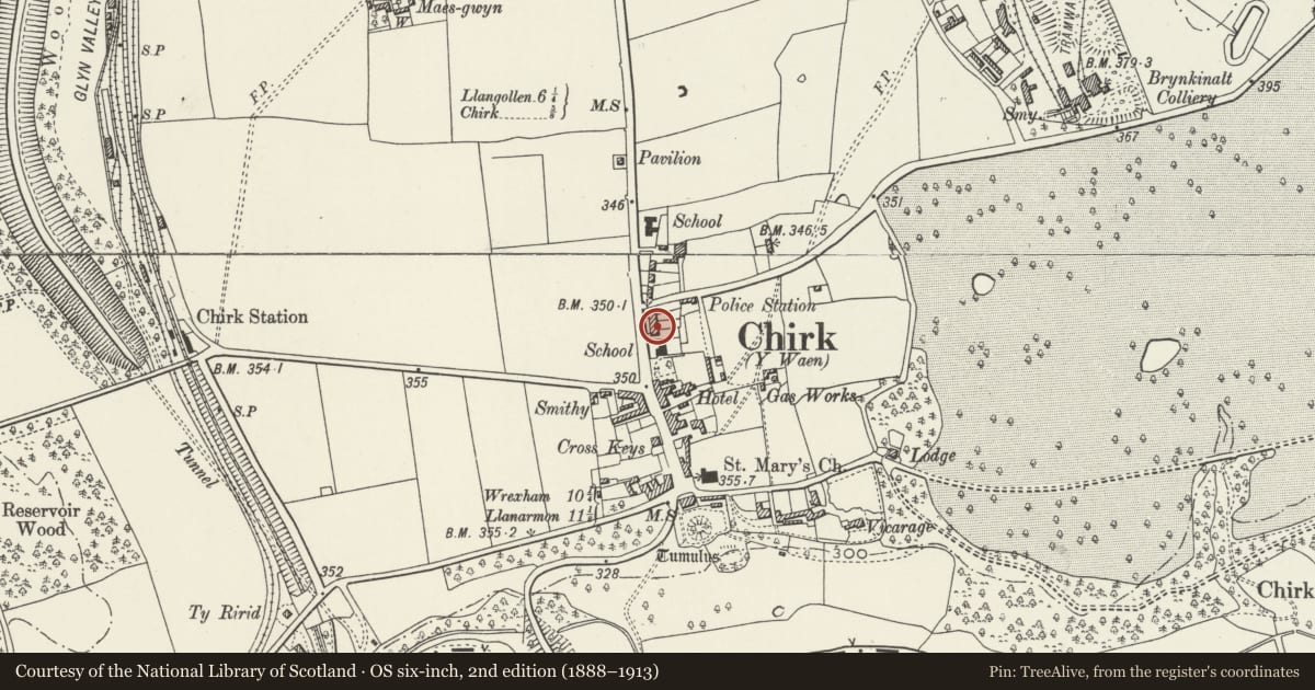
Slide toward Today to fade the historical sheet and see the modern map underneath.
David Rumsey Map Collection, Stanford LibrariesDavid Rumsey Map Collection, Stanford LibrariesDavid Rumsey Map Collection, Stanford LibrariesLlyfrgell Genedlaethol Cymru – The National Library of WalesDavid Rumsey Map Collection, Stanford Libraries
5 historical maps cover this location, the earliest the 1608 map "(13) Cambriae Typus." (David Rumsey Map Collection, Stanford Libraries).
Historical maps covering this location
- 1608 · (13) Cambriae Typus. (David Rumsey Map Collection, Stanford Libraries)
- 1795 · To Sir Watkin Williams-Wynn Bart ... the map of the six counties of North Wales is most… (Llyfrgell Genedlaethol Cymru – The National Library of Wales)
- 1883 · Watershed map England, Wales 3. (David Rumsey Map Collection, Stanford Libraries)
- 1898 · 121 Wrexham (Hills) (David Rumsey Map Collection, Stanford Libraries)
- 1901 · Sheet 9 and 10. (David Rumsey Map Collection, Stanford Libraries)
Cadw's description
Location
The terrace fronts the Holyhead Road, immediately N of the Hand Hotel.
History
The terrace of estate workers cottages was built by Chirk Castle estate in c1820-1825 for Charlotte Myddleton-Biddulph. Some later alterations.
Exterior
Door altered, with glazed upper panel.
Reason for designation
Included as a good example of estate cottages retaining original detailing, built with an apt sense of scale and forming a picturesque composition, carefully fitted into the existing fabric of Chirk.
Nearby in the register
- 3 Hand TerraceDomesticunder 1 mi
- 1 Hand TerraceDomesticunder 1 mi
- 4 Hand TerraceDomesticunder 1 mi
- 5 Hand TerraceDomesticunder 1 mi
Other entries of the same register within about three miles of this one, by straight line.