Cof Cymru: National Historic Assets of Wales · Wales
Barlow House
Milford Haven, Pembrokeshire, Wales
A Grade II listed building in Milford Haven, Pembrokeshire, designated on 22 February 1993.
The record
- Designation
- Listed building, Grade II
- Broad class
- Domestic
- Date of designation
- 22 February 1993
- Community
- Milford Haven
- Unitary authority
- Pembrokeshire
- Country
- Wales
- Coordinates
- 51.71237, -5.03497
- Cadw reference
- 12884
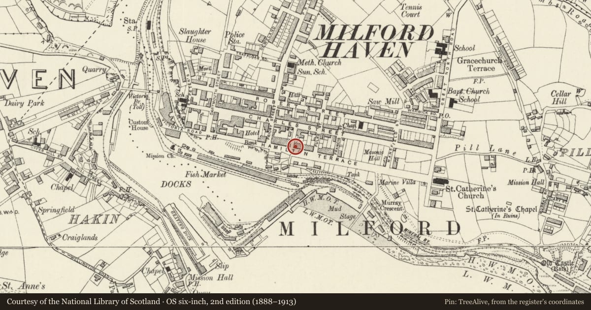
Slide toward Today to fade the historical sheet and see the modern map underneath.
David Rumsey Map Collection, Stanford LibrariesDavid Rumsey Map Collection, Stanford LibrariesDavid Rumsey Map Collection, Stanford LibrariesDavid Rumsey Map Collection, Stanford LibrariesDavid Rumsey Map Collection, Stanford Libraries
5 historical maps cover this location, the earliest the 1636 map "Cornubia : Devonia, Somersetus, Dorcestria, Wiltonia, Glocestria ..." (David Rumsey Map Collection, Stanford Libraries).
Historical maps covering this location
- 1636 · Cornubia : Devonia, Somersetus, Dorcestria, Wiltonia, Glocestria ... (David Rumsey Map Collection, Stanford Libraries)
- 1865 · England and Wales. England No. 6. (David Rumsey Map Collection, Stanford Libraries)
- 1898 · 227 Milford (Outline) (David Rumsey Map Collection, Stanford Libraries)
- 1898 · 227 Milford (Hills) (David Rumsey Map Collection, Stanford Libraries)
- 1901 · Sheet 13. (David Rumsey Map Collection, Stanford Libraries)
Cadw's description
Location
Situated on SE corner of Barlow Street, part of terraced row.
History
Circa l800, restored cl990,
One of the early houses built in the first phase of the new town, built cl797-l8l0.
Exterior
Roughcast with some stucco and concrete tile roof. Chimneys removed. Three-storey three-window front, plastic upper windows replacing 6-pane sashes, l2-pane sashes elsewhere, renewed in restoration. Panelled centre door in simple stucco surround. NW rear wing.
Interior
Panelled hall arch survives.
Nearby in the register
- 23 Hamilton TerraceDomesticunder 1 mi
- Barrallier HouseDomesticunder 1 mi
- 20 Hamilton TerraceDomesticunder 1 mi
- 19 Hamilton TerraceDomesticunder 1 mi
Other entries of the same register within about three miles of this one, by straight line.