Cof Cymru: National Historic Assets of Wales · Wales
Rhydyfantwn Bach
Nevern, Pembrokeshire, Wales
A Grade II listed building in Monington/Eglwys Wythwr, Nevern, Pembrokeshire, designated on 27 October 1992.
The record
- Designation
- Listed building, Grade II
- Broad class
- Domestic
- Date of designation
- 27 October 1992
- Locality
- Monington/Eglwys Wythwr
- Community
- Nevern
- Unitary authority
- Pembrokeshire
- Country
- Wales
- Coordinates
- 52.06201, -4.72636
- Cadw reference
- 12792
Slide toward Today to fade the historical sheet and see the modern map underneath.
David Rumsey Map Collection, Stanford LibrariesDavid Rumsey Map Collection, Stanford LibrariesDavid Rumsey Map Collection, Stanford LibrariesDavid Rumsey Map Collection, Stanford LibrariesDavid Rumsey Map Collection, Stanford Libraries
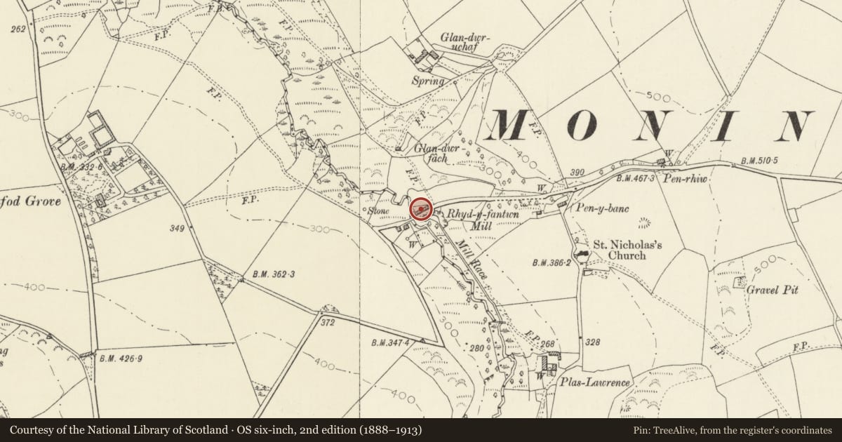
5 historical maps cover this location, the earliest the 1608 map "(13) Cambriae Typus." (David Rumsey Map Collection, Stanford Libraries).
Historical maps covering this location
- 1608 · (13) Cambriae Typus. (David Rumsey Map Collection, Stanford Libraries)
- 1636 · Cornubia : Devonia, Somersetus, Dorcestria, Wiltonia, Glocestria ... (David Rumsey Map Collection, Stanford Libraries)
- 1637 · Particular description of Wales. Cambria seu Wallia (David Rumsey Map Collection, Stanford Libraries)
- 1898 · 193 Cardigan (Hills) (David Rumsey Map Collection, Stanford Libraries)
- 1901 · Sheet 13. (David Rumsey Map Collection, Stanford Libraries)
Cadw's description
Location
Situated on N side of lane, just E of Rhydyfantwn Bridge.
Exterior
Late C18 or early C19 house in whitewashed rubble stone with slate roof and rendered stacks, one at W end, one larger on ridge. Two-storey three-window main range and two-window service range to right, single roof. Main house has 12-pane sashes to outer windows and casement pair to centre, over former door now casement pair. Thick split stone sills, timber lintels to upper windows and painted stone voussoirs to ground floor openings. To right, service range without structural divide has window each floor, stone voussoirs below, timber lintel to upper window and door with stone voussoirs to right. Modern windows. Main house has outshut rear, rendered W end with door. Two stone outbuildings attached at E end, with differing roof pitches.
Interior
Big timber lintel E fireplace, narrow dog-leg stair. Roof structure replaced.
Reason for designation
Associated with former well opposite, recorded from C17. Formerly known as Rhydyfantwn.
Nearby in the register
- Glandwr, including attached outbuildingDomesticunder 1 mi
- Church of St NicholasReligious, Ritual and Funeraryunder 1 mi
- Bier House in Churchyard at St Nicholas ChurchReligious, Ritual and Funeraryunder 1 mi
- Plas Lawrence, including two Bee boles in front of Garden WallDomesticunder 1 mi
Other entries of the same register within about three miles of this one, by straight line.