Cof Cymru: National Historic Assets of Wales · Wales
Llwyngwair Lodge
Nevern, Pembrokeshire, Wales
A Grade II listed building in Llwyngwair, Nevern, Pembrokeshire, designated on 27 October 1992.
The record
- Designation
- Listed building, Grade II
- Broad class
- Domestic
- Date of designation
- 27 October 1992
- Locality
- Llwyngwair
- Community
- Nevern
- Unitary authority
- Pembrokeshire
- Country
- Wales
- Coordinates
- 52.02323, -4.79571
- Cadw reference
- 12780
Slide toward Today to fade the historical sheet and see the modern map underneath.
David Rumsey Map Collection, Stanford LibrariesDavid Rumsey Map Collection, Stanford LibrariesDavid Rumsey Map Collection, Stanford LibrariesDavid Rumsey Map Collection, Stanford LibrariesDavid Rumsey Map Collection, Stanford Libraries
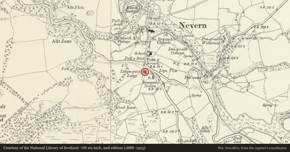
5 historical maps cover this location, the earliest the 1636 map "Cornubia : Devonia, Somersetus, Dorcestria, Wiltonia, Glocestria ..." (David Rumsey Map Collection, Stanford Libraries).
Historical maps covering this location
- 1636 · Cornubia : Devonia, Somersetus, Dorcestria, Wiltonia, Glocestria ... (David Rumsey Map Collection, Stanford Libraries)
- 1891 · Sheet 10. Ordnance Survey of England and Wales. . (David Rumsey Map Collection, Stanford Libraries)
- 1898 · 210 Cardigan (Hills) (David Rumsey Map Collection, Stanford Libraries)
- 1898 · 210 Cardigan (Outline) (David Rumsey Map Collection, Stanford Libraries)
- 1901 · Sheet 13. (David Rumsey Map Collection, Stanford Libraries)
Cadw's description
Location
Situated facing over Nevern Bridge from S. Track (formerly driveway) to Llwyngwair, runs to W.
History
Early C19 house, restored c1990
Exterior
Colourwashed roughcast with imitation slate roof and altered stone end wall stacks. Two-storey three-window front offset to allow for larger chimney to right. 9-pane sashes above, 12-pane sashes below, with painted slate sills and plain raised stucco surrounds. Panelled door in bargeboarded gabled timber porch. SE rear wing, later C19.
Reason for designation
Included for importance in setting of Nevern Bridge.
Nearby in the register
- Nevern BridgeTransportunder 1 mi
- Village HallDomesticunder 1 mi
- Telephone Call-box outside TyrllanCommunicationsunder 1 mi
- Mounting Block by Churchyard entry to Church of St BrynarchReligious, Ritual and Funeraryunder 1 mi
Other entries of the same register within about three miles of this one, by straight line.